-
Hello, please take a minute to check out our awesome content, contributed by the wonderful members of our community. We hope you'll add your own thoughts and opinions by making a free account!
You are using an out of date browser. It may not display this or other websites correctly.
You should upgrade or use an alternative browser.
You should upgrade or use an alternative browser.
Pattern Jan 2025 Powered by Rheem AC
- Thread starter SD
- Start date
accu35
Member
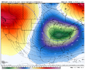
That 5th-7th looking interesting for sure
RDUHeatIsland
Member
I-40 & north still get a nice event. Good news is we have plenty of possible ways to score in this pattern even if the setup isn't perfect. That's all you can ask for imo.
severestorm
Member
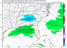
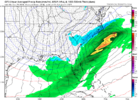
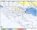
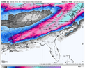
View attachment 157322
In case anyone was curious.
18z for anyone wonderingView attachment 157322
In case anyone was curious.
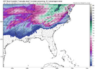
Odd look. Building CAD or retreating CAD there?
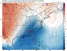
slight in-situ cad signature but it's not the leading actor in this particular movie
i was looking for the words.. this is it. the waves get misaligned and that's why the precip structure kind of looks like a falling jenga tower. generally just happy we're honing in on a date instead of just broadly gesturing at a troughClassic GFS move botching the separate waves and forcing a phase too quickly. Actually good to see.
sorry folks... this might be a storm for me and not many others. i generally think a mid south / mid-atlantic hit that sets up a 50/50 low would be a reasonable precursor to a storm that follows with a track that's further south
accu35
Member
Run to run changes as always, but these are still very favorable for some fun and plenty cold
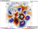
These looks are just intense with blocks that aren't wanting to breakdown quickly. Rare


- Joined
- Jan 23, 2021
- Messages
- 4,602
- Reaction score
- 15,197
- Location
- Lebanon Township, Durham County NC
LukeBarrette
im north of 90% of people on here so yeah
Meteorology Student
Member
2024 Supporter
2017-2023 Supporter
Just going to throw a couple ideas out there.
This pattern could very well be a step down process for this board when it comes to the snow footprint of each event.
First event would be farther north
Second to mid-atlantic/mid south and maybe NC.
Whatever after would be further south.
Would probably be the way everyone would score here.
This pattern could very well be a step down process for this board when it comes to the snow footprint of each event.
First event would be farther north
Second to mid-atlantic/mid south and maybe NC.
Whatever after would be further south.
Would probably be the way everyone would score here.
- Joined
- Jan 23, 2021
- Messages
- 4,602
- Reaction score
- 15,197
- Location
- Lebanon Township, Durham County NC
That’s exactly how I think it’ll go. We need every storm to overperform to our north this week on top of that.Just going to throw a couple ideas out there.
This pattern could very well be a step down process for this board when it comes to the snow footprint of each event.
First event would be farther north
Second to mid-atlantic/mid south and maybe NC.
Whatever after would be further south.
Would probably be the way everyone would score here.
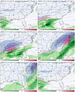
Don't know if a wave could drop any steeper than this. Yields some snow in deep south areas of AL>GA>SC


NBAcentel
Member
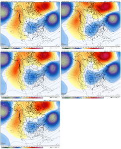
The GFS/CMC are so much better with the 6-8th storm and are closer to the eps members
wow
Member
The GFS does indeed pop a gulf low Jan 11-12 and the deep south and SE coast cashes in
accu35
Member
- Joined
- Jan 23, 2021
- Messages
- 4,602
- Reaction score
- 15,197
- Location
- Lebanon Township, Durham County NC
If you live north of 40/85 in NC, you basically have snow cover for the final seven days of this run.
Makeitsnow
Member
0z gfs shows temps dropping below freezing in north ga/etc wed the 8th and stays below freezing through Sunday with another reload on the way...amazing if that came close
wow
Member
Only common theme is cold for an extended period of time.
accu35
Member
Could wake up in the morning and have a legit winter storm for the 5th-7th time frame on the models. That’s what excites me about this pattern, you never know what surprises may come your way.
- Joined
- Jan 23, 2021
- Messages
- 4,602
- Reaction score
- 15,197
- Location
- Lebanon Township, Durham County NC
We don’t make it above 25 for seven days.
In terms of rarity, that has to be more rare than a foot+ snowstorm.
In terms of rarity, that has to be more rare than a foot+ snowstorm.
accu35
Member

Atlanta is below freezing for 5 days straight on the 0z GFS starting 1/8. No idea what the record is but that has to be close to it
lexxnchloe
Member
LC is one of the greats.I have never heard of this guy? I'm not sure what he's trying to say, but I don't think he is as smart as he thinks he is. what does he mean"remember climatology and ignore index-based predictions, especially those based on just one parameter." And"Duration of the winter weather may disappoint those looking for a "winter comeback", where the run of recent years with virtually no below normal temperatures and above average snowfall will come to a stop. " Sounds like a global warming nut that has made a forecast for a warm winter based on "climate change"and he's praying he won't look like a fool . At the very least he's a winter Grinch!
NBAcentel
Member
NBAcentel
Member
Euro might be a MASSIVE hit
That is the stuff you see one one model run at 384hrs. Not every model and every ensemble.
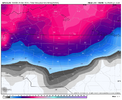
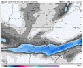
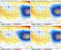
This must be heaven. Hall of fame run that wont ever be topped View attachment 157337
Yeah euro is an all timer holy s***. The potential is there needless to say
Sent from my iPhone using Tapatalk
Avalanche
Member
That’ll keep the Mid-Atlantic mets up all nightThis must be heaven. Hall of fame run that wont ever be topped View attachment 157337
Last edited:
Avalanche
Member
Definitely old school with the Triad piedmont getting all snow and the transition to sleet/freezing rain in the coastal plain. For sure textbook from the 70’s and 80’sLike Webb says- Snowstorms like grandma used to make
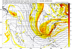
View attachment 157338
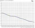
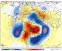
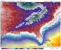
And all that snow cover gets us here View attachment 157339
Foot plus of snow on the ground, massive power line damage, subzero temps equals house plumbing Armageddon.
Not being an alarmist, but you can kiss municipal water goodbye for days as well.
Like Webb says- Snowstorms like grandma used to make
View attachment 157338
Once again that starts at day ten. We aren’t talking about 340+ hrs. Dang….

