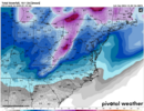
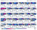
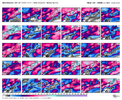
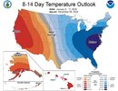
If you want to see snow, you either need the main trough axis anomaly to center itself over the TN Valley (Miller A pathway) or you need to create enough stream separation to get overrunning/cold air damming (Miller B) or some combination of the two.
A big fat
wound up & northern stream dominated trough sitting along or just barely off the east coast without a good southern stream and disturbance to separate from it, usually doesn’t get the job done outside of a clipper system (like we saw in early to mid December)
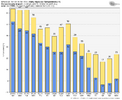
I don’t think we have the right mean pattern just yet during most of the first week of January, except on the GEFS to some degree, but I (still) have concerns about it still not properly handling the pacific jet extension. If we reverse the trends we’ve seen the past day or so, albeit only mildly (because we don’t want too much western troughing), I’ll be more intrigued about potential right at the beginning of January.
Imho, better chances are probably right after this period when the wave pattern starts to retreat
View attachment 156787
View attachment 156788