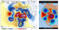
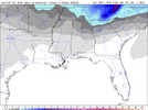
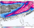
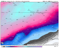
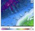
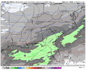
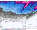
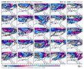
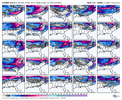
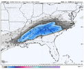
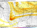
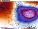
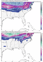
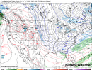
That folks is your classic 1988 snowstorm part 2. Classic miller A. Gonna be some big hits in the ensembles tonight.This must be heaven. Hall of fame run that wont ever be topped View attachment 157337
-
Hello, please take a minute to check out our awesome content, contributed by the wonderful members of our community. We hope you'll add your own thoughts and opinions by making a free account!
You are using an out of date browser. It may not display this or other websites correctly.
You should upgrade or use an alternative browser.
You should upgrade or use an alternative browser.
Pattern Jan 2025 Powered by Rheem AC
- Thread starter SD
- Start date
Webberweather53
Meteorologist
The Euro run was close to doing something extremely stupid.
What amazing about this is. That we have some type of agreement with some type of storm during this time period from all the models. I don’t remember last time we have seen that.The Euro run was close to doing something extremely stupid.
Yes it definitely was! Wanted to pick your brain on possibilities of getting a Feb. 73 type storm? Do you see any hallmarks of a situation like that?The Euro run was close to doing something extremely stupid.
Thank you sir. That run felt like watching you and Burgertime on Americanwx back in the day posting about the Euro late at night. Not sure where he ended up but man that guy is a legendWay to bring it home with the PBP jrips
The last time I've seen a 576 dm contour on a Greenland Block may have been during the absurd block in December 2010
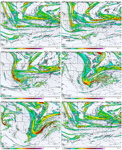
500mb vort. Not sure you could draw it up better if you tried
This must be heaven. Hall of fame run that wont ever be topped View attachment 157337
Can you post 10/1? I’m curious.
We’re talking a days on days on days of lake effect snow. These are the events that get LES down into the western facing slopes of WNC if you get the angle right. And these types of NW flow events can pile the the snow up in a hurry. Prime ski resort conditions. Maybe an all timer season if it all comes together. Which it won’t. But it might 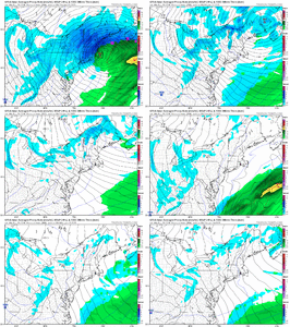

John1122
Member
If that Euro run comes to pass, the Blizzard of '93 would move into second place for a lot of areas, among winter storms.
Sure! It’s lighter definitely but temps support better ratios especially in the northern half of the snow corridor. Atlanta is in the mid 20’s for instance View attachment 157350
Thanks. I was just curious because for instance on 12/08/17, Kuchera was actually low total wise.
wow
Member
The euro and GFS not that far off at 500mb but the euro doesn't botch the surface reflection. This is what I expected to see on the GFS run.
- Joined
- Jan 23, 2021
- Messages
- 4,602
- Reaction score
- 15,197
- Location
- Lebanon Township, Durham County NC
The euro and GFS not that far off at 500mb but the euro doesn't botch the surface reflection. This is what I expected to see on the GFS run.
Big dogs are usually picked up early by models. December 2018 comes to mind for me. Models were honking 9-10 days prior to that storm
Sent from my iPhone using Tapatalk
NBAcentel
Member
That particular euro run, for instance, takes the upstate of sc below freezing around 6pm on 1/7 and doesn’t get it back above freezing for the duration of the run ending 6pm on 1/12. An all timer folks. Even by long range weenie run standards this shouldn’t happen
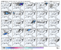
Woof woof. EPS supports the euro on the second storm View attachment 157353View attachment 157354
That mean is nuts on so many levels. Tampa has a trace…
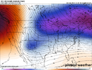
Trend on last 3 runs of Euro Ensemble Mean 5-Day average for Jan 5 to Jan 10. Pacific / North American pattern edging west. Blocks over Greenland and north of AK strengthening. Low anomaly under the block in the Eastern U.S. stretching out (not as suffocating).The NAO region looks superb on euro ensemble this is an insane anomaly for 330hrs out

Sent from my iPhone using Tapatalk

CNCsnwfan1210
Member
Woof woof. EPS supports the euro on the second storm View attachment 157353View attachment 157354
One inch snowfall mean all the way down to NE Louisiana, wow! This has really big potential written all over it.
Sent from my iPhone using Tapatalk
There is already chatter in the MA forum about a HECS
For reference:
SECS 6-12 inches Significant East Coast Storm
MECS 12-24 inches Major East Coast Storm
HECS 24-36 inches Historic East Coast Storm
BECS 36+ inches Biblical East Coast Storm
the hunt is on
For reference:
SECS 6-12 inches Significant East Coast Storm
MECS 12-24 inches Major East Coast Storm
HECS 24-36 inches Historic East Coast Storm
BECS 36+ inches Biblical East Coast Storm
the hunt is on
accu35
Member
Anyone have the EPS snow map?
Just help it snow in Tahoe at very end of Jan/early Feb please. lol.I’ve always felt like the hardest part of this coming winter to nail down was this forthcoming transition zone in late January into the beginning of Feb.
The outcome of this winter from about MLK Day or so and into early Feb is dependent to a large degree on what we do in the earlier part of the month & the stratosphere to some extent as well.
I think we’re making the right moves now to keep things at least more interesting way down the road
wow
Member
Anyone have the EPS snow map?

Models: EPS - Pivotal Weather
View EPS weather model forecast map image for Snow Depth [mean] in Mid-Atlantic on pivotalweather.com.
Six Mile Wx
Member
severestorm
Member
Snow mean has gone down for KAVL since 18z by a full inch.
I figured since some folks were referencing other major winter storms, I would bring up Feb 73'. I don't think the setup as stands now, would be similar to that one or yield that kind of result. I just wanted to get thoughts on how probable it would be to get something like that, this time around (if we are lucky enough to get a storm).Oh no you didn't. We could only hope and pray to ever see the likes of that one again.
Six Mile Wx
Member
wow
Member
Six Mile Wx
Member
CNCsnwfan1210
Member

I mean…look at where we were a week ago, pretty big improvements since then!Let’s put that chef hat on and get to work. This forum is lit and I love it!
Sent from my iPhone using Tapatalk
NBAcentel
Member
Six Mile Wx
Member
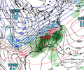
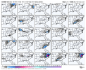
Reminiscent of 1993, bomb dropped down the stove pipeThe 18z AI GFS graphcast was going for a monster View attachment 157368View attachment 157369
Looks like EPS Member 01 would do it!I figured since some folks were referencing other major winter storms, I would bring up Feb 73'. I don't think the setup as stands now, would be similar to that one or yield that kind of result. I just wanted to get thoughts on how probable it would be to get something like that, this time around (if we are lucky enough to get a storm).
The ‘73 storm had a classic, Mod-Strong El Niño, low latitude, west to east tracking wave in the subtropical jet stream (similar to March ‘83). Unlikely to have that in the near future, but what you’d be looking for is a healthy wave to dive sharply SSE on the eastern side of the PNA ridge into E TX / LA before sliding E then ENE out to sea underneath a heavy blocking regime to the north along the east coast
SimeonNC
Member
severestorm
Member
SimeonNC
Member
packfan98
Moderator
There’s the historic Florida snowstorm on the 6z gfs!

