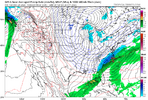
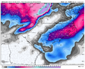
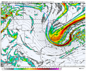
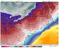
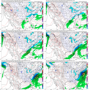
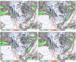
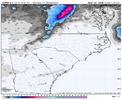
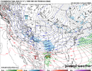
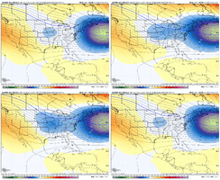
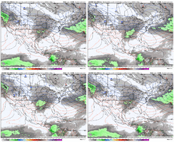
Absolutely- models haven’t really coalesced on a period(s) yet- that broad window is represented by the randomness of of the ensemble plots. Good in that it shows the window is both big and fertile, hoping that we can begin to key in on a particular date or two this suiteSo much potential with such a large window. Energy is flying around everywhere.
-
Hello, please take a minute to check out our awesome content, contributed by the wonderful members of our community. We hope you'll add your own thoughts and opinions by making a free account!
You are using an out of date browser. It may not display this or other websites correctly.
You should upgrade or use an alternative browser.
You should upgrade or use an alternative browser.
Pattern Jan 2025 Powered by Rheem AC
- Thread starter SD
- Start date
Ha, I guess there's a reason most of us have single digit avg / median snowfall. I like how the GFS and CMC runs are maintaining the -NAO and reloading the cold. The Euro big bang cold shot and out of here is a potential fail mode. Lack of southern stream is another - but we can get around that somewhat with dropping waves down into the deep troughit would be impressive if we screwed this look up
D
Deleted member 609
Guest
- Joined
- Jan 23, 2021
- Messages
- 4,577
- Reaction score
- 15,106
- Location
- Lebanon Township, Durham County NC
North trendTake my moneyView attachment 157071
Downeastnc
Member
Those are the best...very Jan 2018ish we had a 4-6" powder hit then 4 days of brutal cold.Snowing in the upper teens & low 20s.
View attachment 157073
Blue_Ridge_Escarpment
Member
What would be devastation is this cold coming with so many still without homes in WNC.Would be a devastating outcome for the upstate of SC, foothills of NC, and western Piedmont areas. You'd have the mountains and coastal areas score big but those in-between stuck with nothing.
Don't worry fam, it'll show it snowing again in Nashville at 3 degrees by the 18z run.Would be a devastating outcome for the upstate of SC, foothills of NC, and western Piedmont areas. You'd have the mountains and coastal areas score big but those in-between stuck with nothing.
RTRwx
Member
At hour 360, the GFS shows snowflakes in the Bahamas and a ZERO degree windchill in Orlando. Absurd. 
Given some of the totals out in the gulf stream sounds like a W for both of usNorth trend
Usmeagle2005
Member
Iceagewhereartthou
Member
coldfront22
Member
We need the NW trend on that GFS run and it would be a classic for both Carolina’s
Sure would.Verbatim, this would be up there with Feb 73 and Dec 89 (and for the western upstate with Jan 2000 and Feb 2004) on the list of all time painful screwjobs. That is absolutely BRUTAL.
wow
Member
you're well in the 300+ hr range on a single OP run. just enjoy the potential right now.
Webberweather53
Meteorologist
Snowing in the upper teens & low 20s.
View attachment 157073
Snowstorms just like grandma used to make
That gfs run was the definition of cold printer go brrr dropping in another cold shot at the end. Regardless of verification these runs are becoming all timers
rburrel2
Member
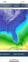
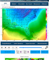
Every orange tree in Florida would be dead.View attachment 157074View attachment 157075
I’ve never seen Florida look that cold 12 am then 12 pm temps.
MichaelJ
Member
Normally these tend to trend N/W but with that extreme cold, outside of the mountains and coastal plain in NC, the Piedmont, foothills, upstate/Atlanta areas it could be a realistic scenario of zero snow for those areas. At this stage though, trying to predict the storm or the path is a fools errand.
wow
Member
so when are you flying back into town, eh?Snowstorms just like grandma used to make
wow
Member
no worries...they put coats on the trees. and a little hat,too.Every orange tree in Florida would be dead.
AJ1013
Member
12z GFS had snow in the Florida Keys. WTF
Little orange hats..no worries...they put coats on the trees. and a little hat,too.
RTRwx
Member
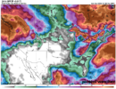
Nothing overwhelming but probabilities for precip next Friday/Saturday are slowly inching up on the Ensembles. Similar increases on the ICON Ensembles as well. There's enough energy flying around the base of that trough for a late bloomer (nothing big, but 1-2" in parts of AL, TN, GA, NC wouldn't be a shocking outcome).

iGRXY
Member
All that takes is it going neutral about 100-150 miles further west and everybody from Georgia and east TN - east is in a winter wonderland.
Also a good chance (I think) that the cold is not really going to be that extreme.Normally these tend to trend N/W but with that extreme cold, outside of the mountains and coastal plain in NC, the Piedmont, foothills, upstate/Atlanta areas it could be a realistic scenario of zero snow for those areas. At this stage though, trying to predict the storm or the path is a fools errand.
AJ1013
Member
Next run is gonna have snow in Cuba
Someone check on Blacksburg.
Webberweather53
Meteorologist
so when are you flying back into town, eh?
I’m leaving back to my Desert oasis right before things get truly interesting. I wouldn’t mind getting stuck here with the early storm on the 3rd-4th
EastmanGAWX
Member
The solution that the GFS is depicting showing snow falling along an arctic front in far Southern Georgia/North Florida is not out of the realm of possibilities, the same thing happened during the artic blast of the first week of February 1996. If my memory is correct, the accumulations in GA were confined to the area between Waycross and Brunswick. All points to the NW just got bitter cold and absolutely nothing, this was the last time that specific area got snow until the early January 2018 storm.
NBAcentel
Member
Euro was close with that energy but it just strung out towards the end, but man if that one turned the corner… ready to see the EPS I’d imagine there’s gonna be some bangers on it
Webberweather53
Meteorologist
As cool as it would be to see the euro verify with a giant high back dooring into NM, it wouldn’t do much good for me.
NBAcentel
Member
wow
Member
12z Euro looking more like GFS/Canadian with more robust 50/50 and an serious overrunning event building up.

