-
Hello, please take a minute to check out our awesome content, contributed by the wonderful members of our community. We hope you'll add your own thoughts and opinions by making a free account!
You are using an out of date browser. It may not display this or other websites correctly.
You should upgrade or use an alternative browser.
You should upgrade or use an alternative browser.
Pattern Jan 2025 Powered by Rheem AC
- Thread starter SD
- Start date
AJ1013
Member
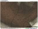
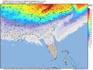
How about a -20F dew point in South FloridaThe GFS is funny, look at these dewpoints. I can't say I've ever seen a -15 F dewpoint temp in Alabama before.
View attachment 157115

LickWx
Member
The GFS is broken, that isn’t even possible . That solution is not grounded in any reality on this earthHow about a -20F dew point in South Florida

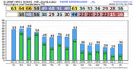
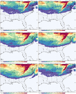
How does one get the NBM temperatures for that range?View attachment 157119That is sustained cold. Can’t say I’ve seen that much in my lifetime.
In the next 48 hours imho.When should we start taking the op runs more seriously? Inside 7 days? They are bound to pick up on this stuff soon. My initial sense is they are lagging here.
AJ1013
Member
You just have to believe!The GFS is broken, that isn’t even possible . That solution is not grounded in any reality on this earth
LickWx
Member
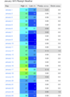
Lowest dewpoint in that region was 0…. This is -19 …You just have to believe!

Dew Point Statistics
www.weather.gov
LukeBarrette
im north of 90% of people on here so yeah
Meteorology Student
Member
2024 Supporter
2017-2023 Supporter
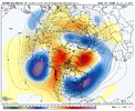
I would like to think that any further west would risk some more cutter like solutions, so let’s try our best to keep it here.I’m away from the griteater basement where I can quickly do the trend loop, but yeah, EPS keeps bumping a little west with the western ridge / eastern trough. Improvement
View attachment 157122
NEGaweather
Member
Sent from my iPhone using Tapatalk
AJ1013
Member
Lake Okeechobee Effect Blizzard
atlweatherman
Member
Here you go

Sent from my iPhone using Tapatalk
Can someone post for Atlanta?
NEGaweather
Member
Can someone post for Atlanta?
Done

Sent from my iPhone using Tapatalk
atlweatherman
Member
Thanks!Done
Sent from my iPhone using Tapatalk
iGRXY
Member
packfan98
Moderator
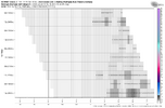
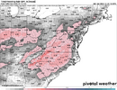
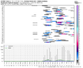
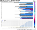
I definitely can't recall so much potential showing from an ensemble run as the EPS just showed. Looks like what you see for Boston during the heart of winter. It also appeared that the good pattern was holding strong, so I can't wait to see what these runs might look like in another couple of days. Obviously, they could trend worse, but I did a little analysis for Greensboro:
-47/52 members showing at least a trace of snow
-31 members had multiple snow events
-11 members had 3+ snow events
-2 members showed 4 distinct snows
-31 members with at least 2"
-23 members with at least 4"
-13 members with at least 6"
-8 members with over a foot
-47/52 members showing at least a trace of snow
-31 members had multiple snow events
-11 members had 3+ snow events
-2 members showed 4 distinct snows
-31 members with at least 2"
-23 members with at least 4"
-13 members with at least 6"
-8 members with over a foot


Last edited:
Psalm 148:8
Member
- Joined
- Dec 25, 2016
- Messages
- 344
- Reaction score
- 789
I’ve got one just like that!! It was my daddy’s. He grew up in Gaston Co NC! I used it in the 1980 or 1981 ice storm!!! Worked great!! Are y’all saying I might need to go get it from Daddy’s shop?? Btw.. I’ve lost 83 pounds this year.. I’m freezing in the 50’s!!! All my thickest clothes are 4 sizes too big!! OMG. I’m gonna be an ice block!! If we don’t get some snow or ice and all I get is cramps from freezing to death, yall gonna see one nut job!! Namely that groundhogzilla come to like!!! Only us old folks who been around here a long time will remember that!!! You met students were probably in elementary school!!
SnowNiner
Member
Done
Sent from my iPhone using Tapatalk
Could this be a classic old school pattern where Atlanta getting snow…leads to Clt getting a storm? Could be.
Wulfer
Member
I've got one of these too. I don't get to use it much in Chattanooga Tn. though.I’ve got one just like that!! It was my daddy’s. He grew up in Gaston Co NC! I used it in the 1980 or 1981 ice storm!!! Worked great!! Are y’all saying I might need to go get it from Daddy’s shop?? Btw.. I’ve lost 83 pounds this year.. I’m freezing in the 50’s!!! All my thickest clothes are 4 sizes too big!! OMG. I’m gonna be an ice block!! If we don’t get some snow or ice and all I get is cramps from freezing to death, yall gonna see one nut job!! Namely that groundhogzilla come to like!!! Only us old folks who been around here a long time will remember that!!! You met students were probably in elementary school!!
whatalife
Moderator
Snowlover34
Member
can you post Hazel Green alabama please?Done
Sent from my iPhone using Tapatalk
NEGaweather
Member
can you post Hazel Green alabama please?
Sent from my iPhone using Tapatalk
NEGaweather
Member
can you post Hazel Green alabama please?

Sent from my iPhone using Tapatalk
DAWG4LIFE
Member
Could you possibly post Dallas, Georgia please?
Sent from my iPhone using Tapatalk
NEGaweather
Member
Could you possibly post Dallas, Georgia please?

Sent from my iPhone using Tapatalk
carolinachaos
Member

Sent from my iPhone using Tapatalk
I don’t wanna ask, however I am… lol can you pull up Florence, SC
Sent from my iPhone using Tapatalk
NEGaweather
Member
I don’t wanna ask, however I am… lol can you pull up Florence, SC
Sent from my iPhone using Tapatalk
lol I’m home bored, it’s fine. Nice to have a pattern to track

Sent from my iPhone using Tapatalk
I don’t think iv ever seen anyone ask to show one for Florence SC lol. What a time to be alive.lol I’m home bored, it’s fine. Nice to have a pattern to track
Sent from my iPhone using Tapatalk
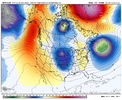
UKMET shifting west and stronger with energy also.
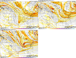
P.S. For those not in the know, the UKMET is one of the better scoring models at H5 and I have personally used it in my own job (both for a tropical and winter forecast) when it latched onto trends ahead of other NWP/ensembles in the past 2-3 years. To be fair, it has also struggled mightily other times, but I can say that about all NWP.

P.S. For those not in the know, the UKMET is one of the better scoring models at H5 and I have personally used it in my own job (both for a tropical and winter forecast) when it latched onto trends ahead of other NWP/ensembles in the past 2-3 years. To be fair, it has also struggled mightily other times, but I can say that about all NWP.
Last edited:
Snowlover34
Member
Thanks
Sent from my iPhone using Tapatalk
Webberweather53
Meteorologist
I definitely can't recall so much potential showing from an ensemble run as the EPS just showed. Looks like what you see for Boston during the heart of winter. It also appeared that the good pattern was holding strong, so I can't wait to see what these runs might look like in another couple of days. Obviously, they could trend worse, but I did a little analysis for Greensboro:
-47/52 members showing at least a trace of snow
-31 members had multiple snow events
-11 members had 3+ snow events
-2 members showed 4 distinct snows
-31 members with at least 2"
-23 members with at least 4"
-13 members with at least 6"
-8 members with over a foot
View attachment 157128
View attachment 157129
I honestly cannot remember the last time I saw meteograms look that good around here, even if it’s out in fantasy land (for now).
Maybe late Jan - early Feb 2014?
But when you do it’s epic. 1994 gave us days of sledding on ours.I've got one of these too. I don't get to use it much in Chattanooga Tn. though.
carolinachaos
Member
I don’t think iv ever seen anyone ask to show one for Florence SC lol. What a time to be alive.
It’s a new day! Lol
Sent from my iPhone using Tapatalk
Webberweather53
Meteorologist

