• Hello, please take a minute to check out our awesome content, contributed by the wonderful members of our community. We hope you'll add your own thoughts and opinions by making a free account!

Wintry Jan 2-4 2022 Winter Weather Event/Obs

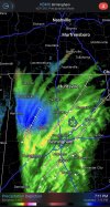
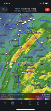
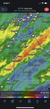
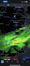
Probably close to Fredericksburg, VA. The warm advection is pretty insane
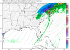
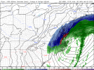
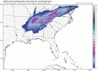
What’s your thought on the deformation zone/axis ? I always consider it a wildcard on these strengthening mid latitude cyclones, even with crappy tracks like last early jan for example, I’m not expecting accumulating snow out of it but I’m just curious on what your thoughts are, certainly seems possible
 
Too far south imo. Likely gonna be a massive sleet fest for a good while there

Agree, but I see very narrow transition zones, it’s a thermal crash and in many ways convective. The boundary setting up along the coast is working its way through eastern NC, I’m underneath of it, and it’s robust. I am chasing this storm, possibly in to the southern Delmarva, details TBD. About a 24hr punch leaving tomorrow early evening.
 
Greg Fishel's post on Facebook.

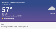
COULD WE GO FROM 79ºF TO SEEING FLAKES IN ABOUT 36 HOURS?

Well, as long as I'm anywhere close to North Carolina, there's always the risk of you seeing a flake on the streets, but in this case I was referring to the white hydrometeors that periodically fall from the sky during the winter season. Before I get into more detail on this, let's look back at our very warm December.

At the RDU airport, we ended up being the second warmest on record to December of 2015 in just about all categories, with one exception. We experienced 12 days at or above 70º, which was one more than the 11 observed in 2015. And even though the month, date, and year changed today, we experienced another incredibly warm day, this time a record breaker of 79º, the second warmest temperature ever observed during the entire month of January at RDU.

Well this evening's weather map shows a couple of frontal zones. The first one stretches from northern Mississippi up across West Virginia to New York City. The air behind this front is only marginally cooler, mainly in the 50s. But a few hundred miles behind that is the leading edge of the genuinely cold air. Temperatures have plunged into the teens and 20s across parts of Missouri, Iowa, Illinois, and Wisconsin. Complicating matters is a vigorous upper air feature over New Mexico, that will slide eastward to Mississippi by Sunday evening, and then pass right over central North Carolina early Monday morning.

This upper air disturbance will induce the development of an area of low pressure along the main cold front, over Georgia Sunday night, and that storm will intensify and eventually head out to sea later Monday. Since the Low will be developing south and east of Raleigh, cold air will be pouring southward into North Carolina Sunday night into Monday morning. The upward motion associated with this disturbance will be rather intense, and the vertical temperature structure of the atmosphere will allow that upward motion to produce maximum cooling of the air column above Raleigh. Thus, there is the very real possibility that the rain could end as wet snow early Monday morning, and could even come down hard for an hour or two!

Now I know what you're thinking! Greg, who cares? It's been so warm of late, it'll never stick, right? Not so fast! I've seen it happen before! If heavy snow falls onto a warm surface, the melting of those flakes on contact extracts heat from the pavement, and the heavier the snow, the more extreme this effect is. So, initially, yes, it will melt on contact, but if it comes down hard for an hour or two, we could see the roads whiten up temporarily. Obviously those of you living north of Raleigh have an even better chance of accumulating snow, while those to the south have a lesser chance, but this is the type of setup where snow could at least be observed as far south as Fayetteville and New Bern.

So we have something to watch, finally. And if it looks good this time tomorrow, I'll probably be driving northwest to see it, and maybe do a facebook live or two! The little boy in me just will not die!
 
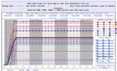
Who says that will happen? We have seen a lot of back and forth with the trends whenever we have a threat of snow. And the models might not be exactly right, either. As long as it shows a storm stll there is a chance.
Yeah models have been back and forth for me all week literally. One run I’ll see 2 plus inches and the next will show flurries. I don’t quite remember ever having this much back and forth before.
 
Back
Top