Not very likely unless you are in higher elevations. Although I will say along highway 11 has a chance.Could any areas in the upper parts of the upstate see anything frozen out of this?
Sent from my SM-A526U using Tapatalk
-
Hello, please take a minute to check out our awesome content, contributed by the wonderful members of our community. We hope you'll add your own thoughts and opinions by making a free account!
You are using an out of date browser. It may not display this or other websites correctly.
You should upgrade or use an alternative browser.
You should upgrade or use an alternative browser.
Wintry Jan 2-4 2022 Winter Weather Event/Obs
- Thread starter SD
- Start date
Stephenb888
Member
Could any areas in the upper parts of the upstate see anything frozen out of this?
YesSent from my SM-A526U using Tapatalk
packfan98
Moderator
Anybody have the 18z Euro? The MA folks say it’s flatter than 12z. Curious what that means for us on the southern fringe.
Ron Burgundy
Member
Look to your west, brother. Things are looking good for you!Really coming down nowView attachment 101279
Not much change tbh. Maybe a little less snow from wake county eastAnybody have the 18z Euro? The MA folks say it’s flatter than 12z. Curious what that means for us on the southern fringe.
StormStalker
Member
Still rain in the Shoals. 37 degrees.
HSVweather
Member
Flotown
Member
I cam tell you for sure it's mixing with sleet I'm just to west of the SProbably gonna start seeing snow reports here within a hour or so View attachment 101277
Stormlover
Member
already changing over just nw of florenceProbably gonna start seeing snow reports here within a hour or so View attachment 101277
SN mPing NW of Florence AL
HSVweather
Member
HSVweather
Member
- Joined
- Jan 2, 2017
- Messages
- 1,566
- Reaction score
- 4,279
Best chances would be areas north of hwy11. Other than that it's very low end but not totally out of the question of seeing a brief change over or flakes mixing in as the system pulls out in the morning. Now the southern end of the deform band could see a dusting..around Landrum, travelers rest areaCould any areas in the upper parts of the upstate see anything frozen out of this?
Sent from my SM-A526U using Tapatalk
JLL1973
Member
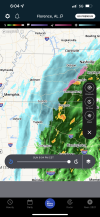
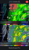
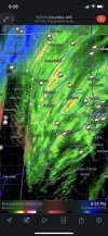
Yes it’s really coming downView attachment 101275Pretty cool to see all the dynamics in play around Memphis with the precip depiction mode. That is a sweet snow band pushing through Corinth, too.
- Joined
- Jan 23, 2021
- Messages
- 4,603
- Reaction score
- 15,199
- Location
- Lebanon Township, Durham County NC
K1M4 and KMSL are your obs stationsProbably gonna start seeing snow reports here within a hour or so View attachment 101277
JHS
Member
.AVIATION /00Z MONDAY THROUGH FRIDAY/...
At KCLT and elsewhere: Most TAF sites are VFR at present, but
such conditions should not persist for much longer. MVFR CIG
restrictions should build back in within the next hour or two across
the Upstate, with the possibility for some spotty IFR CIGs mixed
in, which have been handled with TEMPOs at KGSP, KGMU, and KAND.
In keeping with the previous round of TAFs, have kept mention of
snow confined to KAVL and KHKY, with KAVL now sporting a prevailing
-SHSN Monday morning, and at KHKY still only a PROB30 for -SHRASN.
Went ahead and dropped snow mention altogether at KCLT, as it
seems increasingly unlikely that anything more than brief, thin
flurries will stretch that far east and south. TSRA has been added
across all sites except KHKY, with KCLT even gaining a PROB30 for
+TSRA, as some of the short-term guidance shows an increasingly
dire-looking couple of hours after daybreak Monday. Otherwise,
winds should begin to turn NNEly in the next few hours, and as
they do so, impressive low-level gradient flow should increase
gust potential the second half of Sunday night and well into the
day Monday. Gusts have been expanded in places, as some guidance
now also depicts gap winds at KGSP and KGMU. After perhaps 18Z,
the influx of very dry air behind this system should allow rapid
improvement in CIGs and VSBYs and much calmer conditions to prevail
through the end of the TAF period
Not good news for snow lovers in Charlotte. The 2nd bolded part may be the bigger story for many of us.
Landrum always winsBest chances would be areas north of hwy11. Other than that it's very low end but not totally out of the question of seeing a brief change over or flakes mixing in as the system pulls out in the morning. Now the southern end of the deform band could see a dusting..around Landrum, travelers rest area
StormStalker
Member
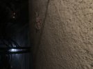
Sleeting here now pretty good. Blowing up against the window.
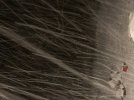
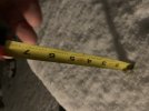
But ,But the ground temp was 65 earlier today.. Rates will always overcome ground temps. Now after it stops,thats another story.Got a dusting now. Still coming down. Finally down to 32 degreesView attachment 101278
HSVweather
Member
- Joined
- Jan 23, 2021
- Messages
- 4,603
- Reaction score
- 15,199
- Location
- Lebanon Township, Durham County NC
Snowing on the MSU campus in Starkville
JLL1973
Member
DadOfJax
Member
I hope it’s before midnight
Right?…moisture will be gone by then!
Brent
Member
Wish I could upload a video but it says file too large. Ground is covered good now
I used streamable last night very easy
HSVweather
Member
Storm5
Member
I hope it’s before midnight
Haha no joke
Sent from my iPhone using Tapatalk
NBAcentel
Member
packfan98
Moderator
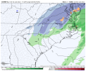
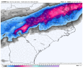
Deform band on the 23z hrrr starting to look more anemic east of the mountains compared to earlier runs.
JLL1973
Member
- Joined
- Jan 2, 2017
- Messages
- 1,566
- Reaction score
- 4,279
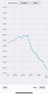
Has cooled down to 59...2inning
StormStalker
Member
Deck and cars got a nice coating of sleet already. Didn’t see any snow yet
NBAcentel
Member
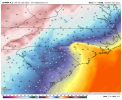
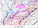
This run has a closed off 546 dm contour that’s probably why hope we’re not starting another amping up trendDeform band on the 23z hrrr starting to look more anemic east of the mountains compared to earlier runs.
Snowflowxxl
Member
23Z HRRRRRRRRR looked good for here. Now I just need to decide if I'm going to stay up till 4 or try and sneak a nap in around 12.
DadOfJax
Member
ChattaVOL
Member
Great idea… but we all know napping is out of the question ?23Z HRRRRRRRRR looked good for here. Now I just need to decide if I'm going to stay up till 4 or try and sneak a nap in around 12.

