DadOfJax
Member
East central and northeast AL even more sohrrr just pivots around and buries the huntsville area View attachment 106290
East central and northeast AL even more sohrrr just pivots around and buries the huntsville area View attachment 106290
3k NAM is a hi res modelYou can toss the globals….hi res models are all that matter.
Well, I honestly don't know the biases of the HRRR, but it is a high res model and I think it normally performs well. I would be cautious following its solutions exactly but the trends can't be ignoredWould a Met please chime in and tell us whether these HRRR runs are plausible or not. The model is sticking to it's guns and has been really consistent on that front end thump.

Robert now calling for what we’ve been seeing on the HRRR
Good grief. Is that the HRRR?noon sunday View attachment 106293


Not so much south I20….but along and north for sure.“Chaotic mess of snow bands”. An NWS dream I’m sure in Alabama. But it matches up with what the models have been trying to show. Just a wintry mess across parts of Alabama tomorrow south of I-20. Rain, Snow, Kitchen sink.
Agreed. For Etowah county probably Noccalula Falls/Black Creek and points north. Blount county around oneonta/highland lake and points north.East central and northeast AL even more so
Which model run is that? It doesn't look like the latest HRRR runs or even 3km nam.View attachment 106291
It looks like elevation is key for Alabama this time, you can see snow depth is greats to the mountains around Huntsville and NE Alabama as well as along the Cumberland plateau west to Franklin and Colbert counties at around 900+ feet in Elevation, and then as you drop in elevation towards the MS line and TN river it gives no accumulation.
YesGood grief. Is that the HRRR?
Can you share a lower pic or this ?noon sunday per HRRR model View attachment 106293
Hoping it bleeds over into LaGrange, GA. We haven’t had squat in 4 years. Wasn’t looking promising till a few hours ago. Still not holding my breath.East central and northeast AL even more so
That's good to know, I've wondered how accurate the snow depth is on HRRR. But ground temperature aside, I know locally elevation for precip type is key many times in N. AL, just 300 feet can mean the difference between a dusting and 2 or 3+ inches of snow here, I've observed this many many times.Snow Depth is not a good tool IMO. I've seen it bust WAY too low several times. In 2017 it had Cobb county at 2 inches and some places got over 10. It thinks a warm ground will eat everything.
Kuchera or regular are the way to go


You can go to weathernerds.org and play with it and get what you want...it's a little tricky to learn how it works, but has great graphicsCan you share a lower pic or this ?
 www.tropicaltidbits.com
Precip always and I mean always arrives earlier than progged around here, fact. Death, taxes, NW trend and precip arriving early, never fail3km NAM has precip moving into Raleigh by 09z now! This has sped up from where we were yesterday. View attachment 106297
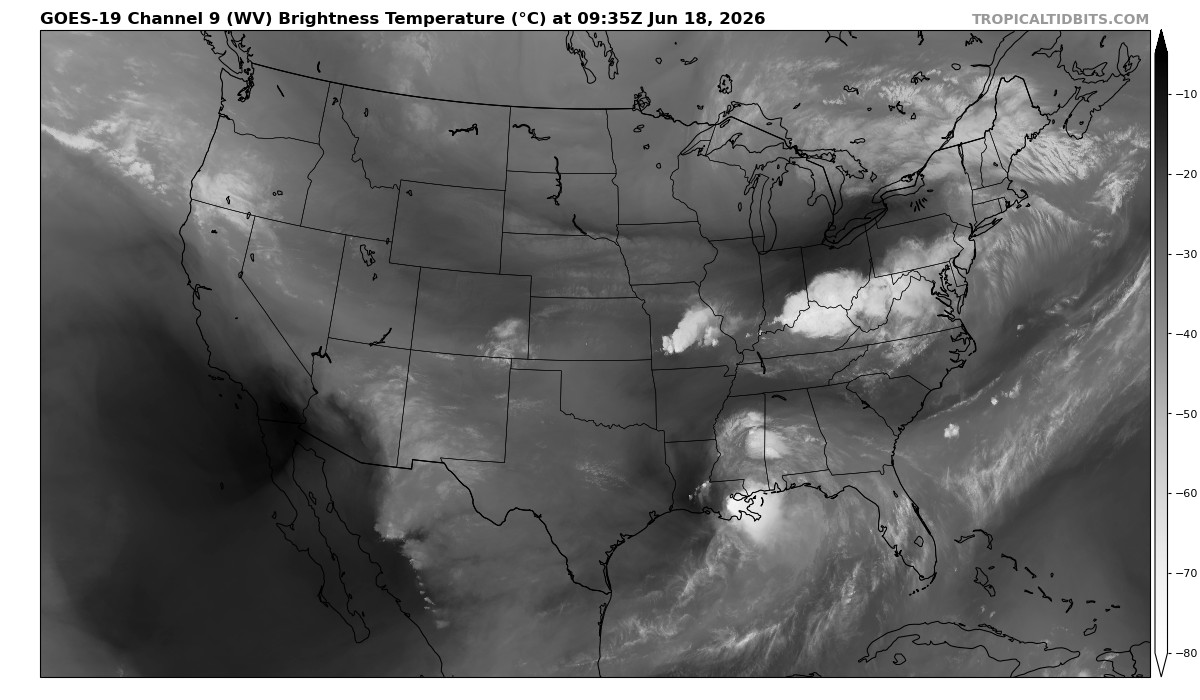
No gonna lie that pretty far south, should start to pivot very soon... unbelievable this still ends up going through western NC, jeezWater Vapor Satellite Loop for United States | Tropical Tidbits
United States Water Vapor Satellite Loop
The center of the ULL looks like it's really about to go right over NOLA.


No gonna lie that pretty far south, should start to pivot very soon... unbelievable this still ends up going through western NC, jeez
