bigstick10
Member
The winds in ATL are going to be insane, they are telling people to sleep in the basement????

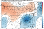
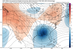
21Z RAP. Overdone no doubt but trending up


These trends man….wonder if the hrrr is on to something. Usually we see these trend tbe opposite direction as we get closer.
 Thought I would share for us Alabama crew.
And that's why I can't understand why locals are downplaying totals. Some has went down from 4-8" to 1-3" I'm confused at what they are thinkingAnother thing to remember is models spit out precip types based soundings. A lot of those soundings that are sleet are so close to snow soundings that it will be snow under heavy returns and this stuff is going to be dumping especially with FGEN forcing.


Usually GSP will include wind headlines in there WSW and not do a separate advisory for windDoes anyone have wind maps for NC and SC? I'd imagine they are going to be pretty strong here as well. Kinda surprised there are no advisories up.

Jimmy, we are getting hammered. I just cooked a big pot of spaghetti and am about to throw some French bread in the oven. Just popped a Pilsner and I’ll be sipping fine bourbon when little man goes to bed.Riding the RGEM to the grave. HRRRR looks very good as well. Transfer is going to be a killer no doubt but when isn’t it. View attachment 106235
Still seeing P-type issues in areas without the heavy precipitation. Just a Mess since we don’t have a cold airmass in place (*cough cough next week*). Model is trying to resolve cooling, but is struggling. Could easily be all rain In areas shown in blue south of I-20.Again the HRRR is really dumping buckets of snow over central Alabama tommorow morning. Would not be shocked for a winter storm warning for portions of central Alabama. These trends are ridiculous. With these snow rates even if it's a degree or two above freezing. It's going to stick.View attachment 106228View attachment 106229
Still seeing P-type issues in areas without the heavy precipitation. Just a Mess since we don’t have a cold airmass in place (*cough cough next week*). Model is trying to resolve cooling, but is struggling. Could easily be all rain In areas shown in blue south of I-20.
Henderson the first to drop below 10F on DPs. All the way to 30/9
I would caution you that the RGEM is about the worst thing to hang your hat on. It has been plum awful with verification so far for this event.Riding the RGEM to the grave. HRRRR looks very good as well. Transfer is going to be a killer no doubt but when isn’t it. View attachment 106235
Speaking of GSP they totally removed any mention of snow out of the forecast, at least in Charlotte.Usually GSP will include wind headlines in there WSW and not do a separate advisory for wind
 Still south……
Really?.. I haven’t pulled the city’s point forecast but that’s surprising. I went back and read their afternoon discussion again and there was actually no mention of any models. All that is said is there is a trend continuing to more ice accrual. I’ve been reading discussions from GSP for as long as I’ve had access to the internet, 25 years or more, and I’ve never known them not mention what short range models are showing as an event is drawing near.Speaking of GSP they totally removed any mention of snow out of the forecast, at least in Charlotte.


Do you happen to know how well the 3kNAM does with wind? I know that wind always is overdone on models, but the storm on 1/3 they actually seemed to be fairly accurate.., of course there was a sting jet coming into the backside of that system, and we don’t seem to have anything like that here
I always say knock 10 or 15 off but yeah they were fairly accurate with that storm. To me they show the potential and if the ingredients line up that's what you could getDo you happen to know how well the 3kNAM does with wind? I know that wind always is overdone on models, but the storm on 1/3 they actually seemed to be fairly accurate.., of course there was a sting jet coming into the backside of that system, and we don’t seem to have anything like that here