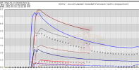
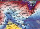
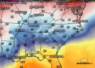
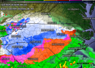
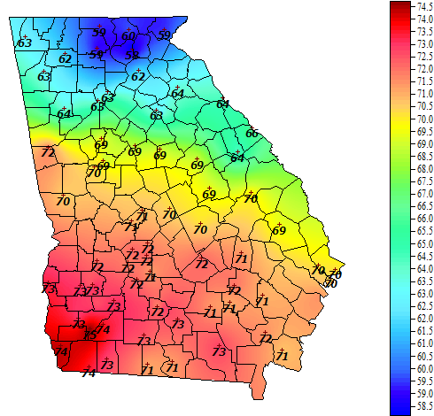
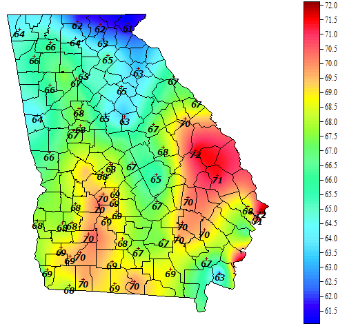
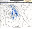
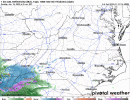
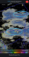
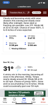
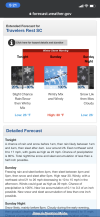
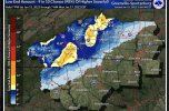
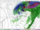
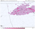
It keeps creeping southwest with each run.The wedge on the HRRR is not good. Gainesville at 25 with ZR and heavier stuff incoming. It's as far out as it goes this run but man this would not be fun. Lights out.View attachment 106156View attachment 106157
-
Hello, please take a minute to check out our awesome content, contributed by the wonderful members of our community. We hope you'll add your own thoughts and opinions by making a free account!
You are using an out of date browser. It may not display this or other websites correctly.
You should upgrade or use an alternative browser.
You should upgrade or use an alternative browser.
Wintry Jan 15-16 Winter Storm Discussion & Obs
- Thread starter SD
- Start date
ALHammerWx
Member
- Joined
- Jan 4, 2017
- Messages
- 61
- Reaction score
- 117
Stormlover
Member
How does the HRRR usually handle wedging? I seem to recall it being too warm in the past, but that may be outdated at this point. It seems to be on the cooler side of guidance now.
Looks like in general the models are picking up on CAD being more robust than previously modeled, which shouldn’t really be shocking and is something we see a lot with legit CAD (not that borderline crap in-situ stuff).
Looks like in general the models are picking up on CAD being more robust than previously modeled, which shouldn’t really be shocking and is something we see a lot with legit CAD (not that borderline crap in-situ stuff).
Stormlover
Member
hrrr


@MotoWeatherman looks like may have capped out today at 42.4, seems like that’s in line with CAD being able to do it’s thing for the front thump.
Snowflowxxl
Member
Final Forecast Call


Drscottsmith
Member
5:00 Report
Duncan, SC
Temp-42.8
Humidity - 52%
DP - 26.4
Duncan, SC
Temp-42.8
Humidity - 52%
DP - 26.4
Snowflowxxl
Member

Boom!
DadOfJax
Member
iGRXY
Member
3K NAM running about 5-8 degrees too high on the DP around this way. Suppose to be in the mid 30's and it's in the mid 20's
iGRXY
Member
WEATHERBOYROY
Member
I've been puzzled at the rain snow hodgepodge under the northern half of the 500mb storm. I believe the temperatures are verifying colder by several degrees at the surface. I also believe the models are giving too much heat value to the warm gulf moisture and not enough cold value to the cold core LP aloft. I will be surprised if most of the precip that falls across the northern half of Alabama and Mississippi tomorrow.
Old weather board saying is "to delay is not the way".....so faster is good!HRRR bringing in the precip faster and faster and the snow line is going further South and west.
View attachment 106175
I’m running degrees lower than the NAM here. It had me at 33 right now and I’m at 28. Also the wind has backed directly from the NE instead ENE, so the flow is now tapping into single digit dewpoints in eastern VA.3K NAM running about 5-8 degrees too high on the DP around this way. Suppose to be in the mid 30's and it's in the mid 20's
Chad Krigbaum
Member
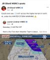
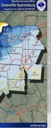
There’s a bit of a difference between TWC and GSP!
Attachments
ATLwxfan
Member

Boom!
Then you wake up with 2 inches on the ground. I have a feeling it’ll probably verify more as ice but let’s see.
Sent from my iPhone using Tapatalk
Snowflowxxl
Member
Agree. I think ATL will see a lot of sleet with the first batch.Then you wake up with 2 inches on the ground. I have a feeling it’ll probably verify more as ice but let’s see.
Sent from my iPhone using Tapatalk
Interestingly this is the first HRRR run that has a surface reflection over my house that is snow. Earlier runs have been showing sleet, but the soundings have clearly been snow.HRRR bringing in the precip faster and faster and the snow line is going further South and west.
View attachment 106175
Snowflowxxl
Member

21Z RAP. Overdone no doubt but trending up
Hrrr gives Charlotte 5” lol
JimBobs
Member
Personally I believe chances of snow in CLT have been too far downplayed. There’s a *chance* it could bust high for once.
Local meteorologists are extremely timid due to CLT’s extended snow drought.
Another NC meteorologist (that is referenced time-to-time on this site) told me to my face that Brad P got a thorough scolding from WCNC several years ago when a forecasted big snow event ended in cold rain.
Ever since then he has been more conservative, in line with the other 2 local news stations.
No snow for you
Member
- Joined
- Dec 28, 2016
- Messages
- 583
- Reaction score
- 890
Why do you keep posting the bottom 10%? Dang troll
Temperature finally dropped here in HSV. Down to 45 (7.3 C) now.
Z
Zander98al
Guest
Jrips2710
Member
Wouldn’t be the first time we’ve seen precip come in quicker than modeled and would obviously be a huge help for front end snow chances for SC/NC.HRRR bringing in the precip faster and faster and the snow line is going further South and west.
View attachment 106175
neelsamb
Member
Looking at the soundings though and I think it’s super close to being all snow for about 3 hours before the switch to freezing rain once the warm nose moves in. For the folks in the WSW I don’t think there will be a time period where there is all rain, aside from the initial light precip that moves in. And that rain/snow line is trending slightly south with each run.Agree. I think ATL will see a lot of sleet with the first batch.
Correct me if I’m wrong, but in the February 2014 storm, didn’t Birmingham get plastered by the ULL and models weren’t showing it until just a few hours before the event? I seem to remember tracking over on the other board and reading something about 2-4”/hr rates during that.The way the HRRR is trending we're going to need shovels if you live in Birmingham ??View attachment 106186
chattweather
Member
- Joined
- Jan 5, 2022
- Messages
- 12
- Reaction score
- 59
Area Forecast Discussion
National Weather Service Little Rock AR
419 PM CST Sat Jan 15 2022
.SHORT TERM...Today Through Sunday
To sum up this forecast in one simple word: OUCH.
That bears repeating: **OUCH**
The theme so far has centered on giant snowflakes, high snowfall
rates, heavy wet snow, and model guidance that remains
significantly warmer than what has been observed thusfar. Model-
derived snow accumulation progs? Laughable!
Still, the forecast for western AR including the Ouachitas/Ozarks
remains largely on track with the most significant and impactful
accumulations in higher terrain (as of 22Z, Chimes is the
*known* snowfall winner so far with a measured 8 inches; other
locations in the mountains have seen similar and largely elevation-
based snow totals). Banded snowfall will continue for the northern
counties for at least another few to several hours with rates on the
order of 1 to 2 inches per hour in the heaviest bands. This is well
reflected in the ongoing Winter Storm Warning with no major changes
to northern
Elsewhere, mosaic radar imagery shows rain continuing across
eastern sections with snow elsewhere. A thin band of SN/RA/PL resides
between the two and continues marching east/southeast with time
and patchy freezing drizzle is also occurring. This trend will
continue with a transition to all snow by 09Z at the latest.
Earlier concerns about marginal temperatures across eastern zones
have all but vanished given the likelihood of further increasing
CAA as the parent cyclone to our east deepens in earnest
overnight.
Add to that the high likelihood of additional snow banding across
portions of north-central, northeast, central, and east-central
(and perhaps even south-central/southeast AR) and a notable
increase in forecast snow accumulation is warranted for the
overnight hours. Anticipated average values remain in the 2 to 4
inch range across the warned area (3 to locally 6 inches above
1500 feet); however, a number of models continue showing several
transient snow bands with rates in excess of 1 inch per hour
through the evening. This will drive up snow totals for those
fortunate/unfortunate enough to end up under one (or more...).
There is also increasing confidence in a primary SW to NE
oriented band developing over portions of central and eastern AR
overnight, well situated within the TROWAL and supplied with
ample moisture and forcing. As such, elected to expand the Winter
Storm Warning to include central/east-central counties from
Faulkner/Pulaski/Jefferson and points east. While confidence in
seeing banded snowfall here is high, where/when this band will
really start cranking remains an elusive piece of the puzzle.
Further adjustments to ongoing headlines and accumulations may be
needed this evening.
Also expanding the Winter Weather Advisory to include the
remainder of counties in southern AR. While expected totals here
are smaller, 1 to perhaps 2 inches cannot be ruled out over
southern sections. Should banded snowfall materialize farther
south than currently anticipated, another set of adjustments may
be needed.
Concerning wind... as the system further strengthens through
tonight, do expect breezy conditions will overspread the remainder
of the area. The combination of heavy wet snow and wind speeds
approaching 20 to 25 mph (gusts to 30 mph) has already caused tree
and powerline damage and this will continue through tonight.
Precip should finally move out no later than Sunday around
lunchtime if not earlier, although guidance has tried to slow this
exit some, so that bears monitoring as well. Temperatures will
rebound into the 30s and 40s by Sunday afternoon.
Despite what may or may not have been forgotten by this point,
fingers are going numb and brain is beginning to short-circuit.
Thanks for reading!
Because this morning the bottom 10% is now the current forecast. So it would make sense to post the updated one in case things trend even icier. I won’t continue this discussion since I made my point and was already told to drop it. I just figured readers wanted to see the new 5pm maps from GSP.Why do you keep posting the bottom 10%? Dang troll
DadOfJax
Member
You were told to stop posting the crap and to listen more….yet you continue to try to annoy people…enjoy the vacation if you get one.Because this morning the bottom 10% is now the current forecast. So it would make sense to post the updated one in case things trend even icier. I won’t continue this discussion since I made my point and was already told to drop it. I just figured readers wanted to know the major changes from GSP.

