Iceagewhereartthou
Member
Amazing the trends for TN; this is really developing into a historic winter for them! ?
cashing in the euro
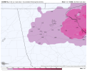
Do you think this will move further south during Sunday Morning...surprise this is not freezing rain.The euro already has snow moving into Atlanta shortly after midnight. Gonna be a fun night.View attachment 105044
So no one would see it (sans the jokers on this board) & by the time everyone wakes up, we're in the dry slot with the sun shining and the concrete melted.That’s probably 1.5” / hr rates if precip starts at 1am.
Possible snownado in Henry Co.cashing in the euro
It does show the snow moving further south a bit through mid morning before retreating north in the late morning. One other interesting thing about the euro is that is has been trending towards much lower ice totals across north Georgia then it did 24 hours ago.Do you think this will move further south during Sunday Morning...surprise this is not freezing rain.


Im wondering if anyone can post a total sleet accum map. I;m guessing MBY is 3-4 snow, 1inch + genuine sleet, .25 frzng rn.I think some areas from CLT-GSO could pick up over a inch to near 2 inches of sleet in this setup with the snow and ZR lol
Rates will overcome all. We saw snow quickly accumulate last week after multiple 75 degree daysThing to note for you weather weenies. Most of the snow won't stick immediately. Takes a bit for the ground to get cold enough, especially after the semi warm temps before. Unless we can get some heavy rain to heavy snow it won't stick immediately. Nonetheless any snow is good snow. Hoping everybody gets covered with some snow.
This is going to be a whole different animal than the hot storm the other week, though. A lot of areas getting snow will be getting it with temps well below freezing. I think for many areas it shouldn’t have any issue sticking. Some areas will be seeing snow at 20F. I’ve seen snow at 20F before and it basically sticks immediately and is such a different experience to snow at 33F. Night and day, really!Thing to note for you weather weenies. Most of the snow won't stick immediately. Takes a bit for the ground to get cold enough, especially after the semi warm temps before. Unless we can get some heavy rain to heavy snow it won't stick immediately. Nonetheless any snow is good snow. Hoping everybody gets covered with some snow.
That's what I was saying unless we see some heavy snow it'll be hard to stick immediatelyRates will overcome all. We saw snow quickly accumulate last week after multiple 75 degree days
I'm in the purple and close to pink...but I want you to get some too, so I'll wait to cash in ;-)Why would you cash that in when it can trend better ?
In all seriousness the SE trend continues . Will be interesting to see if it continues over the next few cycles or if we get the normal NW shift . Either way looks much better up that way and to the NW
Sent from my iPhone using Tapatalk
Hopefully the onset of rain doesn’t wash it away like it always does.GDOT just said on TWC they are going to start with brine on all roads North of I-20.
I'm mainly talking about central Alabama and the areas on the border of freezing temps lol. I should've said that. My badThis is going to be a whole different animal than the hot storm the other week, though. A lot of areas getting snow will be getting it with temps well below freezing. I think for many areas it shouldn’t have any issue sticking.
Yeah they pretty much admitted if they get rain first then it’s going to be tough to keep control of the roads.Hopefully the onset of rain doesn’t wash it away like it always does.
Oh, sorry, I was thinking more GA/SC/NC. My bad! I didn’t pay attention to your location!I'm mainly talking about central Alabama and the areas on the border of freezing temps lol. I should've said that. My bad
ive never seen as hard a left turn as this one on euro and Can op. No bending , just staright on north. This is why I root for coastals.Better track and it still goes dues north.
Brine is useless for ice storms. Just a waste of money and time but whatever.Yeah they pretty much admitted if they get rain first then it’s going to be tough to keep control of the roads.
If it does it will be fascinating to watch from a meteorological perspective. Gonna be some crazy temp gradients along the coastal areas and maybe further inland.ive never seen as hard a left turn as this one on euro and Can op. No bending , just staright on north. This is why I root for coastals.
IF the SE trend continues and then we get the famous NW shift at go time, this euro run may very well be close to the final product.
Obv depends on where you're at but moisture will be moving into MS, TN in 48 hours. The HRRR running now should be interesting for those areas.If you think we have the final answer 3-4 days out you are going to be sorely wrong. Do we really think the models (short range especially) won't change some in all that time. We know it will. Hopefully for the better for many
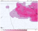
This is a big time clown map. Not very accurateLicking my chops for this View attachment 105055
Lol cause it's not kuchera? I didn't see that option on thereThis is a big time clown map. Not very accurate
Yeah other "accumulations" you saw on the other map was all ice whether it is sleet or freezing rain.. still a problematic set up just not due to snowYes. Here is a more accurate mapView attachment 105058

