-
Hello, please take a minute to check out our awesome content, contributed by the wonderful members of our community. We hope you'll add your own thoughts and opinions by making a free account!
You are using an out of date browser. It may not display this or other websites correctly.
You should upgrade or use an alternative browser.
You should upgrade or use an alternative browser.
Wintry Jan 15-16 Winter Storm Discussion & Obs
- Thread starter SD
- Start date
- Joined
- Jan 23, 2021
- Messages
- 4,602
- Reaction score
- 15,197
- Location
- Lebanon Township, Durham County NC
If you average the ratios bufkit gave RDU, you’d get an average of 15:1 for the event. With an inch of QPF, welp, you see where I’m going with this.
NBAcentel
Member
iGRXY
Member
Just got home and got on the computer and Idk what I was talking about lol. Euro was much better than I initially saw on my
Phone. Definitely more cold air pushing south and definitely more ridging out west. That really helps in getting the wave to dig once it enters the US.
Phone. Definitely more cold air pushing south and definitely more ridging out west. That really helps in getting the wave to dig once it enters the US.
Stephenb888
Member
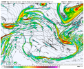
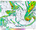
I see nothing to be concerned about.This is a pretty significant difference over the PNW and Northern Rockies and leaves me pretty concerned
View attachment 103442
View attachment 103443
NBAcentel
Member
Well the euro took a pretty big jump in the right direction, just need that south part of the energy to speed up and not get hung backThis is a pretty significant difference over the PNW and Northern Rockies and leaves me pretty concerned
View attachment 103442
View attachment 103443
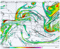
iGRXY
Member
This was my initial worries looking at my phone but it actually took a step away from the 12z which is a big big deal.This is a pretty significant difference over the PNW and Northern Rockies and leaves me pretty concerned
View attachment 103442
View attachment 103443
12z CMC Ens Mean looks pretty good actually. It is trending SW with the wave


It was on the flatter side, so weaker with precip
SONN LOL Looking good folks getting a little excited here. Its been a while to have snow in the 20s. That would be killer rates and since this is a clipper type system we need a higher ratio to achieve significant accumulations imo.
Wonder if this thing could trend about 200 miles west and get more in the game? ??
By the way, I heard thru the grapevine via a little birdie that AMasiello likes a SE hit for this storm (as opposed to Mid Atl / NE)....he's usually pretty good with those kinds of calls
I know this should go into banter, but it should be said where everyone can see it. This right here is why Southernwx is awesome. Such an incredible breakdown of what’s going on, the moving parts, etc. freakin awesome how much energy this place has when we have something to track. Appreciate the heck outta y’all.
Storm5
Member
By the way, I heard thru the grapevine via a little birdie that AMasiello likes a SE hit for this storm (as opposed to Mid Atl / NE)....he's usually pretty good with those kinds of calls
Love him . Extremely nice dude who always responds when contacted . He isn't a know it all he helps people learn and doesn't talk down to people with opposing opinions like some Twitter clowns that hide behind a screen and claim to always be right
Sent from my iPhone using Tapatalk
NBAcentel
Member
Blue_Ridge_Escarpment
Member
Only about 36-48 hours from someone getting NAM’d!When you realize the beginning of the storm is already at hour 113-117 View attachment 103450
D
Deleted member 609
Guest
Nam time 0z tomorrow nightWhen you realize the beginning of the storm is already at hour 113-117 View attachment 103450
ATLwxfan
Member


Buckle up y’all!
Sent from my iPhone using Tapatalk
Jessy89
Member
I know this should go into banter, but it should be said where everyone can see it. This right here is why Southernwx is awesome. Such an incredible breakdown of what’s going on, the moving parts, etc. freakin awesome how much energy this place has when we have something to track. Appreciate the heck outta y’all.
And to add to this a bit. The reason snow so fun in the south is because it’s hard to get. So the weeks days and hours spent following the models and crossing fingers and toes. And having you guys to discuss it with. Makes snow so much fun snow in the south is just special. Don’t think it be the same if we lived up north although I’d always love snow
Sent from my iPhone using Tapatalk
iGRXY
Member
EPS looks like it’s about to be good again
Blue_Ridge_Escarpment
Member
Yep. Taller ridge out westEPS looks like it’s about to be good again
iGRXY
Member
Definitely going to be good. More ridging out west and more interaction with the TPV and 50/50
iGRXY
Member
850s well south of I20.
NBAcentel
Member
iGRXY
Member
iGRXY
Member
Blue_Ridge_Escarpment
Member
Odd surface reflection tho. Everything else looked better
BHS1975
Member
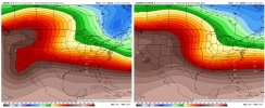
Look at the trend with our 50/50 low, it’s a thing of beauty, far colder run View attachment 103456


Sent from my iPhone using Tapatalk
NBAcentel
Member
you can see how flatter the system looks now on the EPS due to perhaps some energy issues/more suppression from the 50/50 low, I don’t care though I’d rather have the cold and flat issues then have the marginal and amped issues
18z EPS Mean is a little deeper with the wave, but it’s still quite flat out front
NBAcentel
Member
iGRXY
Member
Usually in these setups we’re fighting models that have zero storm and ones that do have one. At least we actually have a potential where a storm seems almost certain but it’s just the difference between a 2-4” enjoyable event and a 6-12” history book type of event.
Blue_Ridge_Escarpment
Member
Geez, snowing in the teens in the NC mtns.
LovingGulfLows
Member
- Joined
- Jan 5, 2017
- Messages
- 1,499
- Reaction score
- 4,100
Personally I think this was a great trend and a step back in the right direction for the Euro.
packfan98
Moderator
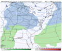
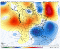
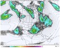
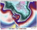
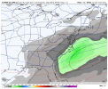
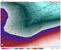
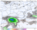
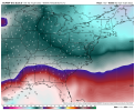
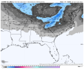
That low pressure is way down there near the gulf coast. Wow.Lol geez cold air is no issue View attachment 103458View attachment 103459View attachment 103461View attachment 103460
D
Deleted member 609
Guest
Cold air not an issue - famous last words hereLol geez cold air is no issue View attachment 103458View attachment 103459View attachment 103461View attachment 103460

