No not at allAre any other models doing that?
-
Hello, please take a minute to check out our awesome content, contributed by the wonderful members of our community. We hope you'll add your own thoughts and opinions by making a free account!
You are using an out of date browser. It may not display this or other websites correctly.
You should upgrade or use an alternative browser.
You should upgrade or use an alternative browser.
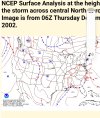
Wintry Jan 15-16 Winter Storm Discussion & Obs
- Thread starter SD
- Start date
And then it barrows up into central Pa. JB will be sweating it out in State College.999mb over raleigh hahaha

UK looks similar to Op Euro. We have fairly good consensus building now. ICON in that camp too.
I think GFS isn't handling the transfer correctly but that's just my opinion.
I think GFS isn't handling the transfer correctly but that's just my opinion.
I hate how those maps include ip. I know its to far out to really care about totals. Hopefully the foothills can hold that warm nose off for as long as possible.This isn't all snow of course but seeing it expand east some is indicative of the stronger CAD and more ice before the transition. For Central NC this is a slight shift but hopeful (if you like anything frozen) the beginning of a trend, still turns all rain but the initial wintry could still be significant. Something to watch
View attachment 104408
Yeah we want to snow as much as quickly as possible Sunday morning and out perform model expectations. Only issue is locking in a colder sfc pool would mean more ice issues on the backI also saw some 850 fgen trying to set up as you always mention, would love to see that overperform as it moves north across the state. Sometimes they can put on a nice frontend thump show before the changeover to slop

IF the GFS was to happen, this would be a ridiculous gradient. I have lived in the Carolinas all my life, but i have never seen anything like that. It's just hard to buy...
Nethertheless, the ole GFS says who cares what you think, i am trucking due North. Screw the haters.
SnowNiner
Member
Well if the GFS is right on this I guess I'll just ignore all other models going forward lol
Sadly, it's led the way on the amplification Miller B train and even the ensembles are ticking west now. I really wanted to see the gfs flatten a bit this run.
Fountainguy97
Member
Yes. The 06z GEFS does have several members with the first low up along the TN/KY border.No lol. Not even the ensembles are doing that.
like it or not the GFS does have some support from its Ens.

Man this is just down right impressive .. I’ve seen cold insitu CAD hold on longer than the Gfs things this does.. something just don’t seem right with the quick erosion .. this is one of the most impressive CADS we’ve had in some time and it’s just going to get moved completely in 6 hours ?? I don’t think soGeez, that’s a mostly IP storm around Charlotte-gso, even tho models show lots of ZRView attachment 104409View attachment 104411View attachment 104412
GFS has SC upstate (GSP) temperature of 32 at 4AM Sunday down to 24 at 11AM as the storm rolls thru
alfoman
Member
GeorgiaGirl
Member
View attachment 104413
IF the GFS was to happen, this would be a ridiculous gradient. I have lived in the Carolinas all my life, but i have never seen anything like that. It's just hard to buy...
Nethertheless, the ole GFS says who cares what you think, i am trucking due North. Screw the haters.
Yeah, I can tell you, based off experience, that if you have a strong CAD, 58 is likely not going to be my high. Upper 40s maybe...but 58...nah.
But it isn't going to make a difference here it seems.
iGRXY
Member
850's warmer on the GEFS
We will finally get a clear picture of the NAM FGEN band with I believe the 00z run tonight .. the differences on models are already intriguing 

NBAcentel
Member
2m temps are slightly cooler on the gefs during the cad
Yeah CAD on the GEFS looks absolutely stout .. this will be a significant winter storm for most in the CAD region even if it switches to rain
Stout winter storm here 
ForsythSnow
Moderator
The GEFS mean seems to be a bit better than prior runs as there are higher means out and along AL and TN. While CAD regions are steady it is worse for NC and SC.
quite a spread.

SnowNiner
Member
UK looks similar to Op Euro. We have fairly good consensus building now. ICON in that camp too.
I think GFS isn't handling the transfer correctly but that's just my opinion.
You have the UK map you can share? If the Uk stays firm that would make many happy.
iGRXY
Member

Still a solid hit with 6" snow means along and north of 85 from NC through SC.
That's probably because it is showing a transfer of the lowsquite a spread.
View attachment 104424
QPF is no joke here. GFS has over 2 inches in SC upstate to AVL to CLT. Major winter storm
you're right. here is 108hrThat's probably because it is showing a transfer of the lows

iGRXY
Member
Looking at the individual member panels on weatherbell and it's really a pretty even split between colder and snowier memebers and icier members.
SnowNiner
Member
That's probably because it is showing a transfer of the lows
I think we've lost the GEFS. The primary lows are all amped and the transfers are all on shore. Just bad. Not what we want to see IMO. Only hope I think is that the GFS family is out to lunch, with Euro/Ukmet/Icon more correct.

NBAcentel
Member
Summary - Ice storm/sleet storm with the possibility of a SN FGEN band in the beginning ? CAD trended even colder in the NC Piedmont 


Stormlover
Member
gefs says the op is too far north

Cadi40
Member
Unfortunately any freezing rain that does fall will likely stay around for quite awhile given the low temperatures next week.
2" of qpf, just wild. praying for sleet and not frz rain.

You have the UK map you can share? If the Uk stays firm that would make many happy.
You can watch it come in here. I could only see coarse panels earlier.

Models: GFS - Pivotal Weather
View GFS weather model forecast map image for Precipitation Type, Rate in Continental US on pivotalweather.com.
Dewpoint Dan
Member
I think highs in the 40s next week is plenty warm enough to melt ice.Unfortunately any freezing rain that does fall will likely stay around for quite awhile given the low temperatures next week.
NEGaweather
Member
CAD is a little stronger for NE GA Gainesville to Athens this run. Gonna be a mess IMO
Sent from my iPhone using Tapatalk
Sent from my iPhone using Tapatalk
gefs members sunday morning 7am.

Flotown
Member
Starting to look pretty decent up here in nw bama...let's see how it goes
WXinCanton
Member
UKMET

Vs 0Z

Vs 0Z