-
Hello, please take a minute to check out our awesome content, contributed by the wonderful members of our community. We hope you'll add your own thoughts and opinions by making a free account!
You are using an out of date browser. It may not display this or other websites correctly.
You should upgrade or use an alternative browser.
You should upgrade or use an alternative browser.
Wintry Jan 15-16 Winter Storm Discussion & Obs
- Thread starter SD
- Start date
MichaelJ
Member
I would not put a lot of faith in the ICON and JB always wants them to cut so the NE can get the storm and shut out the South
Icon is likely to Miller B but that's a pretty good look for a big winter storm
ChattaVOL
Member
Temps on ICON need to be ignored correct? If I remember it likes to take a torch to everything.
D
Deleted member 609
Guest
Temps are low, it just doesn't show sleet/fr on mapTemps on ICON need to be ignored correct? If I remember it likes to take a torch to everything.
iGRXY
Member
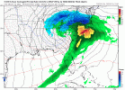
ICON is a miller B as the low moves from south-central Alabama to nearly coastal Georgia in the next frame. Point is that is how a LP would likely move around the cold dome. Get roughly to central Alabama before you see a transfer close to the coast.
It has a strong warm bias that generally plays out regularly to have the temps quite wrong compared to other modelsTemps on ICON need to be ignored correct? If I remember it likes to take a torch to everything.
Can we agree that because certain model runs are being discussed it doesn't necessarily mean anyone believes it to be the final outcome. We've been told to not believe the LR this or don't put faith in that, now we're hugging this one or that one.... for the love of all that is good, this is a weather forum with a legit wintry threat. We can and we will discuss any and all model runs and analyze each run as much as we like. That's why we are here and I nor anyone else needs 50 post to tell us what model run we shouldn't be looking at.
Thank you, I'll step down off the soap box now...... carry on
Thank you, I'll step down off the soap box now...... carry on
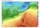
And (I'm surprised somebody hasn't mentioned this -- you people are dropping the ball), the ICON has a warm bias.Look at the CAD strength difference here.. much stronger and instead of the low pressure cutting right into the wall of cold dense air it scurries along the perimeter allowing that CAD to stay solidly in place ..View attachment 104384View attachment 104383
Not to be that guy with this ICON run but while the placement was better, the CAD was better, the slp was also stronger so it's trending stronger..... hope that doesn't mean it eventually trends more NW. Guess we will see
iGRXY
Member
The ICON's LP progression is just more believable to me. It's the ICON and I get all of that but regardless of what it spits out, that LP movement is just a lot more trustworthy IMO. It also matches well with the NAM.
You simply cannot believe an ICON run that...oh wait...never mind! It's actually encouraging that it slid so far south. Great winter storm look, as was said. But if it does wind up, it will be hard to keep it way offshore.Not to be that guy with this ICON run but while the placement was better, the CAD was better, the slp was also stronger so it's trending stronger..... hope that doesn't mean it eventually trends more NW. Guess we will see
Z
Zander98al
Guest
I'f the icon has a warm bias than the whole backside of that low will likely be more close to all freezing precip I would imagine?
packfan98
Moderator
Not a great track through NC on the ICON. Still Yuck for lots of places.

Something I would also watch for.. usually with Miller Bs we end up with some sort of deform band behind the system or an upper low on the backside moves over and usually the short range models pick up in this better but most of the time things changeover to snow and there’s some isolated convective stuff behind the system .. that will be interesting to look at as we get into short range model range
NBAcentel
Member
I don’t recall anything about the ICON being warm-biased like I’m reading some here? I don’t think that’s true? If anything, I’ve seen the opposite in the past at the surface.
LovingGulfLows
Member
- Joined
- Jan 5, 2017
- Messages
- 1,499
- Reaction score
- 4,100
ICON saves much of NGA including the Atlanta area with an area of snow associated with the strong upper level low overhead. I honestly wouldn't be surprised if the backend snow trends more potent as we get closer to the event, similar to the early Jan event.
Yeah, most everyone outside the mountains is going to change over to something other than snow with an onshore track. Really can’t have that.Not a great track through NC on the ICON. Still Yuck for lots of places.

lj0109
Member
Granted the ICON has been all over the place (along with the others) and will likely continue to play catch up with this thing, with its known 2m warm bias...the 12Z is quite the concerning look for the I-20 corridor in E GA/SC for what could be a significant ice event. Also kudos to all and the mods for the continued great discussion with this complex event.
packfan98
Moderator
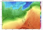
Here's the temps that goes with the timeframe I just posted. ICE for many.

iGRXY
Member
It's been noted by a few people that it does tend to have a warm bias in the LR.I don’t recall anything about the ICON being warm-biased like I’m reading some here? I don’t think that’s true? If anything, I’ve seen the opposite in the past at the surface.
Really not a fan of the slowing trend that seems to be continuing each day. Allowing the 50/50 to move out
That's major ice for a huge chuck SC. My hope is we can trend even colder and and shear out the engery more and more, so we push the low pressure system towards northern Gulf, then more of us get snow/sleet and less areas with freezing rain. Basically wishcasting at this point,but just maybe we pull a Feb 2014 and avoid a very damnaging and historic ice storm.
iGRXY
Member
Yeah a lot of that is ZR in the midlands. It fact the ZR would probably be even further south into the low country if the warm bias of the ICON is also taken into account.That's major ice for a huge chuck SC. My hope is we can trend even colder and and shear out the engery more and more, so we push the low presure system towards northern Gulf, then more of us get snow/sleet and less areas with freezing rain.
weathernerds.org has precip type maps for the ICON but it comes out slower (probably not out yet)
Freezing Rain is a self limiting process! Does the icon run warm!? GSP at 28 degrees
I also distinctly recall last winter in several CAD situations the consensus here was it had a COLD bias and that did verify. Different setup though, and maybe something has changed. IDK.I don’t recall anything about the ICON being warm-biased like I’m reading some here? I don’t think that’s true? If anything, I’ve seen the opposite in the past at the surface.
Could be that some mistake the lack of mixed precip clown maps that have created this thinking? Or does someone have some empirical evidence to the contrary?
NEGaweather
Member
ATL Mets aren’t backing off which is surprising. The strength of the CAD probably has a lot to do with that.
Sent from my iPhone using Tapatalk
Sent from my iPhone using Tapatalk
Cary_Snow95
Member
Gfs is still deepening. Unreal
It's going to be hard to avoid this look unless we can find a model trend of faster, weaker to avoid the trailing wave coming in and really helping bias the pattern NWNot a great track through NC on the ICON. Still Yuck for lots of places.

iGRXY
Member
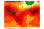
Off first glance, The GFS looks like it has a bit more interaction with the baja low at 33.
NoSnowATL
Member
ATL Mets aren’t backing off which is surprising. The strength of the CAD probably has a lot to do with that.
Sent from my iPhone using Tapatalk
Dew Point -6 in Virginia and single digits in NC. I still think we need to watch for dryer trends and I also believe CAD will not move out as fast given such arid conditions.
ColdCoreLow
Member
Love the position of the low in south GAThat's an icy mess deep into SC
View attachment 104380
Agreed out to 54 still seeing some of itOff first glance, The GFS looks like it has a bit more interaction with the baja low at 33.

