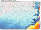
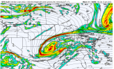
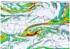
Z
Zander98al
Guest
Crossing fingers for some strong CAD. ?. Better chance for higher snow totals here in the ham, if that comes true.
Definitely don't want that solution. Had trees come down and was without power for quite a while.As Fro stated, this has an almost identical look to December 2002! The 85 corridor in Greenville, started as sleet/ZR, and temps about 29, temps fell to about 24-25 degrees for the duration. Not one flake of snow fell, but up towards Gastonia, they got a hard front end thump of snow, before changeover
Are you thinking from Blairsville over to Toccoa down to Elberton? May get ice down to Gwinnett County, though.I think North Georgia sees a winter mess. A mix of everything. A little shift will make a big difference but I think a winter storm of some sort is likely.
Sent from my iPhone using Tapatalk
Key thing being the last part, if the CAD is as stout (or even stronger) I’ll be surprised if ATL gets above a 32-34 (Sunday) on the warmer side. I think once that wedge settles in, it’s most likely holding firm throughout the entire event. Only going off of past experiences w/ CAD involved winter events. Still an equal scenario this doesn’t happen. I’m still cautiously optimistic despite the OP GFS. Hoping for February 2014 (more sleet vs ice) but preparing for the worst (January 2005; more ice vs sleet).From FFC’s overnight disco:
The GFS and ECMWF have come into better agreement with the
progression of the surface and mid level low tracks. The ECMWF has
also come around to a slightly stronger wedge than in previous runs,
but is still a bit weaker than the GFS. The ECMWF`s upper low track
is still a bit further south than the GFS, but the surface low
tracks are pretty similar.
Models soundings from the GFS (slightly stronger wedge), do show
potential for FZRA during the early/middle part of Saturday.
However, the warm nose isn`t very as strong as it could be due to
some colder temps aloft. This could be due to the deep NW flow in
place from the strong trough/shortwave that comes through Thursday
night/early Friday. Regardless, most of north GA will have the
potential to see the wintry mix late Saturday into Sunday, with
locales in the wedge having the most potential for FZRA. It`s still
too far out to discuss winter precip amounts with any accuracy,
especially since the models have trouble with strength of the warm
nose.
MaxT values on Sunday will be tricky since there are major
differences in the strength of the wedge. May end up going a few
degrees cooler within the wedge.

Are you thinking from Blairsville over to Toccoa down to Elberton? May get ice down to Gwinnett County, though.
Key thing being the last part, if the CAD is as stout (or even stronger) I’ll be surprised if ATL gets above a 32-34 (Sunday) on the warmer side. I think once that wedge settles in, it’s most likely holding firm throughout the entire event. Only going off of past experiences w/ CAD involved winter events. Still an equal scenario this doesn’t happen. I’m still cautiously optimistic despite the OP GFS. Hoping for February 2014 (more sleet vs ice) but preparing for the worst (January 2005; more ice vs sleet).
EDIT: I’ll throw this out there, In a best case scenario with a strong, stout CAD, I’m thinking a range of 26-32 for ATL.
Will Athens be in a better spot with damming than Atlanta?I’m thinking Forsyth and Gwinnett sleet and zr. Hall north snow then sleet and zr back end snow
Sent from my iPhone using Tapatalk
Yea, that's how you know were gonna get F'kd by ice. This isn't your typical 32 / 31 degree and rain model outputs. My only hope and prayer is that 22 -25 degrees is cold enough to refreeze into IP before hitting the ground.I can’t underestimate how strong of a CAD that really is. This is rare, guys. No two ways about it.
Absolutely. Athens will likely get a major winter storm with many modes of winter precip, as it stands now.Will Athens be in a better spot with damming than Atlanta?
Also the energy off the SE coast looks stronger and closed off as well. Might have implications for further in the runWholesale changes on the NAM at hour 57. Energy looks to be more strung out and pulled to the west.
Many areas near the apps will get it bad, If its a strong cad. Northern and northeast Alabama will be pretty bad as well.Absolutely. Athens will likely get a major winter storm with many modes of winter precip, as it stands now.
Just not quite in the nam s deadly range just yetView attachment 104352Although it's closed off, the nam is definitely slower and more sheared out
Maybe so. But I would desperately try to avoid using the LR Nam as evidence of, well, anything lolOne has to wonder if we entered that dead zone where globals waffle in the 3-5 day period. Only to come back to there original’ish solution inside day 3.
Another thing to note here is this is about as classic of a look for a southern snow storm as you can get. Weaker surface low that is right on the gulf coast instead of northern Mississippi, and a classic banana high with deep CAD and a strong high pressure over the top in the plains. Call me a crackhead but if this run continued I don't see how the LP could go north.View attachment 104354This is a great switch on the Nam. Weaker surface low. It's further south. And clearly there is more CAD at the end of the NAM.
This is true. But, the changes that led to the end of run solution were evident by 60 hours and arguably 48 hours. So if for those rooting for a more southern solution, this run was a good start to the 12z suite.Just not quite in the nam s deadly range just yet
I agree, but I don't like how there is not a good push of dry air down into CAD areas (outside of NC, that is) That push is just not super strong and the low is already into MS.Nam is stronger with the wave moving through the ne and compressing the flow more on the EC as well better chance to channel and elongate the upper wave there which is a good thing


Yes Athens is far enough east of Atlanta to stay locked into the CAD. I live about 20 miles from Athens and we are in a good spot usually during CAD events....of course we seem to be right on the north/south line of what precip we get though. I wish we were another 40 or 50 miles north though ?Will Athens be in a better spot with damming than Atlanta?
