-
Hello, please take a minute to check out our awesome content, contributed by the wonderful members of our community. We hope you'll add your own thoughts and opinions by making a free account!
You are using an out of date browser. It may not display this or other websites correctly.
You should upgrade or use an alternative browser.
You should upgrade or use an alternative browser.
Wintry Jan 15-16 Winter Storm Discussion & Obs
- Thread starter SD
- Start date
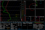
23F at the sfc in Spartanburg.....impressivePlease check your sounding closely. GFS says I am mixing here but the sounding is still snow.
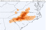
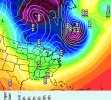
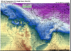
View attachment 103779
WNC special this run. Hopefully it will work a lil south by go time less amped so more can get some snow.
bigstick10
Member
There is always going to be backend snow...Backend snow for Atlanta?
Pooh, pooh run for the greater Atlanta area. Still close, but I'm not a fan of the NW trend this early.
Still some love with the upper low passage though.
Still some love with the upper low passage though.
SimeonNC
Member
GFS is colder on the surface this run for most of the storm too. Temps in the lower 20s now.
D
Deleted member 609
Guest
Anyone have sleet map?
ATLwxfan
Member
I mean you aren’t going to have identical runs every 6 hours. It’s going to waffle. It’s not going to be the 10 inch north GA storm from the 6z, that’s highly unlikely.
One run is not a trend.
Sent from my iPhone using Tapatalk
One run is not a trend.
Sent from my iPhone using Tapatalk
30+ inches Highlands, Cashiers: Historic Ice storm down in SC. Gonna be a major impact winter storm. Need this a little futher south. The Winds/ and long duration cold to follow are gonna make this one to rememeber.
GeorgiaGirl
Member
Yeah, that's basically February 2014, except a bit further north because that storm was a disaster where I live (which thankfully, I was somewhere else during that storm). I'll pass on the 1"+ ice, even though 30's and rain would suck.
Don't like the way the storm is amplifying and ticking NW though. Oof. Maybe I shouldn't have talked.
Maybe the Euro can be suppressed again.
Don't like the way the storm is amplifying and ticking NW though. Oof. Maybe I shouldn't have talked.
Maybe the Euro can be suppressed again.
Wild how the run ended up being cooler. That wedge has ice storm written all over it for parts of South Carolina.
I agree...let's see what the Canadian, Ukmet has to stay...the GFS was overly amped to me.I mean you aren’t going to have identical runs every 6 hours. It’s going to waffle. It’s not going to be the 10 inch north GA storm from the 6z, that’s highly unlikely.
Sent from my iPhone using Tapatalk
iGRXY
Member
MAJOR SC midlands ice storm I can see this happening here before a snowstorm just saying??30+ inches Highlands, Cashiers: Historic Ice storm down in SC. Gonna be a major impact winter storm. Need this a little futher south. The Winds/ and long duration cold to follow are gonna make this one to rememeber.
Please check your sounding closely. GFS says I am mixing here but the sounding is still snow.
Yes… I just looked at mine and it’s all snow… I would guess the sleet line is just to me south towards Pageland… I have a feeling that somewhere in this there’s gonna be an area of very heavy sleet
What a thump. Classic mixed bag power pole snapper. Oof
L
Logan Is An Idiot 02
Guest
Let’s see what the GEFS shows. It’s shown more flatter solutions over northern solutions the last several runs going against the GFS OP
Sent from my iPhone using Tapatalk
Sent from my iPhone using Tapatalk
Don't get too caught up in panic over ice accrual predictions at this range. It's such a thin medium area of precip to forecast just how much you'll get. Plain rain or snow amounts are easier to model at this point than ice.
This run is still mainly snow for CLT metro… based on the soundings.Nw Piedmont crushed. Lots of ice for charlotte
smast16
Member
I hope the GEFS looks a lot different than what the OP is showing, for us here in the Midlands. All of that ice is scary to say the least! HP was stronger too. Just not in an ideal spot, along with the LP (for more sleet/ snow anyways).
NWMSGuy
Member
Nice totals showing up for Memphis northward on the 12z. Hopefully we can see that 540 line drop further south and east. Would be great to see North MS as well as North AL getting in on this storm and some of the higher totals.
blueheronNC
Member
View attachment 103783
Be mindful that the GFS had sleet as the precip type but it was still snow soundings for mby so it could be the same for you.
It had a sounding suggesting 26F and rain at Raleigh by 18z Sunday. I’ll pass.
It looks like the gfs has been bringing the LP further inland with each of the last few runs. Albeit not by much. Hate to say "northwest trend" because this is not the classic type of nw drift we seeUK over the panhandle. Blend the GFS/UK we would have something great
Not enthused with GFS showing snow all the way up into upper PA...so much for a suppressed system.
View attachment 103785
I smell a sleetfest if these nw trends continue for I-40. Don't like being in the bullseye this far out.
iGRXY
Member
GEFS following the GFS suit. More ridging out ahead of the ULL.
so we have the GFS on the north side and the EURO on the south side. They will flip and flop for sure......lets see if the euro holds with the southern look or its a smidge north this run. Either way, a storm is coming.
BelmontWX79
Member
Yeah but this is a stout CAD signal. Areal coverage of ice could definitely be larger than what we would normally see. As modelled on the GFS this really reminds me of 2014. My in laws carport collapsed under the weight of snow and ice.Don't get too caught up in panic over ice accrual predictions at this range. It's such a thin medium area of precip to forecast just how much you'll get. Plain rain or snow amounts are easier to model at this point than ice.
It looks like the gfs has been bringing the LP further inland with each of the last few runs. Albeit not by much. Hate to say "northwest trend" because this is not the classic type of nw drift we see
With this look on the GEFS we would usually be buying shovels...but nowadays we should buy an umbrella.
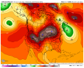
GFS verse The Gefs at Hr 96. Makes a big difference


iGRXY
Member
Really trying to guess precip type at this point is pointless. Just be happy we have a storm with cold air in place for some kind of winter weather. Wait until we get to around hr 48-60 and begin looking at the NAM.
I am still not sure how far north that the GFS really can go because that wedge is ridiculous.
I am still not sure how far north that the GFS really can go because that wedge is ridiculous.
As was stated earlier, I would encourage everyone pull up the sounding data for your area as the surface reflection is not matching up with the soundings… at least for CLT metro back into the Upstate. The key on that run is that the CAD is stronger.
JLL1973
Member
I think this thing would have to dig alot more and push south for us too get in on the action but then again im really surpried its trended this much in our favorNice totals showing up for Memphis northward on the 12z. Hopefully we can see that 540 line drop further south and east. Would be great to see North MS as well as North AL getting in on this storm and some of the higher totals.
smast16
Member
GEFS looks more like Euro.GFS verse The Gefs at Hr 96. Makes a big difference


Canadian not looking so good either; based on black & white charts; lulz
but they're hard to read, so have to wait for other graphics.
but they're hard to read, so have to wait for other graphics.
Save us with some black and white CMC charts will ya?With this look on the GEFS we would usually be buying shovels...but nowadays we should buy an umbrella.

This is strange…one heck of a warm nose
Sent from my iPhone using Tapatalk
LukeBarrette
im north of 90% of people on here so yeah
Meteorology Student
Member
2024 Supporter
2017-2023 Supporter
22 inch maximum here in Roanoke. Not sure I trust that atm. Really want the southern people to score instead of me here.


