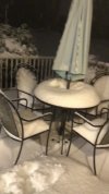
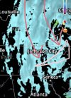
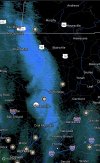
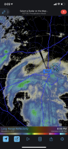
Snowing in Greensboro no reflectivity
-
Hello, please take a minute to check out our awesome content, contributed by the wonderful members of our community. We hope you'll add your own thoughts and opinions by making a free account!
You are using an out of date browser. It may not display this or other websites correctly.
You should upgrade or use an alternative browser.
You should upgrade or use an alternative browser.
Wintry Jan 15-16 Winter Storm Discussion & Obs
- Thread starter SD
- Start date
I may end up having to go out and take another measurement. I think I'll wait until tomorrow morning though, it's not like it's going anywhere tonight. I don't have the energy to get dressed to go out again. Been up since 6am yesterday morning. I did take a 2 hr power nap this morning when I changed to sleet. Moments like this don't happen much and missing a flake is not an option!
L
Logan Is An Idiot 02
Guest
Is this ULL going to move north?
Sent from my iPhone using Tapatalk
Sent from my iPhone using Tapatalk
NBAcentel
Member
- Joined
- Jan 23, 2021
- Messages
- 4,573
- Reaction score
- 15,101
- Location
- Lebanon Township, Durham County NC
UZA has 1.5 vis and light snow
Could see a slight chance at blizzard warnings tomorrow from Blowing Rock NC north into Virginia. Not for falling slow but for ground blizzard. Although some upslope too.
I don’t really think anyone can say where it’s going. This thing was supposed to cut NE up into East Tennessee, instead it’s moving along just to the north of I-20Is this ULL going to move north?
Sent from my iPhone using Tapatalk
nbellenburg
Member
Final measurement for Simpsonville(assuming we don't get anymore from GA) is a fraction of a hair shy of 6" of all precipitation types. Didn't clean a snow board or anything scientific bc I wanted to see what the total pack of all precipitation types would be. I call 6" in southern Greenville county a win in my books.
snowplow
Member
Just got back from playing in the snow on Lookout Mountain.....6 inches easy at Covenant College.....a little less at Lookout Mountain Golf Club....nothing at the foot of the mountain!!!
Per Rays
As low pressure exits NC into VA this evening. Precipitation diminishes this evening. Then, we transition into a NW Flow snow shower period lasting through the daytime Monday. After 5 PM Sunday, additional accumulations will be an inch or so near the Blue Ridge, but 4" or so at favored mountaintops near the TN/NC Border. Wind becomes ferocious later tonight and Monday--NW 15-25 mph with gusts to 60 mph. Blowing snow and drifting will be an issue Monday. Things calm down Tuesday with a slight moderation in temperatures by afternoon.
As low pressure exits NC into VA this evening. Precipitation diminishes this evening. Then, we transition into a NW Flow snow shower period lasting through the daytime Monday. After 5 PM Sunday, additional accumulations will be an inch or so near the Blue Ridge, but 4" or so at favored mountaintops near the TN/NC Border. Wind becomes ferocious later tonight and Monday--NW 15-25 mph with gusts to 60 mph. Blowing snow and drifting will be an issue Monday. Things calm down Tuesday with a slight moderation in temperatures by afternoon.
The back end: impressed, I say overperform! Charlotte
Friend in Greenville posted an 11” measurement beside a wall. I wanted to explain to him the difference between a snow drift and accumulation..??
BufordWX
Member
NBAcentel
Member
@Jimmy Hypocracy Any regrets not staying home for this one? I know you had fun but there's just something about the blanket of white out your own window.
@Myfrotho704_ pretty good band swinging through
I think it slides just to your north you can see it trying to fill in north west of Charlotte too. Could be something for Mooresville later tonightThis thing is about to setup over me and pivot over me
Very much iike 2018 but at night. I'm in Myers Park and we've had a half inch so far
This thing is about to setup over me and pivot over me View attachment 107031
Yes there’s a little bit of feeling like I missed something but we’re having a blast. And we were a part of the same storm. And my 4 year old son can always remember the time he got over a foot of snow at a cabin with his dad up in the mountains. We built a snow cave today and we’ll build another tomorrow. What a storm.@Jimmy Hypocracy Any regrets not staying home for this one? I know you had fun but there's just something about the blanket of white out your own window.
Dude, do you not think before you type? It's literally snowing at a moderate to heavy rate here and I live 15 minutes from Concord. It's not missing us. It's literally right over us.I think it slides just to your north you can see it trying to fill in north west of Charlotte too. Could be something for Mooresville later tonight
L
Logan Is An Idiot 02
Guest
Tiny flurries in Mooresville right now
Sent from my iPhone using Tapatalk
Sent from my iPhone using Tapatalk
L
Logan Is An Idiot 02
Guest
Very much iike 2018 but at night. I'm in Myers Park and we've had a half inch so far
That’s so awesome! Y’all deserve it down there!
Sent from my iPhone using Tapatalk
Thank you for being the one to say it. I’m 25 minutes SE of you guys and I’m seeing moderate snow right nowDude, do you not think before you type? It's literally snowing at a moderate to heavy rate here and I live 15 minutes from Concord. It's not missing us. It's literally right over us.
Friend in Greenville posted an 11” measurement beside a wall. I wanted to explain to him the difference between a snow drift and accumulation..??
Well we got 28 inches here then.
Heelyes
Member
I'm curious to hear how the 4runner does with 27 inch driftsWell we got 28 inches here then.
I'm curious to hear how the 4runner does with 27 inch drifts
I’ve been waiting on you to chime in ?
They better come plow our driveway so we can get back home. I’m prepared to leave Tuesday, but our private drive is a mess without snow.
You're welcome. I honestly wasn't going to say anything because I know it's more banter than a discussion. But I just can't take it anymore. I love this board because we're free to discuss things openly. But good lord, Birdman might need some time in his cage. Aka, a timeout. Sorry, didn't mean to get off-topic. On topic: It's is ripping fatties here though! What a nice and unexpected surprise!Thank you for being the one to say it. I’m 25 minutes SE of you guys and I’m seeing moderate snow right now
all done here aside from flurries. 9 hours of snow today, which was awesome. finished with 1" accumulation out of 4+ inches of snowfall. fun storm to track for sure! 
Heelyes
Member
Hope you packed a shovelI’ve been waiting on you to chime in ?
They better come plow our driveway so we can get back home. I’m prepared to leave Tuesday, but our private drive is a mess without snow.
Hope you packed a shovel
Of course I didn’t. I had two ready to go, but we couldn’t have fit a damn penny in that thing after we packed my sister, wife, and babies belongings. ?
Maybe I can find a good serving spoon in the kitchen.
Sctvman
Member
We may have to get jimmy to just pull us out ?
LukeBarrette
im north of 90% of people on here so yeah
Meteorology Student
Member
2024 Supporter
2017-2023 Supporter
Sleet/snow mix now in Roanoke. Accumulations continuing to rise. Approaching 7 inches of the combined precip types.
Stephenb888
Member
So I’m curious which model was most correct 5-6 days out with this storm? Was it the Euro or GFS? Did either completely whiff on anything?

