LickWx
Member
At one point the clouds began to thin out here a bit . Wonder if the low passed right near here .
Sure man whatever you say just SEND her this way when you’re doneIt really looks like in the higher tilts that thing is trying to pull a feb 2013 and turn into a mesoscale convective vortex


 myfox8.com
Good call with the sleet saving the day. We ended up with almost 2” of it(on top of an inch and a half of snow).Still 28degF here and freezing drizzle has started. Probably 4 to 5" total with snow and a lot of sleet. Road are horrendous. I expect a dusting to another inch later this evening/overnight with the last piece of energy rotating through. Winds will also begin to start cranking and I'm glad we have hardly any ice on the trees.

That still is really starting to consolidate along and north of 85 and looks really good to make its way through the upstate as well.I’m impressed with how the radar still looks. Under one little band now and might get another from the west soon.View attachment 107008

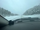
You think we can get some accumulation from this?talk about localized, should still move north in time View attachment 107009
talk about localized, should still move north in time View attachment 107009
Might be hanging it up too early. That stuff coming out of Georgia is looking better and better. Plus it’s snowing pretty decently here right now.I think that's going to do it for me. The backend band pivoted mostly south of here and was very light so probably no need to do another measurement. 6.4 it is for me. I'm very pleased!
GSP had 6.1 earlier but that band may have put down a little more down there. Either way they're less than 4 inches from a double digit year and the pattern is loaded coming up. Double digit seasons used to be fairly common, but after the winter of 92-93 they just stopped. This could finally be their first double digit season since and maybe break the streak!

You really could tell all day from both radar and water vapor that the ULL wasn’t going to cut up the Apps.ULL is moving directly over the upstate instead of the NC/TN border. That is why areas in north Georgia going east are likely going to get some additional accumulation with these backside bands. We over performed with the FGEN and dynamic cooling, escaped serious ice accretion, and got the ULL to verify further east bringing in more snow. Overall A+ for this system as just about everything went right for us.
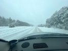
Yes possiblyYou think we can get some accumulation from this?
You would think that this would produce just enough lift to keep this stuff going a little longer than what was previously thought. I notice that both TWC and Accuweather have added light accumulations to my hourly grids this eveningHoly cow look at this MCV !!View attachment 107011

I see that. We just keep winning today!Might be hanging it up too early. That stuff coming out of Georgia is looking better and better. Plus it’s snowing pretty decently here right now.
 ️ ?
️ ?