Nicky B guarantee!
-
Hello, please take a minute to check out our awesome content, contributed by the wonderful members of our community. We hope you'll add your own thoughts and opinions by making a free account!
You are using an out of date browser. It may not display this or other websites correctly.
You should upgrade or use an alternative browser.
You should upgrade or use an alternative browser.
Wintry Jan 15-16 Winter Storm Discussion & Obs
- Thread starter SD
- Start date
Snowing pretty good in Concord right now!!! Again!
31 DBZ coming out of the Upstate towards the western piedmont of NC
Columbia SC need to watch that death band coming through and Charlotte. Actually looks to be growing maybe period of mod snow
Clem282340
Member
8.5” now keeps on piling up here still puking snow
Giddy up
1-3” death band potential for sc and nc? Maybe even a hell marry it produces a pellet or flurry for Raleigh?
NBAcentel
Member
Yep it’s really coming down in concord, and unfortunately I only use RadarScope, but TCLT is picking up on itWait, you've got snow? I don't see any returns over you. That's awesome! By the way, do you have a good radar link?

neelsamb
Member
Really ripping now! Biggest snowflakes I’ve seen all day and accumulating quickly
Death band expanding and getting harder returns (*death band coined by birdman you may use plz reference )
Last edited:
 Dayum.
Edit: Death band incoming
Last edited:

Right after I posted that it dropped another mb to 996Yep @SD that low blasted right into the wedge, traveling right up the interstate.
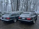
View attachment 106945
Snowflowxxl
Member
Moderate snow. Too bad I’ve been around 33 all day ?
Freezing drizzle past hour. You walk on top of this stuff now. Zero foot print. All concrete. Trees are gonna have that glass look at sunrise.
LickWx
Member
Wilmington hit 64/63 today, Greenville pushing upper 50s, low 40s here in Zebulon now , 62/61 in new Bern rn. What a world of difference .
LickWx
Member
Lots of wet rain here , you walk outside you’ll leave a muddy print . I did have glaze but as the low began to crank the rain began to pour . Melting any trace of frozenFreezing drizzle past hour. You walk on top of this stuff now. Zero foot print. All concrete. Trees are gonna have that glass look at sunrise.
Pressure is slowly rising here and wind is WNW its somewhere between usYep @SD that low blasted right into the wedge, traveling right up the interstate.
View attachment 106945
ATLwxfan
Member
If our front end worked out better we’d probably have 5 inches in Alpharetta. We will gladly settle for the 2+
Edit: We still have several deformation bands coming through so the final tally is TBD
Sent from my iPhone using Tapatalk
Edit: We still have several deformation bands coming through so the final tally is TBD
Sent from my iPhone using Tapatalk
Unbelievable storm. Still pounding snow back at home per my brother. Expecting SER gate to gate for the next 6 winters.
NBAcentel
Member
31/dropping and snow, that heavy band to our SE looks poised to add a inch or 2
LickWx
Member
Uh I’m in between you and him ? You telling me the low pressure is tracking near here ?Pressure is slowly rising here and wind is WNW its somewhere between us
I had given up all hope and went to watch football. Apparently we finally dropped to freezing because my yard is white. Small flakes but a lot of them.
NBAcentel
Member
Many echo tops aren’t even being shown where it’s snowing because it’s so shallow, where its showing up in SC is where it’s ripping 
Always been a fan of daytime snow. It’s gorgeous. Curious to see if it accumulates much better over the next few hours now that it’s getting dark
LickWx
Member
38/38 pressure down to 996.9 at RDU. Will it be our first sub 40 high of winter or will we sneak past 40?
After a lull, it started back snowing again about 10 mins ago. Not really accumulating though.
Kido at 14 mark. 4300 ft Boone
nbellenburg
Member
Do we think that second wave back in ATL makes it to the upstate for another back end round here?
Downeastnc
Member
Pressure down to 996 mb,....
iGRXY
Member
That stuff back in Georgia and Alabama looks promising as well as of right now
The news13 met was calling 3-6 in Asheville last night. He was adamant on that call being the right one. They are near 10”
Low inland, winds shift to s/se, pressures down and temp up 7° in one hour to 43.
Temps look at this gradient


I like it to start late afternoon. Get to see the daytime but know that it will start piling up as soon as the sun goes down. Plus, in my 38 years I haven’t seen many big storms lay down during the day.Always been a fan of daytime snow. It’s gorgeous. Curious to see if it accumulates much better over the next few hours now that it’s getting dark
NBAcentel
Member
getting pumped for that band in SC I’m ready for that thing to pivot thru, getting impatient
Some of the heavier snow of the day right now. Stunning. We’re at about 1.75”


A few pics before darkness set in..........