norcarolinian
Member
Just got in from a short drive/walk to my folks... freezing drizzle now with a few sleet pellets mixed in. Estimate 4-5" snow/sleet on the ground. Have warmed up to 24.3 degrees.
I’ve got a 2020 as well! Blue Lapis. Handles pretty well in the snow, the AWD definitely helps! Of course, the AWD doesn’t help when braking, though! ?What years your wrx? Mines a 2020 wrb
Today was my first time driving in any type of wintry weather and it felt very confidence inspiring.

This is way over performing the HRRR View attachment 106896
Yeah, had us getting near 40, I think, which seems unlikely at this point. Barely above freezing now. You definitely did better than me in SW Durham, though. Those few miles seem to have yielded you a lot more front-end snow and delayed the changeover to RN by a bit.The euro was way too aggressive with the warm front today.
We didn’t go full ZR until 1:45-2PM. Still sitting at 32 here as well.Yeah, had us getting near 40, I think, which seems unlikely at this point. Barely above freezing now. You definitely did better than me in SW Durham, though. Those few miles seem to have yielded you a lot more front-end snow and delayed the changeover to RN by a bit.
I ain't falling for lol. I've got a week of sleepless nights tracking the next storm coming up. Goodnight!Curious whether the backend band will make it to the ATL area. I wrote it off because they always fizzle on the transfer before they reach us but it’s still pretty robust on radar. ?
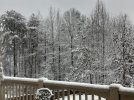
No way. I’m squeezing the backside band until it slips through my fingers like desert sand. Just give me a quick 6-8” thump and I’ll be good. ?Well that looks to be it for the most part, I’ll measure right before bed but should end up around 2in and .10 ice. Definitely not a bust for my area

You think this makes it up this way?This is way over performing the HRRR View attachment 106896View attachment 106897
This looks like another incoming over performer. CAMs had this drying up as it passed the SC/GA border, it’s picking up as it heads this way, Brad is sold on a heavy burst of snow as wellDeform "ish" .....we could use a little dendrites in Crown Town to finish it off

 Lol. If that blob actually goes over my house I’m walking to Publix to buy a lottery ticket.
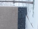
I am pleased with the results of today. View attachment 106892View attachment 106893
I am pleased with the results of today. View attachment 106892View attachment 106893
Looks like 2.5-3in?
View attachment 106910Lol. If that blob actually goes over my house I’m walking to Publix to buy a lottery ticket.
View attachment 106910Lol. If that blob actually goes over my house I’m walking to Publix to buy a lottery ticket.
I’ll let you know here in about 10 minutes what it’s like.View attachment 106910Lol. If that blob actually goes over my house I’m walking to Publix to buy a lottery ticket.
What has helped up here is that we have been below freezing most of the day. Been between about 30-32.Thats what I was thinking, looks to be around 3". That may be the winner for the metro area.
This looks like another incoming over performer. CAMs had this drying up as it passed the SC/GA border, it’s picking up as it heads this way, Brad is sold on a heavy burst of snow as well View attachment 106909

Haha, I think I definitely might look towards north Durham when I buy a house! Nice to be up there near Eno, too! Definitely noticed a difference between here and there with the storms I’ve experienced since moving here!We didn’t go full ZR until 1:45-2PM. Still sitting at 32 here as well.
If you ever buy a house in Durham County and want a good zip code for snow, 27712 is it!
Looks like the bands are beginning to expand as NE Georgia and the northern upstate could see that wave as well.
This thing going out with a bang! Alot of change dumping...Dimes, nickles and quarters!This is way over performing the HRRR View attachment 106896View attachment 106897
Models show them die. You think thats bs?Looks like the bands are beginning to expand as NE Georgia and the northern upstate could see that wave as well.
Correct me if I am wrong, but this looks like it could drop a few inches, no?
Every storm I’ve experienced since we bought, we had way more snow/sleet than the city.Haha, I think I definitely might look towards north Durham when I buy a house! Nice to be up there near Eno, too! Definitely noticed a difference between here and there with the storms I’ve experienced since moving here!

They’re under performing quite a bit on the back end stuff and those bands look like they’re getting better, not dying outModels show them die. You think thats bs?

")