-
Hello, please take a minute to check out our awesome content, contributed by the wonderful members of our community. We hope you'll add your own thoughts and opinions by making a free account!
You are using an out of date browser. It may not display this or other websites correctly.
You should upgrade or use an alternative browser.
You should upgrade or use an alternative browser.
Wintry Jan 15-16 Winter Storm Discussion & Obs
- Thread starter SD
- Start date
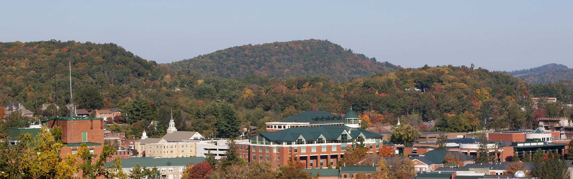
Snowing in Boone:
 www.resortcams.com
King Street Boone NC Webcam - Resort Cams
Located in the heart of downtown Boone, NC, the King Street cam gives a live, streaming view of current happenings and events taking place in the most popular town in the High Country.
www.resortcams.com
4” - it is really adding up. It’s down to 28
esking76
Member
- Joined
- Jan 7, 2017
- Messages
- 52
- Reaction score
- 122
2.5 to maybe a little over 3 inches (eyeballing it) just north of Easley, SC. Temp is 29.8 with moderate snow falling.Any updates in update? How much snow y’all got?
Sent from my iPhone using Tapatalk
Sent from my LM-V450 using Tapatalk
drfranklin
Member
- Joined
- Dec 1, 2016
- Messages
- 511
- Reaction score
- 760
rates increasing, snowflake size increasing; winds increasing; temp has fallen to 29.8
iGRXY
Member
Woke up and it’s at least 2” outside at a minimum and it is absolutely putting it it down right now
It’s been a while 
blueheronNC
Member
Hopefully you switch to some snow or at least all sleet (for a couple of hours). Otherwise, if it's mostly freezing rain it will get "dicey" quick.
Hate to see the CC mixing line already so far north. Wonder if it snows pure here at all.

I just saw one stray snowflake and cannot find another.
Clem282340
Member
I just went outside there has to be around 5 inches here
NBAcentel
Member
And it’s picking up even more 
Heelyes
Member
Light snow here and breezy
TigerSnow
Member
Light snow here in Huntersville. Hoping to get into some of the heavier stuff you guys are getting here soon.And it’s picking up even more View attachment 106510
An official wintry mix is falling here in apex
NoSnowATL
Member
Rain/ Freezing rain now 31-32.
NBAcentel
Member
Should be soon, over 30dbz showing up to our SELight snow here in Huntersville. Hoping to get into some of the heavier stuff you guys are getting here soon.

Clem282340
Member
Okay it’s actually just snow falling right now
NBAcentel
Member
First time in 3 years I’ve seen the roads/parking lots completely covered by snow 
TigerSnow
Member
Hoping the sleet line stays south for some of that heavier stuff as well. Squeeze out all we can get.Should be soon, over 30dbz showing up to our SEView attachment 106513
packfan98
Moderator
Light snow has started here, but the mix line is just south of me. Hoping to avoiding as much frz rain as possible and keep my power! Stay safe everyone!
Several inches back at home from what I can tell
Good storm going here now. NE damming winds blowing snow all over the place
These heavier bands better hurry up while we can still support snow GIMME A DUSTING!
TigerSnow
Member
How long do you think we can keep that sleet line away? Would love to squeeze out some good snow with this heavy stuff coming in.Good storm going here now. NE damming winds blowing snow all over the place
iGRXY
Member
Wind is whipping. Largest snowflakes of the event right now and it is coming down heavy. 28.5/27 but the temp and DP continue to drop and 3.5” so far after an official measurement.
I’m gonna go outside ---- it
Watching the snow fall under the roadside lights will never get old
I’m seeing an occasional burst of flurries at times.
Let’s go!
Think we’ll really be fighting it by 8amHow long do you think we can keep that sleet line away? Would love to squeeze out some good snow with this heavy stuff coming in.
Freezing rain 29/20

Yall enjoy
Yall enjoy
- Joined
- Jan 2, 2017
- Messages
- 1,568
- Reaction score
- 4,283
All over 3" now...wow
Don't know if its even possible but for the moment it seems we are getting the trifecta of snow, sleet and rain/freezing rain in Midland.
iGRXY
Member
Radar is extremely healthy so rates can likely help fight the warm nose for a little longer. Radar actually shows the snow line pretty far south and even further than the HRRR had at this time.Probably around 3 inches, maybe a little more and this is the hardest it's snowed yet. If I can hold on another 2 hrs I'll break a half a foot
NoSnowATL
Member
Dry slot coming in for Atlanta.
jay.p
Member
Snow mixed with sleet in sw Raleigh
Sent from my iPhone using Tapatalk
Sent from my iPhone using Tapatalk
Are we really suppose to get ice for awhile also like Wyff4 said? I have no internet now and trying to navigate on my phone...I don’t believe what they say anymore. Lol
I think I’m getting some mixing now actually...
I think I’m getting some mixing now actually...
Hello mr sleet snow line we meet again 