-
Hello, please take a minute to check out our awesome content, contributed by the wonderful members of our community. We hope you'll add your own thoughts and opinions by making a free account!
You are using an out of date browser. It may not display this or other websites correctly.
You should upgrade or use an alternative browser.
You should upgrade or use an alternative browser.
Wintry Jan 15-16 Winter Storm Discussion & Obs
- Thread starter SD
- Start date
drfranklin
Member
- Joined
- Dec 1, 2016
- Messages
- 511
- Reaction score
- 760
gsp just increased my total snowfall on pinpoint forecast
MamaJen
Member
Temps are dropping fast here - I’m in the southeastern most part of Bartow County, just across the border from Cherokee and Cobb counties, near Acworth, GA. We’re at 38 degrees (down about 4-5 degrees in the last hour or so), east winds only about 4-9mph at the moment. Raining, but no mixing yet. Definitely concerned about those forecasted winds!
Z
Zander98al
Guest
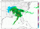
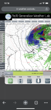
Gut feeling tells me this lows going to be a bit stronger and more southeast in positioning. It's a bit more uniform as well then what the HRRR. ?
Iceagewhereartthou
Member
I wonder how long it will take to see BL temps reach freezing in the upstate. 39/31 for me; long ways from 32. Looks like 850s and 925s are below freezing (925s barely) right on the line. Gonna take some heavy rates to crash those temps without evap cooling. I always hate it when what falls can't accumulate.
accu35
Member
ATLwxfan
Member
Ryan Maue suspects the ULL will overperform tomorrow pm. He’s hardly a sensationalist
.
Sent from my iPhone using Tapatalk
.
Sent from my iPhone using Tapatalk
Snowflowxxl
Member
HRRR has trended warmer here last two runs for initial precip leaving me with rain. Gonna be razor thin
Nomanslandva
Member
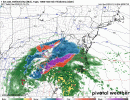
If tomorrow ends up looking more like the fv3 than the 3k NAM, I might have something new to add to the watch list. It does seem to have LP a litter farther south. Have to be a ? and not just buy the thermals of the nam...even if I know better.
Showmeyourtds
Member
At this point, I’m rolling the dice on the ULL. Could be funHRRR has trended warmer here last two runs for initial precip leaving me with rain. Gonna be razor thin
GeorgiaGirl
Member
It is currently 43...obviously not going to get any wintry weather (why am I under a Winter Weather Advisory? the only explanation that I would have would be in case we bust low on the temps), but it shows that at times while tracking this, CAD wasn't modeled well since it can extend to here.
Like I think one GFS run had me close to the 60s for tomorrow and uhhhh...no.
I'm guessing we drop into the mid-30s and the high ends up being in the mid-40s.
Like I think one GFS run had me close to the 60s for tomorrow and uhhhh...no.
I'm guessing we drop into the mid-30s and the high ends up being in the mid-40s.
accu35
Member
So the ULL is currently south of all models ATM except FV3 lol
Deerhunter75
Member
Temp 39.0. dew point 37.8. N.E. winds
Hampton Georgia
Hampton Georgia
Snowed In
Member
Mcdonough, GA
Temp 39
Dew 38
Temp 39
Dew 38
| Wind Speed | E 15 G 22 mph |
- Joined
- Jan 2, 2017
- Messages
- 1,566
- Reaction score
- 4,279
Light snow here
36
36
LukeBarrette
im north of 90% of people on here so yeah
Meteorology Student
Member
2024 Supporter
2017-2023 Supporter
HRRR is not bad here actually, and seems likelyIf tomorrow ends up looking more like the fv3 than the 3k NAM, I might have something new to add to the watch list. It does seem to have LP a litter farther south. Have to be a ? and not just buy the thermals of the nam...even if I know better.
iGRXY
Member
FV3 had the most widespread and heaviest snow on the back side compared to other models lolSo the ULL is currently south of all models ATM except FV3 lol
BufordWX
Member
37.5 now. Occasionally get a few bursts of sleet mixing in with the rain, but it’s not constant.
MotoWeatherman
Meteorologist
Dahlonega GA
36.1/31.1
Light snow
36.1/31.1
Light snow
Mostly light rain but some definite snow starting to mix in. 37.6
Bang. Let’s go man.Dahlonega GA
36.1/31.1
Light snow
37.8 here - 6 miles east of Alpharetta
iGRXY
Member
Sctvman
Member
ATLwxfan
Member
HRRR has trended warmer here last two runs for initial precip leaving me with rain. Gonna be razor thin
Yes still awfully warm in Alpharetta. We’ll get flakes on the front end but would need to get considerably colder to think it sticks.
Sent from my iPhone using Tapatalk
NAtlantaStudio
Member
Cumming, Ga right by Sawnee Mtn
37.6 / 33
We were 40 at 10:45
37.6 / 33
We were 40 at 10:45
L
Logan Is An Idiot 02
Guest
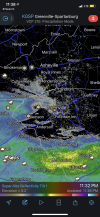
Figured this would be an issue. How long do y’all think it will take fore the atmosphere to saturate?

Sent from my iPhone using Tapatalk

Sent from my iPhone using Tapatalk
iGRXY
Member
Clem282340
Member
Looks like tiny flakes are starting to fall here in liberty sc
Well these models, especially the HiRes ones, do a good job of taking this into account and not showing virga as a surface reflectionFigured this would be an issue. How long do y’all think it will take fore the atmosphere to saturate?
Sent from my iPhone using Tapatalk
Cary_Snow95
Member
Officially down to freezing in Cary. 32.0/15.4
Jessy89
Member
Looks like tiny flakes are starting to fall here in liberty sc
They are there fine but looks like snow to me
Sent from my iPhone using Tapatalk
Crow
Member
29/14 in Franklinton, NC
NBAcentel
Member
35/25
Clem282340
Member
Yes they are so small can barley see them in the lightThey are there fine but looks like snow to me
Sent from my iPhone using Tapatalk
boobear
Member
In Woodstock ,Ga Next to Holly Springs. It stayed around 41 for several hours
. It has been a light rain. Dropped down to 39 for 45 minutes then back to 40.
. It has been a light rain. Dropped down to 39 for 45 minutes then back to 40.
SnowNiner
Member
Figured this would be an issue. How long do y’all think it will take fore the atmosphere to saturate?
Sent from my iPhone using Tapatalk
I wouldn't really call those dews bone dry, especially over us along 77. Maybe to the east perhaps but still...
Light snow, the temp is holding steady right now


