-
Hello, please take a minute to check out our awesome content, contributed by the wonderful members of our community. We hope you'll add your own thoughts and opinions by making a free account!
You are using an out of date browser. It may not display this or other websites correctly.
You should upgrade or use an alternative browser.
You should upgrade or use an alternative browser.
Wintry Jan 15-16 Winter Storm Discussion & Obs
- Thread starter SD
- Start date
Z
Zander98al
Guest
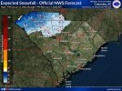
That's the safe forecast, meteorligists have to be conservative, just know there's potential for a pretty big boomJames Spann is sticking to his guns. It hard to argue with him.
View attachment 106322
accu35
Member
Might be a blip but RDU reporting dew of 14 now
GaSnowhound
Member
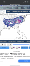
View attachment 106327
I hug this map
Z
Zander98al
Guest
That looks like it could be correct. https://www.wunderground.com/wundermapMight be a blip but RDU reporting dew of 14 now
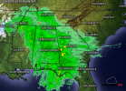
A few mangled wet flakes mixing in the rain here about 6 miles east of Alpharetta, GA.
40.1 degrees
40.1 degrees
GaSnowhound
Member
That’s beauty right there for Atl Metro North and East!!! and the rest of most of SE. How reliable is this model re accum totals in this range?
HSVweather
Member
Interesting
Lee County AL
Member
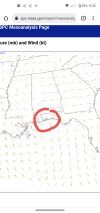
Where did the models have the low at this time ?Amazing the surface low is near orange beach now. Right on the gulf still. View attachment 106328
FamouslyHot
Member
Z
Zander98al
Guest
Right above the panhandle on the state line I'm pretty sure. It's still chugging along on the gulf. Should make a Northeast turn soonWhere did the models have the low at this time ?
Love that wrf, whew if only.
Allright who's in Seneca or spitting distance to the west. Check your floodlights. You should be 1st outside mtns any moment now per radar
Allright who's in Seneca or spitting distance to the west. Check your floodlights. You should be 1st outside mtns any moment now per radar
My goodness. Just walked out to friend’s car. It is BRISK. Stout breeze.
JimRussell
Member
Never heard of this guy, he at NWS or something?From Meteorologist Chris Lisauckis in Huntsville
Good Evening, after reviewing the latest computer model data and applying various meteorological techniques, I see no reason to change the forecast much from earlier. The Tennessee Valley Region of northern Alabama and southern middle Tennessee will be located in an ideal location for very heavy snow between 9am and 3pm Sunday. Whiteout conditions are likely at times over the area and travel problems will likely develop throughout the morning hours. An experimental snow forecasting index I am developing indicates 2-3" per hour snowfall rates are possible, and thundersnow. A fair amount of this snow will likely melt because of above freezing surface temperatures, however I still expect 5-7" across a large part of the area. Unfortunately, due to the difficulty of this forecast, it's not possible to predict locations where these totals are most likely at this time. The Tennessee Valley will be located in the left exit region of the high altitude jet stream portion of the storm system, which may allow temperatures to dynamically cool more than expected at the surface as heavy precipitation continues. Only a few degrees of surface temperature will separate us from getting 5-7" and 8-10" of snow. Things could change with the forecast. Please expect the unexpected.
Lee County AL
Member
So no change in forecast from earlier today ?Right above the panhandle on the state line I'm pretty sure. It's still chugging along on the gulf. Should make a Northeast turn soon
Philconnors
Member
Down to 40/39 and heavy rain in bluff park AL - elevation 900’ on shades Mtn 10 miles south of Bham steadily dropping. Heavy rain drops falling. Warm front is to the west but that circulation is broad looks like a lot of cold and dry air wrapping on Lee side. I think this has bust in a good way!
The last snowfall gave us at 900 feet 1.5 hours MORE snow than at 550 down in Hoover!
Sent from my iPhone using Tapatalk
The last snowfall gave us at 900 feet 1.5 hours MORE snow than at 550 down in Hoover!
Sent from my iPhone using Tapatalk
BufordWX
Member
Now that some of the rain has moved in temperatures starting to go down. Went down about a degree in the past 20 minutes.
39.6/33.3
39.6/33.3
lj0109
Member
Was curious how the models where handling CAD for this event here on the southern edge of it so I put together a little chart for CAE to compare to observations using a handfull of global and mesoscale models.
Here are 2 snapshots from what I have down of the 00Z Saturday and 12Z Saturday Model Runs vs. Observations at CAE for 2 points so far (13:00 Saturday and 19:00). Will try and update at the 06Z observation:
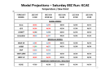
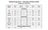
Here are 2 snapshots from what I have down of the 00Z Saturday and 12Z Saturday Model Runs vs. Observations at CAE for 2 points so far (13:00 Saturday and 19:00). Will try and update at the 06Z observation:


Last edited:
Re
View attachment 106327
I hug this map. Quick question. What’s going on in those huge holes? Rain?
Z
Zander98al
Guest
Not sure, it's a snow event in Alabama. Throw everything unexpected in a bag and shake it up and you'll get whatever you land on lol, how it goes for us in the south. imo expect low accumulations, but know they're is a good chance of a boom tommorow. Snow events have a way of pulling a hat trick or two on you.So no change in forecast from earlier today ?
Zanderd98al please keep posting those maps. I cant find under the tabs on spc page
Jayla0714
Member
Still nothing yet in SenecaLove that wrf, whew if only.
Allright who's in Seneca or spitting distance to the west. Check your floodlights. You should be 1st outside mtns any moment now per radar
Light rain with a few flakes mixed in here.
Z
Zander98al
Guest
This is what I use. Spc mesoanalysis mobile. https://www.spc.noaa.gov/exper/mesoanalysis/new/frames_mob.php?sector=18
Philconnors
Member
Not sure, it's a snow event in Alabama. Throw everything unexpected in a bag and shake it up and you'll get whatever you land on lol, how it goes for us in the south. imo expect low accumulations, but know they're is a good chance of a boom tommorow. Snow events have a way of pulling a hat trick or two on you.
It absolutely is a potential snow event here.
Sent from my iPhone using Tapatalk
Benholio
Member
- Joined
- Jan 2, 2017
- Messages
- 1,566
- Reaction score
- 4,279
I'm here bro..gonna check in a minute. Got a few reports from walhalla and westminster of some dandruffLove that wrf, whew if only.
Allright who's in Seneca or spitting distance to the west. Check your floodlights. You should be 1st outside mtns any moment now per radar
Nerman
Member
Now that some of the rain has moved in temperatures starting to go down. Went down about a degree in the past 20 minutes.
39.6/33.3
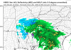
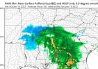
HRRR has us switching to snow around 12. Let's see what it's got. If it verifies that should be a good signal for upstate and nc.
Not sure but does seem the slp is a little south of what the HRRR has been showing, which is interesting b/c HRRR has been one of the colder models.... problem not a huge deal as it looks like it's about to make the turn NE. Now if it doesn't all models will have busted horribly and all bets are off lol
Lee County AL
Member
Very true. Last big snow in my area (Phenix city Alabama / Columbus Georgia area) was 3-1-2009 and it was because of an ULL.Not sure, it's a snow event in Alabama. Throw everything unexpected in a bag and shake it up and you'll get whatever you land on lol, how it goes for us in the south. imo expect low accumulations, but know they're is a good chance of a boom tommorow. Snow events have a way of pulling a hat trick or two on you.
iGRXY
Member
38/27
@Nerman what are your current obvs?HRRR has us switching to snow around 12. Let's see what it's got. If it verifies that should be a good signal for upstate and nc.
I just came in from taking the dog out one last time tonight and man is it brisk our there… 35/22 right now… that snow smell is a bit stronger
LovingGulfLows
Member
- Joined
- Jan 5, 2017
- Messages
- 1,499
- Reaction score
- 4,100
HRRR has us switching to snow around 12. Let's see what it's got. If it verifies that should be a good signal for upstate and nc.
Well, guess I'll use you guys up there in the northern/northeast suburbs as a benchmark as to whether or not I even sniff a chance at seeing snow flakes with this frontend stuff. If you guys don't see snow in the next 1.5 hours, I'm kissing my chances goodbye.
32/14 RDU ?
Cary_Snow95
Member
Temp really beginning to drop 33.4/16.3
iGRXY
Member
Yeah it’s going to have to start turning now to make the expected tract. That’s definitely going to change things if it comes in more south as the changeover is going to be delayed even furtherNot sure but does seem the slp is a little south of what the HRRR has been showing, which is interesting b/c HRRR has been one of the colder models.... problem not a huge deal as it looks like it's about to make the turn NE. Now if it doesn't all models will have busted horribly and all bets are off lol

