Crazy, I’m actually starting to think we may have accumulating snow in excess of an inch here. RAP is 3-4, latest HRRR is 2-5, both WRFs are ~2. This could be a major win for east AL.
-
Hello, please take a minute to check out our awesome content, contributed by the wonderful members of our community. We hope you'll add your own thoughts and opinions by making a free account!
You are using an out of date browser. It may not display this or other websites correctly.
You should upgrade or use an alternative browser.
You should upgrade or use an alternative browser.
Wintry Jan 15-16 Winter Storm Discussion & Obs
- Thread starter SD
- Start date
Snownut
Member
Justice just said it's an over performer in upstate, expect more Snow. Not exact words but t b ats basically what he said
Sent from my SM-A526U using Tapatalk
Sent from my SM-A526U using Tapatalk
30/12 RDU
Wind chill has already touched the teens tonight
MotoWeatherman
Meteorologist
Dahlonega GA
Light snow
35.2/31.5
Light snow
35.2/31.5
boobear
Member
It just went back down to 39.
D-Ray
Member
Iight snow has started
Ward Cleaver
Member
Ten miles north of Greensboro
30.2/14.2
And enough propane for the Generac to get me through about six days.
30.2/14.2
And enough propane for the Generac to get me through about six days.
Benholio
Member
Most stations around Cumming reporting ~37 degrees, which is right in line with FFC hourly forecast. From here it should drop a degree or so per hour, going below freezing at 5am
39/36 with rain. Temp has dropped about 5 degrees in the past 3 hrs.
Bigrandy
Member
PCrazy, I’m actually starting to think we may have accumulating snow in excess of an inch here. RAP is 3-4, latest HRRR is 2-5, both WRFs are ~2. This could be a major win for east AL.
drfranklin
Member
- Joined
- Dec 1, 2016
- Messages
- 511
- Reaction score
- 760
38.8/29, winds NE 12 G 18
njbarrineau
Member
Got snow in Travelers Rest!
Sent from my iPhone using Tapatalk
Sent from my iPhone using Tapatalk
StormStalker
Member
It’s so close to being nothing or up to several inches here. We won’t know until we see where those bands set up.
WeatherAddiction
Member
40/31 here around here near Clemson with a mix going on
Snowflowxxl
Member
Heavy precip heading for NE GA.... its about to be pound town there in the next hour.
Snowed In
Member
Heavy rain here in Mcdonough, GA
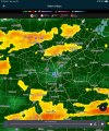
Looking at the Radar returns on Rader in NE GA and what HRRR is spitting out for 0 hour on current run you can tell HRRR is slightly warmer then reality and that seems to be a good thing because HRRR still brings hammer as night goes on if it's off by a few degrees stretching to SW goodness
BufordWX
Member
Based off where things look now and what the hrrr had been showing, I bet within the next 30-90 minutes things start getting interesting north of ATL. Could happen quickly too.Heavy precip heading for NE GA.... its about to be pound town there in the next hour.
Z
Zander98al
Guest
Time to hit the sack. My go time is around 5:30 or 6. Set my alarm for then. Hopefully nothing big changes from the time I go to sleep lol. Cause it's been a pretty fluid situation
drfranklin
Member
- Joined
- Dec 1, 2016
- Messages
- 511
- Reaction score
- 760
winter weather has started just south of DT Greenville SC: mod sleet at 38.7/29
- Joined
- Jan 2, 2017
- Messages
- 1,568
- Reaction score
- 4,283
Light rain/snow mix at 36
Yea the radar looks ahead of schedule vs the HRRR. Wow. Snow in Greenville already.
weatherguy
Member
Wow, Bufkit 00z GFS cobb05 for northwest AL, I don't think I've ever seen the GFS show such a high number, over 17" of snow:

- Joined
- Jan 5, 2017
- Messages
- 3,810
- Reaction score
- 6,066
I have a report of snow falling in Buckhead near Atlanta, GA. This would be near GA 400.
39/39 here.
39/39 here.
iGRXY
Member
2 hours ahead of the HRRR folks. Over performer is looking highly likely right now. Should be able to give y’all a snow report in about 20-30 minutes
neelsamb
Member
37/35 up around exit 12 of 400. Mostly rain with just the occasional snowflake and sleet pellet. I’ve got absolutely nothing to base this on but it just feels like a changeover is going to happen soon. Wind is really blowing
You’re golden my man. In a great spot. Enjoy it! So awesome to see an over performer in real time for once.2 hours ahead of the HRRR folks. Over performer is looking highly likely right now. Should be able to give y’all a snow report in about 20-30 minutes
Snowflowxxl
Member
37/35..... modernweenie
nbellenburg
Member
Getting light sleet/snow mix in Simpsonville, SC
Snownut
Member
Light Snow just SE of Nine Times Sc, 39° NNE Wind Gust to 14mph
Sent from my SM-A526U using Tapatalk
Sent from my SM-A526U using Tapatalk
37.6F/36.5
I can’t see anything other than probably rain, but we need some drier air or some colder air aloft to come down to push these temps down further. Current wet bulb is 37.0F
I can’t see anything other than probably rain, but we need some drier air or some colder air aloft to come down to push these temps down further. Current wet bulb is 37.0F
NBAcentel
Member
What a interesting drop now 35/19
Let’s go boys