I could enjoy my fantasy blizzard a whole lot more if I wasn't constantly moving banter post, c'mon y'all. Thanks
-
Hello, please take a minute to check out our awesome content, contributed by the wonderful members of our community. We hope you'll add your own thoughts and opinions by making a free account!
You are using an out of date browser. It may not display this or other websites correctly.
You should upgrade or use an alternative browser.
You should upgrade or use an alternative browser.
Wintry Jan 15-16 Winter Storm Discussion & Obs
- Thread starter SD
- Start date
NBAcentel
Member
This TPV trend is heavenly, it’s a big reason why we’re seeing such deep cold CADView attachment 103577
This is awesome, no other way to describe it, this setup is just getting colder and colder, MSLP pattern is trending better

LickWx
Member
NC-12 would cease to exist . A storm like the GFS shows would be a beating on the outer banks . I wish just once it would bomb out like the model shows . There’s some mid 70s just offshore there in the gulf stream . There’s enough juice to make it happen . Has a storm ever bombed like that recently ?Hampton Roads had serious flooding, within 2 feet of records, even with last week's storm (worse than Dorian). A strong low pressure like the one on the GFS would not be good news, especially if heavy snow accumulates on trees and power lines with the kind of wind a storm like that would produce. Coastal flooding on top of power outages would not be ideal
Yeah that track is worrisome though, definitely think we have a ton of mixing issue, no wiggle room for sureYou only net 24.5 inches.
Halifax County USA the jackpot
L
Logan Is An Idiot 02
Guest
I think the main thing to take from this right now is there’s going to be a winter storm across the southeast. The intensity and precip type for each state is not necessarily what we should be paying attention to right now. There’s going to be a storm. Most likely it’s going to be wintry. We will have to wait for the short range models to come into range to start determining precip types. But it’s definitely looking like there’s going to be a board wide winter storm.
Sent from my iPhone using Tapatalk
Sent from my iPhone using Tapatalk
This feels like our first legitimate big dog potential since December 2018 for the SE east of the Apps.
A bomb like that over the warm ssts would be a guaranteed stronger than modeled warm noseYeah that track is worrisome though, definitely think we have a ton of mixing issue, no wiggle room for sure
- Joined
- Jan 23, 2021
- Messages
- 4,604
- Reaction score
- 15,203
- Location
- Lebanon Township, Durham County NC
Digging into the data further, 21” of snow falls in 12 hours between 12z Sunday and 00z Monday.
Cary_Snow95
Member
Well the fact that the GFS depicts a 980 monster over the coastal plane and central nc is still snow is a good sign. I would be surprised if we get something that juiced up
Didn’t someone post something a while back about sea surface temperatures .. if this stone has a way to tap into those warm water right off the coast maybe that could be a trigger to something big like this in some way
NBAcentel
Member
The closest analog I have found to this storm has been March 1980. Obviously some notable differences with less of a 50/50 low, and a low coming out of SE Canada. However, the wave orientation and tilt are similar. View attachment 103402View attachment 103403
With the TPV slowing down even more in SE Canada, the analog @Ollie Williams brought up is actually looking more legit

iGRXY
Member
Personally I think the GFS is trying to drive the LP into probably one of the strongest CADs I’ve seen in a long time. Usually a warm nose is worrisome but with the entrenched TPV located where it is with the CAD in place, I think this is something that isn’t likely.
Im counting only 3 GEFS members with a very north solution
But if you haul in a low that strong, that’s gonna bring WAA inPersonally I think the GFS is trying to drive the LP into probably one of the strongest CADs I’ve seen in a long time. Usually a warm nose is worrisome but with the entrenched TPV located where it is with the CAD in place, I think this is something that isn’t likely.

iGRXY
Member
Problem is the low isn’t likely to come that far north. That’s the point of a strong CAD. Globals routinely try and drive LP into it and that’s not happening. It will pivot around it or Miller B with a transfer to the coast.But if you haul in a low that strong, that’s gonna bring WAA in
NBAcentel
Member
Looks like the GEFS has less QPF and a lower snow mean, but not really for bad reasons
IF the CAD is that strong, the low isn't going to just plow right through the middle of it. Let's not forget, the GFS isn't, shall we say, all that accurate with 6 day snowstorm placement.
Storm signal is there on the models. Pattern supports it. Cold air looks available. Overall, great news at this lead.
Storm signal is there on the models. Pattern supports it. Cold air looks available. Overall, great news at this lead.
BHS1975
Member
This is awesome, no other way to describe it, this setup is just getting colder and colder, MSLP pattern is trending betterView attachment 103578
Would be a decade or more since we had a CAD that cold.
Sent from my iPhone using Tapatalk
That track and strength would have a serious warm nose, ugh
Indeed. The GFS also laid down a crippling ice storm under that warm nose along the Hwy 1 corridor in NC.
Sent from my iPhone using Tapatalk
NBAcentel
Member

Cary_Snow95
Member
Hmm more northern jackpot
1980 was a major NC Blizzard. Also last time the Dawgs won a natty. History repeat? Stay tuned
iGRXY
Member
QPF lowered likely due to much more cold air.
BHS1975
Member
Didn’t someone post something a while back about sea surface temperatures .. if this stone has a way to tap into those warm water right off the coast maybe that could be a trigger to something big like this in some way
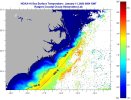
Yeah they are several degrees above normal in the gulf stream.
Sent from my iPhone using Tapatalk
Cary_Snow95
Member
I’m assuming it’s still snowing here
NBAcentel
Member
UKMET is suppressed to hell, with some light snow 

Only reason to be weary is if you have some ridging nudging into the southeast coast and we’re not seeing that here with that big PV in the Atlantic. This really is a great white Buffalo setup. The opportunity is there. No doubt about.IF the CAD is that strong, the low isn't going to just plow right through the middle of it. Let's not forget, the GFS isn't, shall we say, all that accurate with 6 day snowstorm placement.
Storm signal is there on the models. Pattern supports it. Cold air looks available. Overall, great news at this lead.
UKMet is way south

A lot more solutions were suppressed although did give out snow just not by nearly enough and was shunted south… these trends would actually be welcomed right now as we know at some point these models have to correct back the other way at least some what
Well GFS went all in, Euro your next……
This might be the run of the night so far tbh. That’s beautiful.UKMET is suppressed to hell, with some light snow View attachment 103585View attachment 103586
NBAcentel
Member
I actually like this trend, one more slowing trend with the S/W and better tilt and boom 
Yes!!UKMet is way south
UKMet didn't interact with the Baja cutoff low....that's part of the winning formula we 'talked about' earlier

I haven’t noticed it so much recently, but I know that the UKMET used to have a suppression bias.
You love to see it. That’s absolutely beautiful. This euro run is about to be interesting. Should favor the Ukie. Weenie time.UKMet is way south