I’m perplexed!
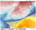
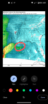
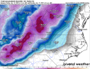
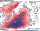
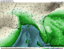
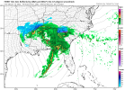
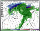
Does anyone else think the models showing ATL staying above 32 for the entire front part of the storm are wrong? I realize it may be above 32 for however many hours at the start with any rain that falls in the first part of the night, but the wedge will be then be strengthening overnight with increasingly strong E winds bringing in cold air. 850s never get above +4 C on any model.
History back to 1950 at ATL and other nearby areas (per examining old maps) says that when there is a strong wedge that holds combined with ample rainfall (in this case ~1”, which is plenty ample) and 850s don’t get above +5C, there will very likely be at least some ZR. But I’m seeing only down to 38ish on the Euro/GFS. Sorry, but that’s not going to happen imho as long as they actually get that ~1” of rain of course. If it does, that would be isothermal from 850 to the surface!! How can that possibly be with a wedge of colder air?? A wedge by definition has to be colder at the sfc than at 4K feet up (850 at ATL is 4K feet above ground, which is 5K feet elevation).
The next thing I wanted to eliminate is that the parent high isn’t that cold. I can eliminate that right now because highs in much of SE Canada were way down in the -0s. Lows this morning and tomorrow are in the -20s to some -30s!
Then I checked NYC and Philly, where the cold air is coming in. They’re expecting lows well down in the teens the next two nights with highs tomorrow only near low to mid 20s. There’s a strong (1040 mb) high that will move into the NE and will be slow to move out and weaken thanks to a 50/50 low.
By the way, with as cold as 850s are expected to be (only 0 to +2C through much of the night), that’s actually an indicator more for sleet than ZR per history. I see no mention of sleet in the FFC ATL forecast. I’m thinking that there could very well be several hours of sleet preceding a change to ZR.
@dsaur even down your way there COULD be some sleet.
Side note: FFC has a high of 51 at KATL tomorrow. Maxar also does but has the coldest Sat/Sun low only down to 36. That’s going to bust!

