Snowflowxxl
Member
The 18z has not been kind to much of TN. This is probably their worst of the last six or seven runs.
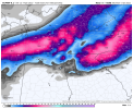
I don’t know that I’ve ever seen such extreme model discrepancies. 12Z Euro and it’s ens run says winter is coming while the 18Z NAM says I’ll be building a mud man.The 18z has not been kind to much of TN. This is probably their worst of the last six or seven runs.
How do you think the scenic city fares with this one?
Nam, is getting beefy for Atlanta metroI don’t know that I’ve ever seen such extreme model discrepancies. 12Z Euro and it’s ens run says winter is coming while the 18Z NAM says I’ll be building a mud man.
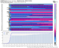
Here is the 12Z Euro plus it’s Ens run.
View attachment 105604View attachment 105605
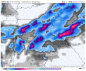
And the 18z Nam
View attachment 105610
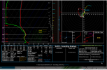
For Example Soundings off of Pivotal for Cherokee, Etowah, and Lawrence counties in AL all show Snow sounds even though model depicts rain and no accumulation at frame 4818z
View attachment 105616
I have a tough time believing the sporadic mixing issues along the way on this system... I will believe these gaps will get some coverage as well during this event until it proves me wrong
So are HRRR, Icon and RGEM.Nam, is getting beefy for Atlanta metro
Meh, I think he may be possibly overdoing doing ice totals. I think a WSW is sufficient enough considering the uncertainty in what type of precip may fall. What's concerning to me is the fact that we may see a quick burst of 1-3 inches of front-end snow and if we add even a .50 inch on top of that, with the wind we could be looking at some significant issues. But not sure if that warrants an Ice storm warning.For you Charlotte proper peeps. -- leaning to an Ice Storm for the metro.. (even though we are under WSW)
What is the sounding for The Atl airport or how can I access this?For Example Soundings off of Pivotal for Cherokee, Etowah, and Lawrence counties in AL all show Snow sounds even though model depicts rain and no accumulation at frame 48
View attachment 105620
I like Chris but this is a bad graphic. Really bad call here for the southern extent imoChris says pull out the rain boots.
And no this isn’t banter iv seen first call maps posted all day so it shouldn’t be deleted again.
I think we most likely see a sloppy mix of sleet and maybe a little snow with a dash of rain mixed in around Charlotte. Seen this story a lot. Warm nose always wins even in my area north of Charlotte. The low is just cranking to much and blowtorching with those windows from the south.Meh, I think he may be possibly doing ice totals. I think a WSW is sufficient enough considering the uncertainty in what type of precip may fall. What's concerning to me is the fact that we may see a quick burst of 1-3 inches of front-end snow and if we add even a .50 inch on top of that, with the wind we could be looking at some significant issues. But not sure if that warrants an Ice storm warning.
NWS likes the HRRR and that southerly track
Sent from my iPhone using Tapatalk

What is the sounding for The Atl airport or how can I access this
I definitely don't think we will see much in the way of rain. Whatever falls is going to be frozen. This CAD is just too stout. Area's further east, closer to the LP, sure. But I am pretty confident CLT stays frozen throughout the entire duration.I think we most likely see a sloppy mix of sleet and maybe a little snow with a dash of rain mixed in around Charlotte. Seen this story a lot. Warm nose always wins even in my area north of Charlotte. The low is just cranking to much and blowtorching with those windows from the south.
I would not bet against the NAM and it sniffing out a warm nose. It always seems to win out.Something about that NAM and it’s mixing issues in WNC got me thinking. We all pay attention when the NAM is throwing mixing issues out there inside 60 hours, because of the track record it has with sniffing out warm noses. However it also has a known problem with sniffing out the dynamic cooling that comes with a strong FGEN band of precip. It actually had problems with it in the December 2018 storm, but it was even more prevalent in that western SC Upstate, southern NC Mountains/Foothills event last February. The HRRR was steadfast as soon as it came into range and many just kept saying it would fold, but it never did. It wasn’t until about 6 hours before the start of the event that the NAM finally caught onto it. Not saying that definitely going to happen here, but it does play into know biases.
Yeah.., I really feel like the Ice Storm Warning is well placed by GSP, because again looking at the soundings a lot of what these have been showing as freezing rain is with a strong sleet sounding.Meh, I think he may be possibly doing ice totals. I think a WSW is sufficient enough considering the uncertainty in what type of precip may fall. What's concerning to me is the fact that we may see a quick burst of 1-3 inches of front-end snow and if we add even a .50 inch on top of that, with the wind we could be looking at some significant issues. But not sure if that warrants an Ice storm warning.
I think there’s a couple inches of sleet in charlotte, and I highly doubt we get warm enough to rain. LolI think we most likely see a sloppy mix of sleet and maybe a little snow with a dash of rain mixed in around Charlotte. Seen this story a lot. Warm nose always wins even in my area north of Charlotte. The low is just cranking to much and blowtorching with those windows from the south.
For Example Soundings off of Pivotal for Cherokee, Etowah, and Lawrence counties in AL all show Snow sounds even though model depicts rain and no accumulation at frame 48
Agree. This would be completely different if this was a in-situ CAD event, there wouldn’t be any front end snow, this CAD is a hybrid setup and will have dry air in the low levels feeding in as precip starts, there’s gonna probably be a burst of snow on the beginning from dynamical cooling. it happens with almost every Miller B winter storm that has a hybrid/classical CAD, even 2002 had snow to start out, any ticks south with the 850mb low helps a ton thoSomething about that NAM and it’s mixing issues in WNC got me thinking. We all pay attention when the NAM is throwing mixing issues out there inside 60 hours, because of the track record it has with sniffing out warm noses. However it also has a known problem with sniffing out the dynamic cooling that comes with a strong FGEN band of precip. It actually had problems with it in the December 2018 storm, but it was even more prevalent in that western SC Upstate, southern NC Mountains/Foothills event last February. The HRRR was steadfast as soon as it came into range and many just kept saying it would fold, but it never did. It wasn’t until about 6 hours before the start of the event that the NAM finally caught onto it. Not saying that definitely going to happen here, but it does play into know biases.
I agree… I really am getting the sense that when this is over, it may be one of the biggest sleet events that CLT metro has seen in the last several decades.I think there’s a couple inches of sleet in charlotte, and I highly doubt we get warm enough to rain. Lol
I think there’s a couple inches of sleet in charlotte, and I highly doubt we get warm enough to
Hopefully we can get a front end thump of snow. Models have been hinting at it. I guess I am just pessimistic from years past when that front end snow never develops or it’s gobbled up by dry air.Agree. This would be completely different if this was a in-situ CAD event, there wouldn’t be any front end snow, this CAD is a hybrid and will have dry air in the low levels feeding in as precip starts, there’s gonna be a burst of snow on the beginning from dynamical cooling it happens with almost every Miller B winter storm that has a hybrid/classical CAD, even 2002 had snow to start out
Thanks! Had me as snow at 1am Sunday in Chastain Park area ITP.Just pick you a time on the RDP scroll over map and pick a spot by right clicking

Models: RDPS - Pivotal Weather
View RDPS weather model forecast map image for Precipitation Type, Rate in Southeast US on pivotalweather.com.www.pivotalweather.com
Yes, but it is short lived as the column quickly warms and you switch to rain. I bet there is a warm nose in there, though, that makes it all rain to start, too. Best chance for Atlanta is under the upper level low.Thanks! Had me as snow at 1am Sunday in Chastain Park area ITP.
What really makes me giggle is just how different some of these models are when it comes to snowfall amounts, etc. That includes NAM, HRRR, ICON, GFS, and in-house weather models. It's literally all over the place right now. Basically might as well play a game of Russian Roulette. Or make this into a drinking game. Whatever floats your boat. ?
Meh, I think he may be possibly overdoing doing ice totals. I think a WSW is sufficient enough considering the uncertainty in what type of precip may fall. What's concerning to me is the fact that we may see a quick burst of 1-3 inches of front-end snow and if we add even a .50 inch on top of that, with the wind we could be looking at some significant issues. But not sure if that warrants an Ice storm warning.
