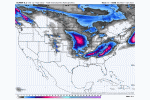
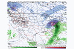
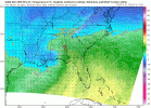
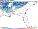
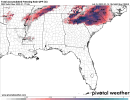
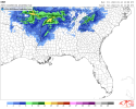
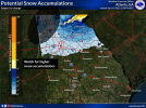
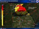
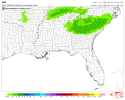
Yeah overall NAMs are a improvement and they inched toward that HRRR run as well....But I think NAM got a little touch of Covid or something with those soundings of Rain in areas West....Now previously that Precip field was drying up and not even there so perhaps its' just feeling it out for now
-
Hello, please take a minute to check out our awesome content, contributed by the wonderful members of our community. We hope you'll add your own thoughts and opinions by making a free account!
You are using an out of date browser. It may not display this or other websites correctly.
You should upgrade or use an alternative browser.
You should upgrade or use an alternative browser.
Wintry Jan 15-16 Winter Storm Discussion & Obs
- Thread starter SD
- Start date
Nice 8” lollipop in southern MS. Funky solution, no way it goes down like that.
Flotown
Member
Yeah,do t know what's up with this but that northwest side of precip field should be snow or mix
If you’re a snow lover in the Atlanta area, you need to be cheering hard for the HRRR and to a lesser extent the Euro. The front end thump is going to be the ticket. We can’t rely on that backside stuff for anything more than another inch max
Winds still could be problem, RAH NWS mentioned they may have to increase winds also


GSP hoisting winter storm warnings soon.
HSVweather
Member
Found this interesting from this morning, a true boom or bust scenario for the area highlighted across North MS/AL
bingcrosbyb
Member
Wack-a-mole snowstorm. Dusting and 1 mile away 6" of snow? This solution seems very odd. Model struggling with cooling/thermal issues causing weird output.
HSVweather
Member
beautiful


SnowNiner
Member
ForsythSnow
Moderator
Found this interesting from this morning, a true boom or bust scenario for the area highlighted across North MS/AL
So if that map is what he says it is, around here and Gainesville have a near 100% chance of extreme snowfall if that's what I'm getting at from the European. Never seen this map before so idk how valuable it is.
JHS
Member
GSP going with warnings for their entire CWA. Will be an ice storm warning for the southeastern edge of the area in SC and GA.
Snowflowxxl
Member
Yeah and honestly the 18z run looks very similar to yesterdays 18z which didn't have the wacko thermal crapWack-a-mole snowstorm. Dusting and 1 mile away 6" of snow? This solution seems very odd. Model struggling with cooling/thermal issues causing weird output.
Soddyman
Member
How do you think the scenic city fares with this one?
iGRXY
Member
NAM has a ton of mixing issues in WNC and I am not really buying that yet.
drfranklin
Member
- Joined
- Dec 1, 2016
- Messages
- 511
- Reaction score
- 760
I don't recall when this occurred last during a winter event for GSPGSP going with warnings for their entire CWA. Will be an ice storm warning for the southeastern edge of the area in SC and GA.
mydoortotheworld
Member
One of the oddest snow maps I've ever seen
1,132 days ago was the last winter storm warnings for the UpstateI don't recall when this occurred last during a winter event for GSP
NWMSGuy
Member
All snow for AR and then crosses the River and tells North MS they need Ice.One of the oddest snow maps I've ever seen
NAM has a ton of mixing issues in WNC and I am not really buying that yet.
Looks Canadian’ish and I’m starting to buy it. Stacking does not occur until north of the Carolinas, while H5 is maturing 850 takes off late, heaviest snow totals will be NW VA, western MD and parts of PA. If I were in the mountains I would want to be above 4000 feet.
winter storm watch up for CAE
JHS
Member
Sunday...Confidence high that the predominate precipitation
type across the region will be freezing rain...with the most
icing during the morning. The greatest icing impacts are
expected during the morning...
The forecast problem remains how cold the near surface layer
will be. With strong upper level convergence over the Delmarva
region and offshore, expect the strong pressure ridge (Modified
Arctic air mass ) to build southwest across the western
Carolinas. This will set up a rather strong cold air damming
wedge. Prefer the colder Nam and ECMWF models over the GFS and
NBM Mos guidance for surface temperatures. If the wedge is a
little stronger, the significant icing may spread a little
further south. Will continue to monitor model trends. During
Sunday morning the region will be under a favorable upper level
jet structure ahead of the approaching cyclone. Strong upper
level divergence and very strong warm advection/isentropic lift
over the cold dome aided by low level 60kt to possibly 70kt low
level east/southeast jet may result in some heavy rain with
precipitable water > 150-175 percent of normal. With a deepening
warm nose aloft and surface temperatures near or below freezing
across the central and especially northern Midlands, the
precipitation will be mainly freezing rain. Significant icing
expected across the northern Midlands 0.25-0.35 in., and 0.10 in
the CAE metro area. In the southern Midlands and CSRA, expect
mainly rain but again if the cold surface layer is a few degrees
colder, some freezing rain may develop in those areas. Will
have to watch model trends. Some snow/sleet still possibly
mainly during the onset before the warm nose deepens but any
accumulations should be minimal. Another issue is the potential
for gusty winds 20 to 30 mph through early afternoon. These
winds could bring down a few trees due to icing.
They like the NAM and Euro better than the GFS for this and hint the major icing could occur farther south in their CWA. This is from CAE by the way.
iGRXY
Member
BufordWX
Member
Why not? It usually nails this stuff. I'd definitely be worried if I lived there and started seeing this from the NAM. Don't doubt the warm nose, when the NAM gets hold if it.NAM has a ton of mixing issues in WNC and I am not really buying that yet.
iGRXY
Member
NWMSGuy
Member
Is this showing a foot for Memphis?Lat
Latest HREF. Only goes out to 12pm on Sunday so more would be added to this.
View attachment 105591
LovingGulfLows
Member
- Joined
- Jan 5, 2017
- Messages
- 1,499
- Reaction score
- 4,100
Lat
Latest HREF. Only goes out to 12pm on Sunday so more would be added to this.
View attachment 105591
Interesting to see that band of 4-8 inches east of Atlanta....likely where you're getting dynamic cooling through very intense rates of precip.
Snowflowxxl
Member
The icon is much colder
Lat
Latest HREF. Only goes out to 12pm on Sunday so more would be added to this.
View attachment 105591
Careful, this is the ensemble max and not a mean so take with a grain of salt, correct me if I'm wrong someone.
I am absolutely fascinated to see how NWS Peachtree City handles Atlanta. What a tough forecast.
LovingGulfLows
Member
- Joined
- Jan 5, 2017
- Messages
- 1,499
- Reaction score
- 4,100
Careful, this is the ensemble max and not a mean so take with a grain of salt, correct me if I'm wrong someone.
Damn, didn't realize that. Well, I guess that's the base case scenario for those areas lol.
Ron Burgundy
Member
Dang @ those 6-8” lollipops on the East side of ATL! ?Lat
Latest HREF. Only goes out to 12pm on Sunday so more would be added to this.
View attachment 105591
BufordWX
Member
Form what they put out before mentions likely expansions of the watch or possibly warning. Probably will come out in a few minutes.I am absolutely fascinated to see how NWS Peachtree City handles Atlanta. What a tough forecast.

