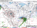
The biggest thing I’m seeing right now from this Euro run is it continues with FGEN for the SC Upstate over to CLT metro. It’s been very consistent with that for the last couple days
-
Hello, please take a minute to check out our awesome content, contributed by the wonderful members of our community. We hope you'll add your own thoughts and opinions by making a free account!
You are using an out of date browser. It may not display this or other websites correctly.
You should upgrade or use an alternative browser.
You should upgrade or use an alternative browser.
Wintry Jan 15-16 Winter Storm Discussion & Obs
- Thread starter SD
- Start date
packfan98
Moderator
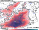
For areas that stay all frozen (in whatever form), that's going to be a mess!Euro precip totals...no pushover

In a perfect world we get the CAD signatures near the WFA and RGEM models on the start of the event and then the Low riding thru southern AL/cutting thru S.GA to Savannah and then up coast before lifting off which will maximum the ULL rolling thru
Shows well how the mid level flow will bank strongly into the Blue Ridge given the 850 low orientation, and then have the downsloping and drying on the other side in E TNEuro precip totals...no pushover
ForsythSnow
Moderator
I'd not hold your breath on the backside unless it's 6 hours out from being at your doorstep. Too many times it's overmodeled or too light. In few instances will it get enough moisture to really perform but you've got to be in the right place at the right time.Meh... for Western Side the back precip dry's up and gets carried off quickly :/
Ron Burgundy
Member
C
Source?You will have to drive way north just to see that inch brother.
Which is essentially what the 12z NAM run yesterday did...In a perfect world we get the CAD signatures near the WFA and RGEM models on the start of the event and then the Low riding thru southern AL/cutting thru S.GA to Savannah and then up coast before lifting off which will maximum the ULL rolling thru
Euro 3hr precip rates....runs forcefully into the upstate


That’s good for a lot of areas just too heavy for extreme icing.Euro 3hr precip rates....runs forcefully into the upstate

Euro ice totals?
iGRXY
Member
Agree, it does cut down some on icing. Long duration, lighter event is more efficient....but then there's the snow and sleet sideThat’s good for a lot of areas just too heavy for extreme icing.
I think precip with this one is going to be the real deal. The overrunning forcing is excellent, and that's the most reliable precip you can have. It's just not going to be super long duration (9-12 hours)
Since someone gave us permission to keep using the Euro and GFS, here's the Euro ice/sn maps


Charlotte metro will max out around 0.25” ZR. The bigger totals south or east prob won’t verify maybe 0.25” in isolated areas due to warming and heavy rates. I’ve spent a lot of time with ice maps to know the bottom half sometimes don’t verify more than a glaze to 0.1”. With that said, some will see ice storm warning criteria with a bullseye around Charlotte north imo maybe even to Asheboro near the NC state Zoo area
Nerman
Member
Z
Zander98al
Guest
Feels like the euro has been the most consistent so far out of the global models. Lines up well with the mesoscale models. My gut tells me that the temps are a little higher forecasted then what they verify as in Alabama. Seen enough snow events in my short life to know winter weather is wacky. Feels like I've had a couple years took off my lifespan from this one event. Central Alabama is flirting with a REAL thin line in terms of impacts if even a tiny adjustment is madeEuro last 3 12z runs:
TodayView attachment 105511
Yesterday
View attachment 105512
Wednesday
View attachment 105513
It's been moving SE incrementally
Ron Burgundy
Member
Trending stronger and longer with the CAD. C’mon Kang!Euro last 3 12z runs:
TodayView attachment 105511
Yesterday
View attachment 105512
Wednesday
View attachment 105513
It's been moving SE incrementally
Met,Since someone gave us permission to keep using the Euro and GFS, here's the Euro ice/sn maps


That ice map is terrifying.
What is the most accurate ice map available at this lead time? TIA
Tbh I'd look at the short range models, especially the 3k NAM and HRRR.Met,
That ice map is terrifying.
What is the most accurate ice map available at this lead time? TIA
ATLwxfan
Member
I’m struggling to understand why there are such large scale discrepancies among the mesoscale models. I don’t know how to reconcile this.
Sent from my iPhone using Tapatalk
Sent from my iPhone using Tapatalk
I still honestly expect those sleet maps are way underdone and a lot of what is showing up as ZR on those maps will turn out to be sleet, especially on the northern periphery. I’d be surprised if the predominant P-type here isn’t IP.
I'm thinking the same. At least in the Triad region of NC. The depth of the cold should be enough in this area to prevent major Fzrn, at least I hope so.I still honestly expect those sleet maps are way underdone and a lot of what is showing up as ZR on those maps will turn out to be sleet, especially on the northern periphery. I’d be surprised if the predominant P-type here isn’t IP.
I agree with you. I really feel like the algorithms that are used on these models to differentiate between precip types has difficulty distinguishing between sleet and ZR. The key to me on that is the soundings and what does the temperature at 925mb look like. We seeing a lot of areas showing freezing rain on the surface output, but the 925s are below freezing. If the temperatures at 925mb is below freezing, then most likely sleet is the predominant precipI still honestly expect those sleet maps are way underdone and a lot of what is showing up as ZR on those maps will turn out to be sleet, especially on the northern periphery. I’d be surprised if the predominant P-type here isn’t IP.
Looking at the 925Mb maps from today's EMCF, I highly suspect the surface temps with the wedging will get below freezing as far south and west as the Atlanta airport. And should the low both surface and aloft continue ticking south as has been the trend of late, this could be a lot bigger deal for the fringe Ga. areas. MBY weenie over and out 


Stormlover
Member
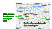
from Firsthand Weather:


Flotown
Member
Not sure I've checked them out...they pretty good?
StormStalker
Member
I don't feel terrible about this storm but a general consensus looks like 1-3 inches here of wet snow. Similiar to what we had last weekend or whenever that was. If that big heavy band shift just a little more south then anything is possible.
SimeonNC
Member
Yeah, for most of Piedmont the storm looks to be snow and sleet with some freezing rain but not nearly as much as modeled.I agree with you. I really feel like the algorithms that are used on these models to differentiate between precip types has difficulty distinguishing between sleet and ZR. The key to me on that is the soundings and what does the temperature at 925mb look like. We seeing a lot of areas showing freezing rain on the surface output, but the 925s are below freezing. If the temperatures at 925mb is below freezing, then most likely sleet is the predominant precip
Sent from my LM-Q730 using Tapatalk
Stormlover
Member
Firsthand is usually very good. He's a met with a Ph.D.Not sure I've checked them out...they pretty good?
Yes, the lack of IP they’re spitting out just doesn’t make sense to me from looking at the various maps. There’s no way we are getting ZR with the BL all the way up to 925 mb well below freezing. And from past experience, the maps have underdone IP and overdone ZR. I’d expect the same again, and am hopeful that it’s the case as I’d much rather have IP than ZR. ?I agree with you. I really feel like the algorithms that are used on these models to differentiate between precip types has difficulty distinguishing between sleet and ZR. The key to me on that is the soundings and what does the temperature at 925mb look like. We seeing a lot of areas showing freezing rain on the surface output, but the 925s are below freezing. If the temperatures at 925mb is below freezing, then most likely sleet is the predominant precip
Stormlover
Member
There are many indications of more than that for you.I don't feel terrible about this storm but a general consensus looks like 1-3 inches here of wet snow. Similiar to what we had last weekend or whenever that was. If that big heavy band shift just a little more south then anything is possible.
Stormlover
Member
euro ens mean


For all parts west of Atlanta and north of I-20 going back in AL it's all going to depend on that ULL and just how much moisture feed it has and how far it travels eastward before being pulled awayThere are many indications of more than that for you.
MichaelJ
Member
Yeah I agree with this, more sleet, less (much less) ZR. Snow looks about right to me.I'm thinking the same. At least in the Triad region of NC. The depth of the cold should be enough in this area to prevent major Fzrn, at least I hope so.
PARSONBROWN
Member
That is true… now I’m not saying that there want be some ZR mixed in for those areas, but I think the glaze will be more in the line of .1-.2” and not over .25”… it will be enough to make the sleet and snow that does fall be like concrete. As for the highest and most damaging ice amounts, .3-.5”+ in NC, I’m favoring the Hwy 1 corridor.Yes, the lack of IP they’re spitting out just doesn’t make sense to me from looking at the various maps. There’s no way we are getting ZR with the BL all the way up to 925 mb well below freezing. And from past experience, the maps have underdone IP and overdone ZR. I’d expect the same again, and am hopeful that it’s the case as I’d much rather have IP than ZR. ?
Stormlover
Member

