• Hello, please take a minute to check out our awesome content, contributed by the wonderful members of our community. We hope you'll add your own thoughts and opinions by making a free account!

Wintry Jan 15-16 Winter Storm Discussion & Obs

Pretty similar to the 18z run overall, but a touch further north and warmer in general. Maybe a 50ish mile shift, which is enough to have some significant impacts for those on the margins, for sure. Can't say it's what I was wanting to see, but eh. ?‍♂️
 
Pretty similar to the 18z run overall, but a touch further north and warmer in general. Maybe a 50ish mile shift, which is enough to have some significant impacts for those on the margins, for sure. Can't say it's what I was wanting to see, but eh. ?‍♂️
From 18z the north shift is pretty tiny but compare to 12z and it really stands out
 
Euro still holding firm on that front end snow Sunday Morning.
Yep, that’s going to have to be the saving grace here for those that want good snow and not just backside showers. Might ride this one out with some family East of Alpharetta
 
Brad P. Seems to be buying the backend snow for the Piedmont of NC


Sent from my iPhone using Tapatalk
 
6z nam definitely has some minor positive changes. Cad slightly stronger. 500mb closed low is slightly farther south at hour 48. The hi-res/3k also has better CAD if you compare dewpoints to 0z


Sent from my iPhone using Tapatalk
 
Special weather statement put out by FFC.

Dade-Walker-Catoosa-Whitfield-Murray-Chattooga-Gordon-Floyd-
Bartow-Cherokee-Forsyth-Polk-Paulding-Cobb-North Fulton-Gwinnett-
Barrow-Clarke-Oconee-Oglethorpe-Wilkes-Haralson-Carroll-Douglas-
South Fulton-DeKalb-Rockdale-Walton-Newton-Morgan-Greene-
Taliaferro-Heard-Coweta-Fayette-Clayton-Henry-
340 AM EST Fri Jan 14 2022


...SNOW AND ICE ACCUMULATIONS LIKELY OVER NORTH GEORGIA SATURDAY
NIGHT AND SUNDAY...

...BLACK ICE LIKELY SUNDAY NIGHT AND MONDAY MORNING...

A strong upper level storm system will combine with very cold
temperatures aloft and near the ground to produce wintry
precipitation this weekend.

The rain will begin mixing with and changing to snow after
midnight on Saturday night and switch to mainly snow over far
northeast Georgia with a mix of rain, freezing rain, sleet and
snow over the rest of north Georgia during the day Sunday. Light
snow or snow flurries will be ending from west to east Sunday
evening.

The heaviest snow will fall on Sunday over far northeast Georgia,
where a Winter Storm Watch is in effect and up to 6 inches of
snow is expected with higher amounts possible at elevations above
2000 feet. Elsewhere across north Georgia north of I-20, up to 2
inches of sleet and snow and up to two-tenths (0.20) of an inch of
ice will be possible. South of I-20, there may be some snow or
sleet mixed with the rain but little to no accumulation is
expected.


After the precipitation clears out Sunday night, temperatures
will fall into the 20s and any remaining liquid runoff from
earlier precipitation will likely freeze on roadways across north
Georgia. These icy spots will persist well into Monday morning.
 
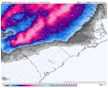
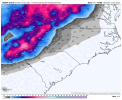
Woke up to see what we have and doesn’t look like anything has really changed. Starting with the 12z run we’re starting to get much more in the 12K NAMs range more so I’ll be paying more attention to the hi res stuff a lot more today.
 
1642153861689.png
1642153922727.png
I tell you what, we make fun of the ICON but that is probably one of the best visualizations of snow totals that I’ve seen and matches up well with our local Mets and GSPs thinking. You are probably sitting somewhere around 2-5” around DT Spartanburg but you get anywhere close to 85 and it shoots up to 4-6” and everything along and north is 6”+. Matches up really well in my opinion.
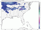
 
View attachment 105350
View attachment 105351
I tell you what, we make fun of the ICON but that is probably one of the best visualizations of snow totals that I’ve seen and matches up well with our local Mets and GSPs thinking. You are probably sitting somewhere around 2-5” around DT Spartanburg but you get anywhere close to 85 and it shoots up to 4-6” and everything along and north is 6”+. Matches up really well in my opinion.

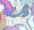
The ICON really beefed up the front end dump versus last run....

icon_asnow_seus_fh57_trend.gif
 
Winter Storm Watch for central NC:

Winter Storm Watch​

URGENT - WINTER WEATHER MESSAGE
National Weather Service Raleigh NC
307 AM EST Fri Jan 14 2022

NCZ009-010-025-026-040-041-073>077-083>086-088-141700-
/O.NEW.KRAH.WS.A.0001.220116T0500Z-220117T0500Z/
Vance-Warren-Durham-Franklin-Chatham-Wake-Stanly-Montgomery-Moore-
Lee-Harnett-Anson-Richmond-Scotland-Hoke-Cumberland-
Including the cities of Henderson, Kittrell, Warrenton, Norlina,
Durham, Rougemont, Louisburg, Franklinton, Siler City, Pittsboro,
Raleigh, Cary, Apex, Wake Forest, Knightdale, Albemarle, Troy,
Southern Pines, Pinehurst, Aberdeen, Carthage, Sanford,
Lillington, Angier, Buies Creek, Erwin, Dunn, Wadesboro, Polkton,
Rockingham, Ellerbe, Laurinburg, Camp Mackall, Wagram, Raeford,
Fayetteville, Spring Lake, and Hope Mills
307 AM EST Fri Jan 14 2022

...WINTER STORM WATCH IN EFFECT FROM LATE SATURDAY NIGHT THROUGH
SUNDAY EVENING...

* WHAT...Heavy mixed precipitation possible. Total snow
accumulations of up to two inches and ice accumulations of up
to three tenths of an inch possible.

* WHERE...Portions of central North Carolina.

* WHEN...From late Saturday night through Sunday evening.

* IMPACTS...Power outages and tree damage are likely due to the
ice. Travel could be nearly impossible.

* ADDITIONAL DETAILS...A mix of snow, sleet, and freezing rain is
forecast, although locations southeast of US 1 will likely
change over to rain Sunday afternoon.

PRECAUTIONARY/PREPAREDNESS ACTIONS...

Monitor the latest forecasts for updates on this situation.

&&

$$
aaaa1.jpg
 
Here's the watch discussion for areas west of the zone discussed above:

Winter Storm Watch​

URGENT - WINTER WEATHER MESSAGE
National Weather Service Raleigh NC
307 AM EST Fri Jan 14 2022

NCZ007-008-021>024-038-039-141700-
/O.NEW.KRAH.WS.A.0001.220116T0500Z-220117T0500Z/
Person-Granville-Forsyth-Guilford-Alamance-Orange-Davidson-
Randolph-
Including the cities of Roxboro, Oxford, Creedmoor,
Winston-Salem, Greensboro, High Point, Burlington, Graham,
Mebane, Hillsborough, Chapel Hill, Carrboro, Lexington,
Thomasville, Asheboro, and Archdale
307 AM EST Fri Jan 14 2022

...WINTER STORM WATCH IN EFFECT FROM LATE SATURDAY NIGHT THROUGH
SUNDAY EVENING...

* WHAT...Heavy mixed precipitation possible. Total snow
accumulations of 2 to 4 inches and ice accumulations of one
tenth to three tenths of an inch possible.

* WHERE...Portions of central North Carolina.

* WHEN...From late Saturday night through Sunday evening.

* IMPACTS...Power outages and tree damage are likely due to the
ice. Travel could be nearly impossible.

* ADDITIONAL DETAILS...Precipitation will initially begin as snow
before changing to a mix of snow, sleet, and freezing rain.

PRECAUTIONARY/PREPAREDNESS ACTIONS...

Monitor the latest forecasts for updates on this situation.

&&

$$
 
Nam 3km has around temps at 34/35 in central Alabama on the backside of the Low pressure. Anybody that knows. Does nam have a temperature bias of any means. With the dense cold air we're dealing with. Any shift in a few degrees colder will result in some people receiving a good chunk of snow, to almost zilch.
 
Huntsville AFD

So, as mentioned, it now appears that the most likely scenario takes
the core of the strong short wave just to our south as it traverses
the region. This will place the TN Valley region in a more favorable
location for wintry type precipitation, and indeed forecast snowfall
amounts have increased with this forecast package. However, we are
still probably a little conservative with snowfall amounts due to
model output changes and run-to-run inconsistencies. Nevertheless,
the trend is clear, and with better model agreement with the latest
00Z guidance suite on the placement of large scale features, this
lends increasing confidence in snowfall across the area. In addition,
given the latest suite of operational guidance, it appears that some
banding of snow and heavier snowfall rates could occur along a mid-
lvl TROWAL along the northern flank of the upr low. The exact
placement of this feature and the better, enhanced dynamic lift
associated with it are still a bit uncertain, but a reasonable
scenario does place it at least for a time across our southern Middle
TN counties and perhaps along the TN/AL border area. So, there are
still a lot of details to work out and honestly, this will probably
be an ongoing process right up until Sunday.

Anyway, rain appears likely to change over to snow generally from
W-E on Sunday morning and into the early afternoon (although timing
refinement will still occur). Given the prospects for strong dynamic
lift and even convective potential, snowfall rates could be
moderate/heavy along a band north of the low and would be sufficient
to produce accumulating snow. The best chances for this again will
occur along/near the TN border and in southern Middle TN. Current
forecast snowfall amounts there have prompted the issuance of a
Winter Storm Watch, which will go from 06Z Sunday to 00Z Monday.
But, if current model output trends hold, then the Watch may need to
be expanded to other counties in northern AL. Quite a bit of
adjustments were needed for NBM output and forecast highs were
adjusted to between the 10th-25th percentiles for Sunday, which
seemed more fitting given the strong dynamic/column cooling and
precipitation-laden scenario. Temperatures will probably be in the
30s all day, and will likely fall in the afternoon as CAA takes place
and winds back around from the N behind the departing system.
Snowfall may continue into the early evening, especially for eastern
locations. With regards to snowfall totals, we currently have amounts
less than one inch for valley locations in N Alabama, with amounts
ranging from around one inch to 3 inches in TN...and yet higher
amounts on some of the highest elevations of the plateau. But again,
these amounts are really preliminary and significant revisions are
still likely...so keep abreast of the latest forecast updates.
 
Back
Top