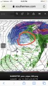
• Hello, please take a minute to check out our awesome content, contributed by the wonderful members of our community. We hope you'll add your own thoughts and opinions by making a free account!

Wintry Jan 15-16 Winter Storm Discussion & Obs

While the L placement on the maps looks similar, the wind streams show significant differences.

NAM with its stiff easterly wedge enhance surface winds:
namconus_mslp_wind_us_53.png

The GFS with its amped upper low drilling the surface low down to the surface resulting in a SE wind over the gulf coast states:
gfs_mslp_wind_us_16.png
 
Another thing to note here is this is about as classic of a look for a southern snow storm as you can get. Weaker surface low that is right on the gulf coast instead of northern Mississippi, and a classic banana high with deep CAD and a strong high pressure over the top in the plains. Call me a crackhead but if this run continued I don't see how the LP could go north.
If by southern, you mean northern TN and Kentucky, sure.
 
I agree, but I don't like how there is not a good push of dry air down into CAD areas (outside of NC, that is) That push is just not super strong and the low is already into MS.

One thought…the track is further south and more strung out. Does that allow us to depend less on CAD?


Sent from my iPhone using Tapatalk
 
If by southern, you mean northern TN and Kentucky, sure.
I agree. The NAM shifted slightly toward the Euro solution over the GFS. We’re still way out and it’s anyone’s guess, but it’s too early for anyone to throw in the towel yet.
 
Back
Top