• Hello, please take a minute to check out our awesome content, contributed by the wonderful members of our community. We hope you'll add your own thoughts and opinions by making a free account!

Pattern Jammin January 2024

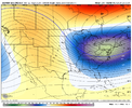
Thanks Grit. So let me get educated here please and make sure i have this right. We need the the TPV to be further east, so the confluence between the blocking ridge and the TPV feed south further east, over the Carolinas, rather than over the Mississippi River as shown. That allows high pressure to flow down further east, and keeps the storm track to our south.

As shown, the cold is muted because the TPV is too far west, and still allows cutters, once they gets east past the confluence over the Mississippi. Is that generally correct? Thanks.
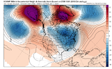
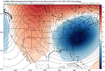
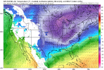
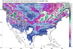
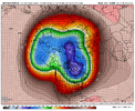
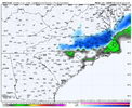
In first image here from last night's Euro, the surface high is stuck back to the west (behind the big SE Canada TPV), and the low is allowed to cut up thru WV since the heights aren't lowered off the NE coast.
oqwWgMr.png


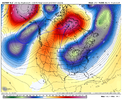
Here in this image prior to your favorite storm, the TPV is weaker, but it extends to the south out off the NE and Mid-Atl coast, with ridge behind it over MN. Sfc high in S Wisconsin. Sfc low in the gulf with wave moving east over TX. The extended, lowered heights off the NE coast don't allow the storm to cut inland - instead, it is forced to slide ENE
vqw5bcA.gif


Many ways to get winter storms, but I'm just pointing out a key difference in the 2 setups. The Greenland Block helps to get the lowered heights off the NE coast (not the only way), but the configuration doesn't always work out each time a block / -NAO forms.
 
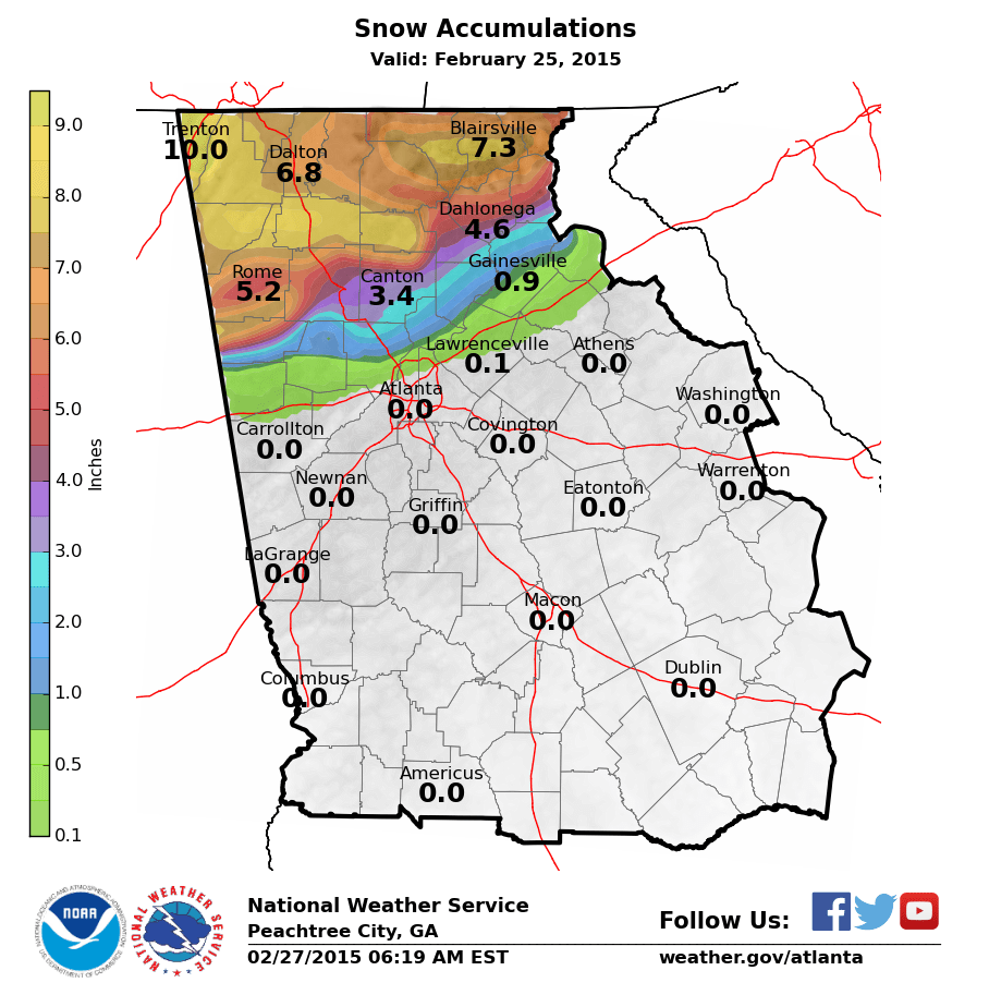
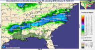
I'm almost afraid to ask but do you guys have any maps for SC for the Feb 2015 time frame? That period doesn't stand out to me at all, so that may be my answer right there.
 
I'm almost afraid to ask but do you guys have any maps for SC for the Feb 2015 time frame? That period doesn't stand out to me at all, so that may be my answer right there.
I don't have maps but GSP got 3.7" that month. Probably not what NC got and was a below average year but I'd kill for 3.7" right now.
 
I'm almost afraid to ask but do you guys have any maps for SC for the Feb 2015 time frame? That period doesn't stand out to me at all, so that may be my answer right there.
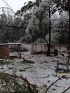
February 16, 20151 inch of sleet 1/10th inch of icemin temp of 27huge bust in our favor, models at 31/32 temp and freezing rain to rain, got 90% sleet and just a little freezing rain, wetbulbed to around 27 and temp was still 31 as final band came through
February 24, 20151 inch snow
February 26, 20150.7 inch snowepic bust by forecasters... they(nws) were calling for 9-11 as the event was unfolding but boundary layer too warm
That 2/16/15 storm had very poorly modeled temps all the way to NE Georgia…I remember there were areas there that got over 1/2” of ice accrual when they were forecasted to not go below 35-36. MBY ended up with 1” of sleet and about .2” of ice with temperatures in the mid 20s the whole event. If I remember correctly a mesohigh developed over northern VA that wasn’t modeled and it kept the CAD stronger and deeper than models were showing. The NAM was almost 10 degrees too warm in some areas
 
That 2/16/15 storm had very poorly modeled temps all the way to NE Georgia…I remember there were areas there that got over 1/2” of ice accrual when they were forecasted to not go below 35-36. MBY ended up with 1” of sleet and about .2” of ice with temperatures in the mid 20s the whole event. If I remember correctly a mesohigh developed over northern VA that wasn’t modeled and it kept the CAD stronger and deeper than models were showing. The NAM was almost 10 degrees too warm in some areas
Yep, and dew points were much lower than forecasted with the airmass in place ahead of the storm, (for whatever reason). All the short range models were way off with dew points even 18 hours before the event began.
 
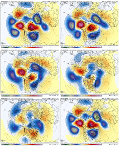
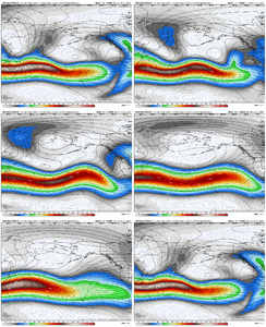
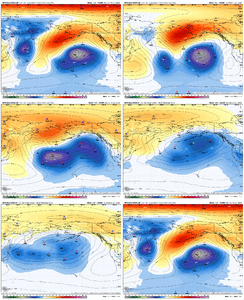
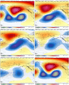
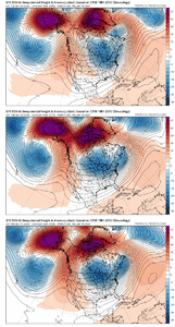
it’s eerily similar how the large scale pattern progression is to dec 2021/jan 2022. The difference this time is, we will already have an initially equatorial shifted pac jet. But it’s almost the exact same evolution to that time. Initial AK/Aleutian ridge, which destroys the -NAO via +NAMT, the cutoff ridge retrogrades to Siberia, adds a significant amount of momentum to the pacific jet, it extends, and boom a big +PNA. Love to see it 9BACA1F7-8002-40EA-8557-3E59ABF4DD46.gifC8D45200-0BD4-455A-913A-AC97A74EA9A6.gif
 
it’s eerily similar how the large scale pattern progression is to dec 2021/jan 2022. The difference this time is, we will already have an initially equatorial shifted pac jet. But it’s almost the exact same evolution to that time. Initial AK/Aleutian ridge, which destroys the -NAO via +NAMT, the cutoff ridge retrogrades to Siberia, adds a significant amount of momentum to the pacific jet, it extends, and boom a big +PNA. Love to see it View attachment 141181View attachment 141182
Well I hope this opens up better opportunities at winter weather moving forward if this indeed happens but hopefully the cold air source is still available
 
That 2/16/15 storm had very poorly modeled temps all the way to NE Georgia…I remember there were areas there that got over 1/2” of ice accrual when they were forecasted to not go below 35-36. MBY ended up with 1” of sleet and about .2” of ice with temperatures in the mid 20s the whole event. If I remember correctly a mesohigh developed over northern VA that wasn’t modeled and it kept the CAD stronger and deeper than models were showing. The NAM was almost 10 degrees too warm in some areas
Yeap. I remember pulling up to my house listening to the weather on radio. He was saying we dodged a bullet. I saw icicles on my birdfeeder and was thinking how weird. Boy were they wrong. It was a mess.
 

Attachments

  • a2820ccf-2f55-40b7-9ecb-8d4a5c9284f6.jpg
    a2820ccf-2f55-40b7-9ecb-8d4a5c9284f6.jpg
    940.5 KB · Views: 50
There are a number of frames on each model today where you look at them and say woo boy that could be a big one. Obviously getting near or inside of D7 you want more fruit from the models but the setup is certainly there for 2-3 opportunities anyone of which could be large. I will say this as well we all remember and love to run analogs of the supportive patterns that hit by I guarantee you that there are good patterns on paper that missed that most don't remember the missed.
 
There are a number of frames on each model today where you look at them and say woo boy that could be a big one. Obviously getting near or inside of D7 you want more fruit from the models but the setup is certainly there for 2-3 opportunities anyone of which could be large. I will say this as well we all remember and love to run analogs of the supportive patterns that hit by I guarantee you that there are good patterns on paper that missed that most don't remember the missed.
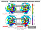
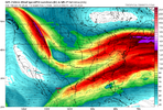
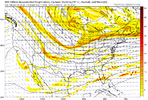
I know it has already been said by you and @griteater and others, but for RDU typically once we get a -NAO established it's on the backend where they do best. We really want the trough and cold air in place, and then for another spoke of vorticity to rotate around the TPV and hopefully interact with something in the southern stream (for a big dog).

rduSnow.jpeg
 
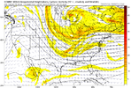
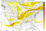
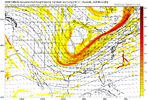
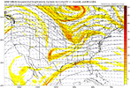
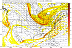
Here are some examples

Big Miller a signal on the euro
ecmwf_z500_vort_us_60 (1).png

Overrunning/low amp waveon the euroecmwf_z500_vort_us_48 (1).png

Overrunning/low amp x2 on the cmc
gem_z500_vort_us_24 (2).png
gem_z500_vort_us_35 (2).png

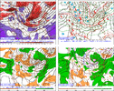
Miller a on the gfs
gfs_z500_vort_us_40 (8).png

Obviously these worked out poorly on the 12z runs for most of us but we aren't the far off and at 6+ days a few relatively subtle changes at this lead time drastically changes sensible impact
 
Here are some examples

Big Miller a signal on the euro
View attachment 141201

Overrunning/low amp waveon the euroView attachment 141202

Overrunning/low amp x2 on the cmc
View attachment 141204
View attachment 141205

Miller a on the gfs
View attachment 141206

Obviously these worked out poorly on the 12z runs for most of us but we aren't the far off and at 6+ days a few relatively subtle changes at this lead time drastically changes sensible impact
Based on my observations the past couple years, I wouldn't even want the ops showing a perfect solution this far out. Some of those solutions are just about right where you'd want them for this delta from verification. I probably like the first one the best - speed up that open southern wave and sharpen the western trough a tad and let those two streams meet and dance over the Mississippi.
 
Based on my observations the past couple years, I wouldn't even want the ops showing a perfect solution this far out. Some of those solutions are just about right where you'd want them for this delta from verification. I probably like the first one the best - speed up that open southern wave and sharpen the western trough a tad and let those two streams meet and dance over the Mississippi.
I do wonder if the models are placing too much emphasis on the vortices across Southern Canada and shearing everything S in the relatively steep height gradient so as we go forward in time we will see more consolidated energy across the conus
 
I do wonder if the models are placing too much emphasis on the vortices across Southern Canada and shearing everything S in the relatively steep height gradient so as we go forward in time we will see more consolidated energy across the conus
One of the things that I've noticed through the years (and this isn't situation specific - meaning, it may be of little value in this particular setup or may not apply at all) is that way out in time, say, around D10, models show a robust wave that generates a fantasy storm, and then they shear it apart in the D4-7ish range, and then bring it back. When they never show it to begin with, that's a bit more of a red flag for there eventually being no system at all.

I don't know why this is but it may have something to do with waves traveling over data voids or something of that nature. It's just an anecdotal observation.
You are not wrong....GFS is super notorious for this. Dr. NO does it as well.
 
Here are some examples

Big Miller a signal on the euro
View attachment 141201

Overrunning/low amp waveon the euroView attachment 141202

Overrunning/low amp x2 on the cmc
View attachment 141204
View attachment 141205

Miller a on the gfs
View attachment 141206

Obviously these worked out poorly on the 12z runs for most of us but we aren't the far off and at 6+ days a few relatively subtle changes at this lead time drastically changes sensible impact
Great post! That was really good, and I wonder how much we really just don't know outside of 5 days. I mean, what if you are right and the TPV doesn't shear a bunch out or, the PAC and that energy can break free and send something down the west and then out..I think there is ALWAYS a 1st storm, (usually gets sacrificed) a 2nd, that produces over the South..mainly west and the caboose that really has a shot to collapse the whole pattern and then flush out the cold for now. **That caboose** if my theory is right would be coming down the west coast before the Canada gets warm again. *that post I circled the area*
 
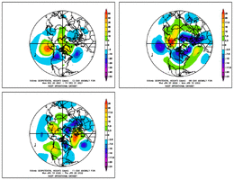
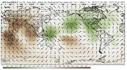
Eqtrl shifted jet > -WPO > +NAMT > +NAO and return of +TNH (Hudson bay vortex) > quick warmup across the eastern US > retrograding -WPO ridge to Siberia > high descends into Eastern Asia (+EAMT) > added momentum to the pacific jet > jet extension to around Hawaii and resultant +PNA/Aleutian low > MJO reaches western pacific by then 1CB0396B-16FE-495C-8889-6291DCC3548F.gifC4753D6A-DCF2-4500-A79D-5C4E9E7E9E24.png562F399E-A7CD-4100-BA7A-2E5F9B0F8646.gif95D348C4-0B51-487D-A881-53D73C7F7FE6.gif

Think the bigger question is, do we undercut the +PNA ridge via the subtropical jet stream ? If we do, we would probably activate another -NAO via breaking and persisting southern waves eventually bombing out as they they reach the Atlantic
Another thing that could happen to is we stay with +NAO due to going crazy and poleward with the western ridge which would induce continued +NAMT and encourage the main TPV lobe to sit around Hudson Bay/Baffin bay, sort of like 2022 and result in a hostile tropospheric pattern for blocking, even with a weakened strat PV. That’s my biggest “concern” 3EF4CEE7-B6A3-495E-8073-0FF5A891E3C2.png
 
Last edited:
One of the things that I've noticed through the years (and this isn't situation specific - meaning, it may be of little value in this particular setup or may not apply at all) is that way out in time, say, around D10, models show a robust wave that generates a fantasy storm, and then they shear it apart in the D4-7ish range, and then bring it back. When they never show it to begin with, that's a bit more of a red flag for there eventually being no system at all.

I don't know why this is but it may have something to do with waves traveling over data voids or something of that nature. It's just an anecdotal observation.
Tale as old as time.
 
Back
Top