• Hello, please take a minute to check out our awesome content, contributed by the wonderful members of our community. We hope you'll add your own thoughts and opinions by making a free account!

Pattern Jammin January 2024

nice little pattern coming

the risk is that the PV shreds everything apart. little impulses that would have a chance to be a cute event in other setups don't have a chance here. everyone thinks "suppression" here but it's less that and moreso these shortwaves not getting a chance to dig and slow down a hair. a strengthening surface low has a symbiotic relationship with a shortwave (surface WAA pumps the ridge, surface CAA strengthens the trough, in response shortwave gets stronger, means better lift, means stronger LLC. positive feedback, etc...) and that can't happen if the shortwave is consistently outrunning the low

as others have mentioned the remedy is a stouter, taller western ridge that would force waves to dig more. or honestly.. a little more amplification in general would be nice. this broad trough is cool in theory but doesn't really provide any great mechanisms to create qpf and spur cyclone development. that's an issue and with such a lauded pattern... would be nice to get a 6-10 incher across the i-85 corridor at like hour 300, you know? just ground truth that it's a fruitful pattern? something that doesn't just look like a virga storm?

good news is that there's still a lot of time on the clock. so here's the trend for the day 7.5 gfs. pick out our storm. you can't? exactly. models don't have a handle on this yet (i wouldn't expect them to) and still plenty of time for a consolidated shortwave with better tilt to come along and take advantage of things. just hoping waiting for that isn't a fools errand

View attachment 141071
very well said
 
It didn't work out on the 6z GFS, but still had energy dropping over the Rockies. Plenty of time to watch, hope we can get something out of this.
1fb3af2aa7486844f3c8c840a33e3c4e.jpg


Sent from my SM-A136U1 using Tapatalk
 
It didn't work out on the 6z GFS, but still had energy dropping over the Rockies. Plenty of time to watch, hope we can get something out of this.
1fb3af2aa7486844f3c8c840a33e3c4e.jpg


Sent from my SM-A136U1 using Tapatalk
10 days out this is honestly not a bad look at all from the GFS especially when you look at the 500mb chart.
 
This has always been a more realistic time frame east of the apps, in my opinion. Rarely do we score on the front end of a cold air mass. I think a lot of us are getting discouraged that the ops aren’t syncing anything up at this time frame. Canadian and Euro both have a system but too far north. GFS has a better look regarding cold but no phasing/ too suppressed with the southern stream. At this point, at 7 to 10 days out, it’s all about pattern recognition on the ensembles, but it would be nice if one of the ops would show us something to get everyone excited for 6 to 12 hours at least. Hopefully one of them locks in soon.
 
This has always been a more realistic time frame east of the apps, in my opinion. Rarely do we score on the front end of a cold air mass. I think a lot of us are getting discouraged that the ops aren’t syncing anything up at this time frame. Canadian and Euro both have a system but too far north. GFS has a better look regarding cold but no phasing/ too suppressed with the southern stream. At this point, at 7 to 10 days out, it’s all about pattern recognition on the ensembles, but it would be nice if one of the ops would show us something to get everyone excited for 6 to 12 hours at least. Hopefully one of them locks in soon.

Yeah I know it's not the end of the story, but the lack of fantasy hits, and the paltry snow mean on the ensembles is a head scratcher. With the great look for the 19th I would think there'd be more hits. We're missing an ingredient I think.
 
Eps seems to be holding the block longer which is what you want to increase your chances. I think the time to shine for most of us is after the 18th when the cold gets dumped and the pattern is likely relaxing before the final cold shot
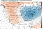
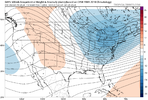
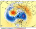
Definitely agree. I like this period until the pattern relaxes for a time. eps_z500a_us_43.pnggfs-ens_z500a_us_42.png
 
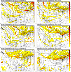
Look at the op gfs the trough axis is west and the are numerous ripples in the flow gfs_z500_vort_us_fh162-258.gif

We've seen this many times where the models are too unenthusuastic about moisture return and they also shear these waves to much as you go out in time. Take this pattern add in a decent amplitude wave throw moisture into an existing arctic aimass and all we do is win win win no matter what
 
  • Like
Reactions: WSW
I'm sorry that's just sad. For a great pattern east of the apps there should be blues in the Piedmont.


Perhaps the issue goes back to what @ILMRoss said that the trough isnt sharp enough. Also, the trough looks too far east. I'm grasping, but trying to find the disconnect.
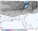
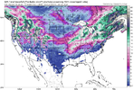
That's a snow depth map at 360 sooo if it's warming up on the back of the cold then that snow would melt and that map would suck
 
Definitely agree. I like this period until the pattern relaxes for a time. View attachment 141104View attachment 141105
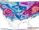
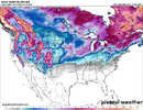
I was just looking at that too. Unfortunately the Apps continue to keep the cold air West and won't let it bleed. I mean we'd be below average but probably not enough. Here's the same time frames. We really need that western ridge to pump more and let the trough dig more.

1704897039491.png

1704897066945.png

GFS does show a s/w in Mexico but it gets squashed by the 1048. We really need that high out in front of the s/w to push down the cold in front of it; maybe a 1040 over the Great Lakes. Sharpen the trough and let it ride.

1704897658864.png
 
I’m having a real hard time believing that this cold stretch will be mostly dry like what’s being depicted right now on most Operationals. The STJ has been raging as of late and now it’s going to completely shut down??? Call me skeptical, I believe a couple of systems will occur and they’ll show up quick when the short range models get into play. Maybe I’m being a bit of a wish caster right now but something has got to happen.
 
I’m having a real hard time believing that this cold stretch will be mostly dry like what’s being depicted right now on most Operationals. The STJ has been raging as of late and now it’s going to completely shut down??? Call me skeptical, I believe a couple of systems will occur and they’ll show up quick when the short range models get into play. Maybe I’m being a bit of a wish caster right now but something has got to happen.
No, I agree with you. You are not a wishcaster in your point. All the models are struggling at this point with this "pattern change." I think by Friday 0z runs we will start hinting or actually seeing some nice hits almost boardwide. The cold is coming for sure and STJ is on steroids. We are in this but just need to let the models come to Jesus collectively and bring the goods??
 
^ As Kylo mentions, we still have an 'escape hatch' problem where waves / storms that amplify are allowed to run inland of the coast & be too warm

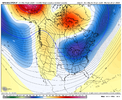
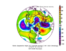
Here is 5-day pattern avg for Jan 16-21 where the center of the low anomaly / TPV under the block is north of the Great Lakes
5zzh8Ew.png


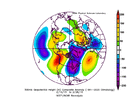
And during that time, the mean sfc high placement is just east of the Rockies (too far west)
gPxEX3j.png


And it looks like when the low anomaly does progress east, it's kind of a last gasp of the cold air swinging thru.

As a comparison, here is the pattern from mid-Dec to mid-Jan in 2010-2011. So, that's a better location of the TPV up under the block there off the NE coast - it's farther to the SE compared to what we have now, which of course suppresses the pattern to the south more and doesn't allow storms to easily amplify and run inland of the coast.
Wxc0QVw.png


With just the shear amount of cold air spilling down to our NW, we have a shot here, but in no way would it be fair to call this a great pattern. I wonder if our best chance wouldn't be from a sort of late blooming system along the coast like some have mentioned as that would give us a better shot with cold air on the NW side.
Ahh, the good ole "Pattern Relaxer" surprise!
 
^ As Kylo mentions, we still have an 'escape hatch' problem where waves / storms that amplify are allowed to run inland of the coast & be too warm

Here is 5-day pattern avg for Jan 16-21 where the center of the low anomaly / TPV under the block is north of the Great Lakes
5zzh8Ew.png


And during that time, the mean sfc high placement is just east of the Rockies (too far west)
gPxEX3j.png


And it looks like when the low anomaly does progress east, it's kind of a last gasp of the cold air swinging thru.

As a comparison, here is the pattern from mid-Dec to mid-Jan in 2010-2011. So, that's a better location of the TPV up under the block there off the NE coast - it's farther to the SE compared to what we have now, which of course suppresses the pattern to the south more and doesn't allow storms to easily amplify and run inland of the coast.
Wxc0QVw.png


With just the shear amount of cold air spilling down to our NW, we have a shot here, but in no way would it be fair to call this a great pattern. I wonder if our best chance wouldn't be from a sort of late blooming system along the coast like some have mentioned as that would give us a better shot with cold air on the NW side.

Thanks Grit. So let me get educated here please and make sure i have this right. We need the the TPV to be further east, so the confluence between the blocking ridge and the TPV feed south further east, over the Carolinas, rather than over the Mississippi River as shown. That allows high pressure to flow down further east, and keeps the storm track to our south.

As shown, the cold is muted because the TPV is too far west, and still allows cutters, once they gets east past the confluence over the Mississippi. Is that generally correct? Thanks.
 
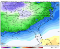
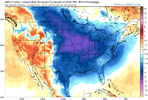
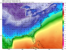
Unfortunately the Canadian is garbage when it comes to modeled surface temps; has a terrible cold bias. I also notice a significant difference b/w the GFS and GEFS.

No way TN is going to be teens below zero.

1704907894270.png

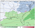
GEFS has a much more reasonable solution:

1704907997544.png

This is really just marginal cold for us and keeps the bulk of the cold West of the Apps. I know that's a shocker.
 
Back
Top