We couldn’t get cold to settle in east of the mtns long enough to get a storm if our life literally depended on it. It’s hard to watch
-
Hello, please take a minute to check out our awesome content, contributed by the wonderful members of our community. We hope you'll add your own thoughts and opinions by making a free account!
You are using an out of date browser. It may not display this or other websites correctly.
You should upgrade or use an alternative browser.
You should upgrade or use an alternative browser.
Pattern Jammin January 2024
- Thread starter SD
- Start date
NBAcentel
Member
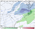
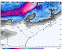
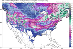
Nice 3 incher central NC off the gfs all thanks to ratios friday week.
That's what she saidNice 3 incher central NC off the gfs all thanks to ratios friday week.
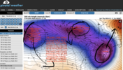
Gotta start somewhere. Gfs is way more muted than it should be imo but plenty of time to goIt tried though View attachment 141322View attachment 141323
The good thing is we're seeing multiple threats showing up on the models now. Just have to get lucky with the timing to score.
I have never heard a woman say anything about a 3 incher being nice.That's what she said
SnowwxAtl
Member
I don't think it is timing anymore as much as have the moisture not flatten or shear off. With that STJ this season, someone has to be lucky on this board!The good thing is we're seeing multiple threats showing up on the models now. Just have to get lucky with the timing to score.
Luck be a lady tonight.I have never heard a woman say anything about a 3 incher being nice.
SnowwxAtl
Member
Should we start next Friday thread and jinxs that one too? ???
Haha, well we do avg like 5 inches of snow....and the median is probably like 3 lolWe couldn’t get cold to settle in east of the mtns long enough to get a storm if our life literally depended on it. It’s hard to watch
^ The late blooming coastal on the 20th, that's our ticket guys! Unfortunately, it has to hit just right. The CMC cuts the Jan 20 storm as well
I love how all this talk has been about mid to late January.. we’re getting threats in mid to late January in a strong El Niño winter that is known for its February cold patterns across the US. Should be good news for things down the line for everyone!
Anywho.. I’ll take the 00z UKMET for southern Illinois on Sunday-Monday please!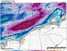
Anywho.. I’ll take the 00z UKMET for southern Illinois on Sunday-Monday please!

Well we got mostly what we been asking for pattern wise: Day 10 EPS.


NoSnowATL
Member
NoSnowATL
Member
D
Deleted member 609
Guest
12z GFS was the gift that keeps on giving
12z GFS keeps the cold pattern going through the run with a western ridge, Greenland block, and -NAO. What's not to love?
W
WSW
Guest
Best example of cold suppression I've ever seen...gulf low cries for momma on its way to the Bay of Campeche


MichaelJ
Member
That is okay, when it gets to the Bay of Campeche, maybe we will have a hurricane to track! ?
Sounds familiar. ?That is okay, when it gets to the Bay of Campeche, maybe we will have a hurricane to track! ?
Or a snow-cane if the right shortwave comes along to juice it up.That is okay, when it gets to the Bay of Campeche, maybe we will have a hurricane to track! ?
If this is the case then why would they use it for the base for the EPS runs? Doesn't that mean the EPS runs are based on a crappy low resolution solution? Why would we ever put any stock in the EPS?
I think it's a computing power issue. It seems to take forever to get the operational output. If you took the operationals at their current resolution and reran them many times over, it would probably take a very long time. So what is done is that they rerun the operational at a lower resolution for the entirety of the time scale. Then they perturb the initial conditions as many times as a particular suite calls for (for the Euro, that would be 50 times - hence 50 individual ensemble members, based off of a control run with 50 slight initial condition variations).
I think we, in the weather forum and social media world, quite often see a failure to use the ensembles for the purpose for which they are intended. For instance, they could be used to validate 7-10 day pattern that might be conducive to a winter storm. Conversely, they are not intended to nail down the specifics of a 7-10 day snowstorm. They are also not intended to be used on an individual member basis. So, when you see a Euro operational model not showing a D7 threat but the Euro control is showing a D7 snowstorm, your point is quite valid: Why would we believe a control run with only one eye looking through a milk jug over an operational run with two eyes with scratched up glasses with the wrong prescription? Answer? We shouldn't. Is it fun to look at? Yes. Is it worth anything, not really (when used like that).
We could have a lengthy discussion about use cases for ensembles. But professionals generally use them to determine the uncertainty around short term specific events (storm formation, rainfall totals, etc.) and the validity of medium and longer range patterns. If the ensembles generally agree with the operational, then you can have higher confidence.
When it comes to winter storms threats, IMO (and others may feel differently), but you should not look at an individual ensemble member to validate anything at all, i.e. the Euro control. However, there is value in observing trends and run to run changes. There is value in observing how many ensemble members are showing a system vs. not (and a note here, as we have all seen, a few big members can skew the mean, so looking at the mean by itself may not be all that valuable in some instances).
Everything gets less skilled out in time, particularly the lowest-skilled solutions like individual ensemble members. Use the ENS to validate the OP and the individual members to see if there are wild or minor differences among members, which will give you an indication of how volatile the atmosphere is. Ensembles are best used to detect the level of uncertainty. Use them against themselves and against other ensemble suites for that purpose.
Last edited:
In regards to the Euro Control run in this current situation, I think I may partly disagree. I'll offer this up for consideration:I think it's a computing power issue. It seems to take forever to get the operational output. If you took the operationals at their current resolution and reran them many times over, it would probably take a very long time. So what is done is that they rerun the operational at a lower resolution for the entirety of the time scale. Then they perturb the initial conditions as many times as a particular suite calls for (for the Euro, that would be 50 times - hence 50 individual ensemble members, based off of a control run with 50 slight initial condition variations).
I think we, in the weather forum and social media world, quite often see a failure to use the ensembles for the purpose for which they are intended. For instance, they could be used to validate 7-10 day pattern that might be conducive to a winter storm. Conversely, they are not intended to nail down the specifics of a 7-10 day snowstorm. They are also not intended to be used on an individual member basis. So, when you see a Euro operational model not showing a D7 threat but the Euro control is showing a D7 snowstorm, your point is quite valid: Why would we believe a control run with only one eye looking through a milk jug over an operational run with two eyes with scratched up glasses with the wrong prescription? Answer? We shouldn't. Is it fun to look at? Yes. Is it worth anything, not really (when used like that).
We could have a lengthy discussion about use cases for ensembles. But professionals generally use them to determine the uncertainty around short term specific events (storm formation, rainfall totals, etc.) and the validity of medium and longer range patterns. If the ensembles generally agree with the operational, then you can have higher confidence.
When it comes to winter storms threats, IMO (and others may feel differently), but you should not look at an individual ensemble member to validate anything at all, i.e. the Euro control. However, there is value in observing trends and run to run changes. There is value in observing how many ensemble members are showing a system vs. not (and a note here, as we have all seen, a few big members can skew the mean, so looking at the mean by itself may not be all that valuable in some instances).
Everything gets less skilled out in time, particularly the lowest-skilled solutions like individual ensemble members. Use the ENS to validate the OP and the individual members to see if there are wild or minor differences among members, which will give you an indication of how volatile the atmosphere is. Ensembles are best used to detect the level of uncertainty. Use them against themselves and against other ensemble suites for that purpose.

Credit to Allan, as I will confess I was not aware of this information.
I didn't know that either. I guess my question would be, why would a control replace the operational? Usually they beta test a potential replacement. I know the ensembles are built off of the lower resolution control, so I'm not sure how that factors into what Allan posted. IdkIn regards to the Euro Control run in this current situation, I think I may partly disagree. I'll offer this up for consideration:
View attachment 141446
Credit to Allan, as I will confess I was not aware of this information.
Essentially the control should be your base model run. EPS should handle the range of variability within that one run. Or am I out of my element here?I didn't know that either. I guess my question would be, why would a control replace the operational? Usually they beta test a potential replacement. I know the ensembles are built off of the lower resolution control, so I'm not sure how that factors into what Allan posted. Idk
I just threw this question back to Allan -
Allan - can you explain what this means with respect to the control replacing the op because isn’t the control the same as the op, but run at a different resolution?
Allan - can you explain what this means with respect to the control replacing the op because isn’t the control the same as the op, but run at a different resolution?
Personally I don’t like the 3 run eps trend of continuing to shear out and shift the light snow south. Just continues to harp on the idea that maybe we get too much cold air and suppression to the point where we are not allowing a storm or wave to materialize to an extent we need it to.
Still time to track this and for things to shake out differently.. it is the driest outlier of all the models so we will see.. almost getting within short range models now though..
Still time to track this and for things to shake out differently.. it is the driest outlier of all the models so we will see.. almost getting within short range models now though..
Allan responded, but I'm still scratching my head. Help!I just threw this question back to Allan -
Allan - can you explain what this means with respect to the control replacing the op because isn’t the control the same as the op, but run at a different resolution?

You really feel we'll get this much suppression next week? Awful lot on that 12z runPersonally I don’t like the 3 run eps trend of continuing to shear out and shift the light snow south. Just continues to harp on the idea that maybe we get too much cold air and suppression to the point where we are not allowing a storm or wave to materialize to an extent we need it to.
Still time to track this and for things to shake out differently.. it is the driest outlier of all the models so we will see.. almost getting within short range models now though..
Regarding the Op vs. Control, this is from a paper on Ensembles. It says that the Op (high resolution) is better than the Control (low resolution) from days 1-5, and the Control is better than the Op from days 6-11....and both are better than the ensemble members. I suppose the high resolution presents additional issues as you go out in time


Hmm, I'm a little confused by this (and another comment he made about the op and control run being similar) myself. For one thing, the op and control runs were quite divergent at H5 on the 6z runs, but further this whole concept about the control replacing the deterministic is odd because I know the deterministic ECMWF is at least 9 km and has been for years and it doesn't appear to me that the control run is the same resolution. Perhaps it is just the model parameterization schemes that are set to replace the deterministic and that the deterministic will serve as the control run for the ensemble suite going forward? Not really sure.Allan responded, but I'm still scratching my head. Help!

Prestige Worldwide
Member

