EPS 3-run temp trend for 5-day period Jan 17-22


Damn you can already see the Aleutian low/pending +PNA setting up. Fab Feb babySeems like this is the Carolinas last chance before the anticipated reshuffle prior to Feb. Unless the models are too quick to break down the blocking.
View attachment 140930
Agree after Jan 22 or soSeems like this is the Carolinas last chance before the anticipated reshuffle prior to Feb. Unless the models are too quick to break down the blocking.
View attachment 140930
Pattern is going to have to shuffle through mjo ph5-6 before end of January.Seems like this is the Carolinas last chance before the anticipated reshuffle prior to Feb. Unless the models are too quick to break down the blocking.
View attachment 140930
Pattern is going to have to shuffle through mjo ph5-6 before end of January.
Get some cross-polar flow over the top and we'll be in business.Classic precursor to a long lived +PNA pattern with the pacific jet extending to Hawaii View attachment 140934View attachment 140935
I would be surprised if we don't see blocking come right back, assuming we see it breakdown between 22-30th.Yeah, but I was hoping the monumental -nao would hang on through it, keeping us in the game into February. It doesn't look like that's going to happen, but maybe the models are rushing its demise.
Would be great if it hung on until the pacific reshuffle and we have our pna. Too much to ask? Lol.
The process of retrograding the AK block towards Siberia will most likely initially kill it. But we’re at a stratospheric point where a wave break could pop one off real easily. In fact the weeklies immediately bring back a -NAO in tandem with a +PNA. Once the pacific trough comes back and starts feeding in southern stream waves that amplify/wavebreak during the jet extension, it’ll be backYeah, but I was hoping the monumental -nao would hang on through it, keeping us in the game into February. It doesn't look like that's going to happen, but maybe the models are rushing its demise.
Would be great if it hung on until the pacific reshuffle and we have our pna. Too much to ask? Lol.
The 500mb analog composite has some very good dates in there for CAD.Maybe we can trend this to a cold air damming event in the Carolinas. 50/50 low kinda sneaking in there View attachment 140897 if we continue to slow things down View attachment 140895View attachment 140899
I can see this working out except SC
ECMWF MJO forecastEPS bringing the mjo wave towards the pacific/whem at the end.View attachment 140939View attachment 140940

That there is a set-up for a SENC Special, flizzard
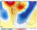
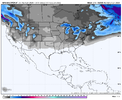
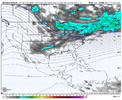
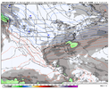
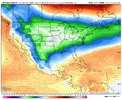
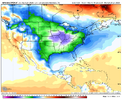
In contrast, I thought the GEFS run was a pretty good one. Cold air setup is improved. Just need to find us a shortwave to sharpen at the right time at the base of the troughMay have been the most boring 18z GFS run I have ever seen.


Really really like this timeframe. Cold settled in across the entire SE. western ridge spike. northern stream trough slipping south as the block retrogrades, just gotta get a decent southern stream wave or turn the corner with some northern stream. Nothing huge showing up right now, but it’s a really favorable pattern right before a transition. But imho if there’s a look everybody scores, it’s here. Hope to see some operational runs start showing something or better ens runs at the surfaceView attachment 141009View attachment 141004View attachment 141005View attachment 141006View attachment 141007View attachment 141008
Yep. The cold that’s in place here will be comparable to January 2022. You can already see the energy in the southern plains. Got much stronger Atlantic confluence this time as well which would prevent cutting. Won’t be long before a OP model shows a fantasy storm from this. Question this time is the S/W itself more so then anything, the cold is thereThat is bloody beautiful.
Also we’re going to continue to see snow pack building over the northeast this week. Probably more so than what we saw in January 2022Yep. The cold that’s in place here will be comparable to January 2022. You can already see the energy in the southern plains. Got much stronger Atlantic confluence this time as well which would prevent cutting. Won’t be long before a OP model shows a fantasy storm from this. Question this time is the S/W itself more so then anything, the cold is there
Make no mistake, it going to get cold! Cpc highlights it wellThe Apps continue to hang up the cold. The Lake Hartwell warm middle finger is holding strong. 40 in Anderson while 19 in Huntsville.
View attachment 140980
Looks like we're back to this look againReally really like this timeframe. Cold settled in across the entire SE. western ridge spike. northern stream trough slipping south as the block retrogrades, just gotta get a decent southern stream wave or turn the corner with some northern stream. Nothing huge showing up right now, but it’s a really favorable pattern right before a transition. But imho if there’s a look everybody scores, it’s here. Hope to see some operational runs start showing something or better ens runs at the surfaceView attachment 141009View attachment 141004View attachment 141005View attachment 141006View attachment 141007View attachment 141008

For the past month or more we’ve had storm after storm ride right through the southeast and now the low is just gonna form drift out to sea? I’m shocked.General setup is still there. Need to get some good high pressure to filter in out ahead of our low development. Checks a couple boxes though View attachment 141069
Let me take a guess. The northeast?This is about to be a monster fantasy run for somebody. Late run voodoo land Triple phase incoming. I can’t not share thisView attachment 141070
Yeah no shot. SER screaming. Not that it matters anyway because it’s out there and will never happen anyway. I just think it’s coolLet me take a guess. The northeast?
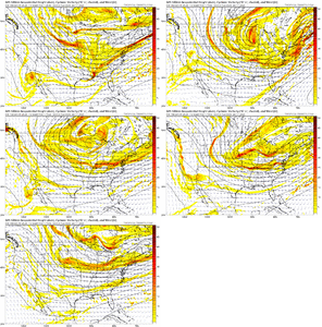
very well saidnice little pattern coming
the risk is that the PV shreds everything apart. little impulses that would have a chance to be a cute event in other setups don't have a chance here. everyone thinks "suppression" here but it's less that and moreso these shortwaves not getting a chance to dig and slow down a hair. a strengthening surface low has a symbiotic relationship with a shortwave (surface WAA pumps the ridge, surface CAA strengthens the trough, in response shortwave gets stronger, means better lift, means stronger LLC. positive feedback, etc...) and that can't happen if the shortwave is consistently outrunning the low
as others have mentioned the remedy is a stouter, taller western ridge that would force waves to dig more. or honestly.. a little more amplification in general would be nice. this broad trough is cool in theory but doesn't really provide any great mechanisms to create qpf and spur cyclone development. that's an issue and with such a lauded pattern... would be nice to get a 6-10 incher across the i-85 corridor at like hour 300, you know? just ground truth that it's a fruitful pattern? something that doesn't just look like a virga storm?
good news is that there's still a lot of time on the clock. so here's the trend for the day 7.5 gfs. pick out our storm. you can't? exactly. models don't have a handle on this yet (i wouldn't expect them to) and still plenty of time for a consolidated shortwave with better tilt to come along and take advantage of things. just hoping waiting for that isn't a fools errand
View attachment 141071
