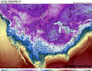
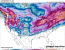
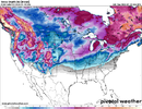
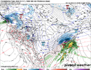
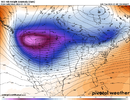
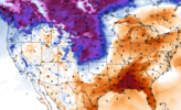
I will make the thread this evening if the 12z models hold serve.View attachment 140809
One week out.. when do we pull the new thread trigger on this one?
-
Hello, please take a minute to check out our awesome content, contributed by the wonderful members of our community. We hope you'll add your own thoughts and opinions by making a free account!
You are using an out of date browser. It may not display this or other websites correctly.
You should upgrade or use an alternative browser.
You should upgrade or use an alternative browser.
Pattern Jammin January 2024
- Thread starter SD
- Start date
NWMSGuy
Member
Getting somewhat excited for us here in the Mid-South. Anyone believe we may be looking at snow ratio's higher than 10:1?
- Joined
- Jan 23, 2021
- Messages
- 4,602
- Reaction score
- 15,197
- Location
- Lebanon Township, Durham County NC
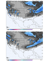
1" contour almost into the triad thereSeems like a good bet a good chunk of TN, n-AL have a great chance.
12z v/s 0z
View attachment 140823
That’s a good look for being that far out.Seems like a good bet a good chunk of TN, n-AL have a great chance.
12z v/s 0z
View attachment 140823
JLL1973
Member
absolutely. looks like temps could be in the lower 20s when the precip beginsGetting somewhat excited for us here in the Mid-South. Anyone believe we may be looking at snow ratio's higher than 10:1?
Hmm.


Yep. Still gets held up west of the Appellations.This will be fun for all our TN folks
But man, what a front!
UNCSC
Member
Seems like the past couple years, being east of aps is such a curse. Every front gets held up, and every storm will miss because we can’t buy a storm that will digYep. Still gets held up west of the Appellations.
But man, what a front!

JLL1973
Member
much less precip for midsouth area on 12z gfs
UNCSC
Member
GFS is a big drop in snow for everyone, but still low pressure sitting right off coast with cold air near by. The way for east of aps to score is that coastal low that has shown up the past few runs.
Showmeyourtds
Member
Cold push doesn't seem to be quite as strong either on 12z
much less precip for midsouth area on 12z gfs
You’re going to get several different looks. No need to focus on one run. You look at the overall picture.GFS is a big drop in snow for everyone, but still low pressure sitting right off coast with cold air near by. The way for east of aps to score is that coastal low that has shown up the past few runs.
UNCSC
Member
7 days out stuff starts getting weird every single timeYou’re going to get several different looks. No need to focus on one run. You look at the overall picture.
JLL1973
Member
no doubt. just like the cmc increased amountsYou’re going to get several different looks. No need to focus on one run. You look at the overall picture.
- Joined
- Jan 23, 2021
- Messages
- 4,602
- Reaction score
- 15,197
- Location
- Lebanon Township, Durham County NC
That low popping on the front and bringing snow to the tidewater is how those of us east of north of 64 and east of I-74 can score next week
- Joined
- Jan 23, 2021
- Messages
- 4,602
- Reaction score
- 15,197
- Location
- Lebanon Township, Durham County NC
Less potent vortex this run - does it mean we see the vortex that got squished in Louisiana last run gain latitude
ForsythSnow
Moderator
Not less at 216. If anything it's looking more intense and further south possibly bringing a system in if it doesn't get too suppressed.Less potent vortex this run - does it mean we see the vortex that got squished in Louisiana last run gain latitude
underwhelming gfs run, but not something to gnash teeth about imo
that first shortwave looks like a NE/AR/TE deal and nothing else as the vortex tears that wave to shreds

now, the northern stream shortwave, the one rounding the rockies, that certainly has potential. qpf was muted on this run compared to 6z because of a less favorable tilt and broader trough, but still a lot of time left. i could say "wouldn't it be nice" for a lot of things, more digging, stream separation, etc... but it's a weather forum, not a beach boys forum. but that probably is the feature that, if future runs go in our way, elevate this from "potential" to "threat"
that first shortwave looks like a NE/AR/TE deal and nothing else as the vortex tears that wave to shreds

now, the northern stream shortwave, the one rounding the rockies, that certainly has potential. qpf was muted on this run compared to 6z because of a less favorable tilt and broader trough, but still a lot of time left. i could say "wouldn't it be nice" for a lot of things, more digging, stream separation, etc... but it's a weather forum, not a beach boys forum. but that probably is the feature that, if future runs go in our way, elevate this from "potential" to "threat"
Ok you’re comparing the Piedmont to areas that have a considerably higher elevation. The December 2022 Arctic blast was one in every sense even east of the mountains. Much of the NC Piedmont and SC upstate went more than 50 hours below freezing and there were widespread single digit lows on Christmas EveIf you compare it to places West of the apps, it was. Places in North GA & Eastern TN didn’t get out the single digits for highs..
W
WSW
Guest
Might be my first actual digital snowfall of the season lol


Call it a gut feel but my sense for this particular pattern (short/temp whatever it turns out to be) next week is best suited (for mby anyway) to produce in the 19th-21st time range if it does do anythingunderwhelming gfs run, but not something to gnash teeth about imo
that first shortwave looks like a NE/AR/TE deal and nothing else as the vortex tears that wave to shreds

now, the northern stream shortwave, the one rounding the rockies, that certainly has potential. qpf was muted on this run compared to 6z because of a less favorable tilt and broader trough, but still a lot of time left. i could say "wouldn't it be nice" for a lot of things, more digging, stream separation, etc... but it's a weather forum, not a beach boys forum. but that probably is the feature that, if future runs go in our way, elevate this from "potential" to "threat"
- Joined
- Jan 23, 2021
- Messages
- 4,602
- Reaction score
- 15,197
- Location
- Lebanon Township, Durham County NC
Gotta watch that one.It's the one the eps really liked.Might be my first actual digital snowfall of the season lol

W
WSW
Guest
W
WSW
Guest
accu35
Member
GEFS still have some juicy members, like what @TheBatman mentioned, the operational will vary and have different looks.
Ilovesnow28
Member
Hey can you post the GEFS?GEFS still have some juicy members, like what @TheBatman mentioned, the operational will vary and have different looks.
Hey can you post the GEFS?

W
WSW
Guest
NBAcentel
Member
UNCSC
Member
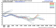
2021 here we come
MichaelJ
Member
For those east of the Apps, nothing on the table for at least 15 days at this point. Guys (and gals) Apps west are likely to see a couple of events during this period, Ark, Tn, parts of Ms and Al
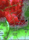
ok now this is something to gnash teeth about lol. not greatUKMET really dumping out west way more then other models View attachment 140862
W
WSW
Guest
Unless you are in Virginia, where the Euro shows a couple of threats in that timeframe. Especially the 16th/17th.For those east of the Apps, nothing on the table for at least 15 days at this point. Guys (and gals) Apps west are likely to see a couple of events during this period, Ark, Tn, parts of Ms and Al
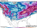
CMC ensembles were colder


