-
Hello, please take a minute to check out our awesome content, contributed by the wonderful members of our community. We hope you'll add your own thoughts and opinions by making a free account!
You are using an out of date browser. It may not display this or other websites correctly.
You should upgrade or use an alternative browser.
You should upgrade or use an alternative browser.
Pattern Jammin January 2024
- Thread starter SD
- Start date
UNCSC
Member
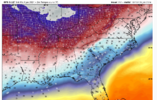
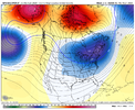
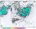
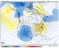
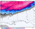
Shearing out at 276 hours is much better than amped at 276 hoursShears it out, but lots of potential.
NBAcentel
Member
NBAcentel
Member
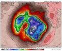
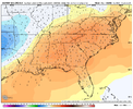
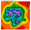
Hypothetically speaking, if a scenario like that were to happen this would rival January 2014. Coldest low was a record 4 degrees that month/year down here. Can’t remember the exact day, but I believe it was early January (weeks prior to SnowJam 2014)Brrr.

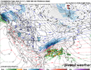
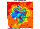
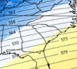
Main takeaway: cold is probably coming east. Southern stream is still active.
TNweathergurl62
Member
A little Dixie land delight for Middle Tennessee looks really good.Main takeaway: cold is probably coming east. Southern stream is still active.
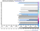
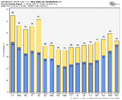
GEFS holding steady. A small increase for most.
NBAcentel
Member
Gefs looks good west of apps. Nothing much east of the apps
NBAcentel
Member
Pilotwx
Member
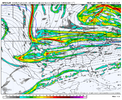
If your East of the Mountains In NC , VA and upper SC winter is going to have to wait for snow. West or NW winds will dry any moisture up anywhere East of the Apps. West of Apps, Tenn., Northern ALA, Miss., Southern SC and GA should see some snow if you look at the overall Jet structure and High placement , and more than likely we will see several l clippers during this period then those close to the gulf will probably see some small disturbance riding south along gulf during this Arctic outbreak. Just going off past history
Until I see a high pressure funneling the cold air down the east side of APPs. and not the brutal cold , we are in a holding pattern for winter storms that produce SNOW. Things can change fast but as of now this is how i see it.
Until I see a high pressure funneling the cold air down the east side of APPs. and not the brutal cold , we are in a holding pattern for winter storms that produce SNOW. Things can change fast but as of now this is how i see it.
accu35
Member
NBAcentel
Member
Brent
Member
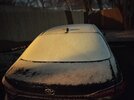
Snow band moving in here for an hour or so. Maybe a dusting if we're lucky
This wind is something else
But the Euro buries us on Sunday
This wind is something else
But the Euro buries us on Sunday
tennessee storm
Member
Gfs caving to euro this morning tooSnow band moving in here for an hour or so. Maybe a dusting if we're lucky
This wind is something else
But the Euro buries us on Sunday
Blue_Ridge_Escarpment
Member
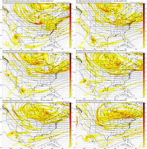
I actually thought the euro and GFS both looked better especially at 500mbGfs caving to euro this morning too
tennessee storm
Member
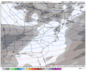
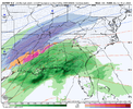
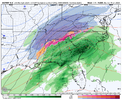
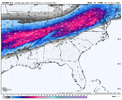
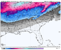
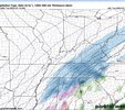
Yeah. Gfs is caving into the euro. Big suprise lol6z GFS. Some huge totals in Tennessee View attachment 140778View attachment 140779
Brent
Member
Blowing snow on the towercam here
If this is any sign of the weekend ?
If this is any sign of the weekend ?
- Joined
- Jan 23, 2021
- Messages
- 4,602
- Reaction score
- 15,197
- Location
- Lebanon Township, Durham County NC
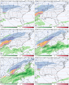
That secondary development is what interests me the most. 50% of EPS members at 0z showed something IMBY.
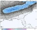
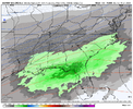
Local Mets are suggesting the Bham area may deal with more ice than snow next week.View attachment 140797
Best EPS run of the year at 00z last night. That ain’t saying a whole lot but it’s a nice thing to see.
Brent
Member
Not being negative, just giving my thoughts on this threat coming next week. I do get 2021 Feb vibes as far as the actual Arctic boundary just struggling for way to long to get East of Apps. You can clearly see that on all model runs. You got to get that boundary in a similar place like Late Jan 2014 for us to score. This looks like a big Winter storm signal for the Mid South & Western Deep South. I think just like Feb 2021, this threat will slowly increase for areas even in Alabama. Wild how the shallow air of these Arctic airmasses just struggle to get into the Southeast. Even with the late Dec 2023 Arctic front, the air was modified compared to areas South & West of the Apps.
yeah im hoping we can something to make it east of apps before all is said and doneNot being negative, just giving my thoughts on this threat coming next week. I do get 2021 Feb vibes as far as the actual Arctic boundary just struggling for way to long to get East of Apps. You can clearly see that on all model runs. You got to get that boundary in a similar place like Late Jan 2014 for us to score. This looks like a big Winter storm signal for the Mid South & Western Deep South. I think just like Feb 2021, this threat will slowly increase for areas even in Alabama. Wild how the shallow air of these Arctic airmasses just struggle to get into the Southeast. Even with the late Dec 2023 Arctic front, the air was modified compared to areas South & West of the Apps.
- Joined
- Jan 23, 2021
- Messages
- 4,602
- Reaction score
- 15,197
- Location
- Lebanon Township, Durham County NC
It may have been modified in Columbia but it certainly wasnt up this wayNot being negative, just giving my thoughts on this threat coming next week. I do get 2021 Feb vibes as far as the actual Arctic boundary just struggling for way to long to get East of Apps. You can clearly see that on all model runs. You got to get that boundary in a similar place like Late Jan 2014 for us to score. This looks like a big Winter storm signal for the Mid South & Western Deep South. I think just like Feb 2021, this threat will slowly increase for areas even in Alabama. Wild how the shallow air of these Arctic airmasses just struggle to get into the Southeast. Even with the late Dec 2023 Arctic front, the air was modified compared to areas South & West of the Apps.
If you compare it to places West of the apps, it was. Places in North GA & Eastern TN didn’t get out the single digits for highs..It may have been modified in Columbia but it certainly wasnt up this way
- Joined
- Jan 23, 2021
- Messages
- 4,602
- Reaction score
- 15,197
- Location
- Lebanon Township, Durham County NC
- Joined
- Jan 23, 2021
- Messages
- 4,602
- Reaction score
- 15,197
- Location
- Lebanon Township, Durham County NC
That was a function of those places having snow cover, though. We had no snow cover and it was 17 degrees on christmas eve when I was driving through Winston Salem around noon that day which is more impressive imo.If you compare it to places West of the apps, it was. Places in North GA & Eastern TN didn’t get out the single digits for highs..
Brent
Member
ghost1
Member
If we go dry for 9-10 days I aint gonna be a happy camper. Been a super el nino firehose and that window is as big as you can ask for, duration wise down here.
- Joined
- Jan 23, 2021
- Messages
- 4,602
- Reaction score
- 15,197
- Location
- Lebanon Township, Durham County NC

