• Hello, please take a minute to check out our awesome content, contributed by the wonderful members of our community. We hope you'll add your own thoughts and opinions by making a free account!

Pattern Jammin January 2023

2
It will certainly be interesting to see which is going to blink… the MJO or the ensembles. I remember in February 2021 how all of the ensembles were in agreement of wanting to bring arctic cold and winter storm chances east of the Apps a week to 10 days out, but the MJO was showing what we knew should be a phase that would promote a strong SER. Obviously we all know that once we got to within the 7 day mark the models came around to the MJO. Now obviously there’s not nearly the intensity of a cold air mass that we were dealing with then, but like I said yesterday, if the MJO is being modeled correctly and along with the AO going into the tank again, I would expect those of us in the western and central Carolinas and areas back to the west from the I-20 corridor and north to have a 10-14 day window for legitimate winter storm chances. After that I think we have to deal with the SER becoming dominant again
My money is to stick with the MJO. I can't remember a time where it ever lost to the models.
 
Wait til AK flips cold. If y’all think this pattern can’t get any worse, it can. I assure you.
When that happens, the ridge will be so strong in the east that all of the tornadoes will be in the plains and Texas. We will be basking in 75 to 80 degree, sunny days and 55 degrees at night, but dry. Right?
 
2

My money is to stick with the MJO. I can't remember a time where it ever lost to the models.
Agreed. Ensemble means are a useful tool, but we’ve gotta remember they are only as good as the members going into them, and just showing an average of those members. The average can be skewed by a handful of members showing a similar outcome (which could be right or wrong). At this point, there is still a good bit of spread 10-15 days out, when the favorable MJO would be starting to have an influence. What I’m looking for right now are positive trends (more members showing cold). Definitely looks like the EPS just threw us a bone, but it’s gotta continue in a big way in order to get some of us off the ledge.
 
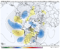
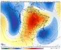
That’s by no means a slam dunk looking pattern, but that’s a look that can have a very big reward.
Yeah, very marginal pattern, but it’s a big dog sort of pattern, just with no cold. Most likely would work for the NE, but I mean it’s winter and there’s always a small chance. I would watch this one especially in the mountains, those juicy marginal pacific waves work for them more often
 
Word from JB-
January 3, 2022

I'm in a State of Confusion by the disagreement between each model's MJO and surface temperature forecasts.

Originally our idea for January was that the warm MJO signals would bring the end of winter after the colder start. The years 1951,1990, and 2006 served as analogs for this.
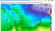
The analogs above are very close to the recent CFSv2 forecasts:
When I saw that the MJO is in fact staying away from the warm phases, I realized the premise was incorrect. This is why I believe the pattern will cool down significantly after the first ten days.
As I said though, the confusing part is that models' MJO forecasts are becoming stronger into cold phases, while their United States temperature forecasts continue to be warm.
All these forecasts bring us to Phase 8 by Week 2, which is a strong indicator for cold, yet surface temperature forecasts are still extremely warm.

My take is that the pattern will shift to cold, as ridging breaks down over the Eastern United States and the ridge sets up back over Western Canada. I simply don't see how we can see a warm pattern with such a strong cold signal in the MJO.


But for now either me or the models are in a State of confusion
 
Sounds like we’ve got a case of favorable MJO with unfavorable teleconnections/ lack of blocking. Which may mean we are looking to mid Feb before we really have a shot in ATL.

Upper south may luck out sooner though.


Sent from my iPhone using Tapatalk
 
Sounds like we’ve got a case of favorable MJO with unfavorable teleconnections/ lack of blocking. Which may mean we are looking to mid Feb before we really have a shot in ATL.

Upper south may luck out sooner though.


Sent from my iPhone using Tapatalk
Should be near 80 by the middle of February with lows near 60
 
Should be near 80 by the middle of February with lows near 60

When the classic nino breaks down we may fire up the SER and have a window of opportunity for people to pound on the doors of their community centers and clubhouses to demand the pools be opened.


Sent from my iPhone using Tapatalk
 
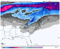
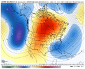
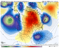
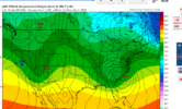
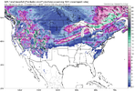
It’s nice to see the pretty snow maps on the EPS, but being 10-12 days out knowing there isn’t much cold air in place in general & no trough offshore Atlantic Canada to help lock in any would be cooler air & keep the storm track to the suppressed, don’t feel great about this for now.

Maybe a shortwave trough in the northern branch of the jet sneaks under the ridge and out to New England + Atlantic Canada and is getting damped by the means this far out.

This is definitely the kind of pattern w/ a strong subtropical jet, cut off upper lows, and a very marginal air mass, where you get a paste bomb (esp over the mountains and foothills) or nothing at all, not much room for anything in between.

ED26CA4B-37CA-44A9-A780-A69FF2374225.png
 
It’s nice to see the pretty snow maps on the EPS, but being 10-12 days out knowing there isn’t much cold air in place in general & no trough offshore Atlantic Canada to help lock in any would be cooler air & keep the storm track to the suppressed, don’t feel great about this for now.

Maybe a shortwave trough in the northern branch of the jet sneaks under the ridge and out to New England + Atlantic Canada and is getting damped by the means this far out.

This is definitely the kind of pattern w/ a strong subtropical jet, cut off upper lows, and a very marginal air mass, where you get a paste bomb (esp over the mountains and foothills) or nothing at all, not much room for anything in between.

View attachment 129247
Trip to Boone with jimmy looking pretty valid right now
 
Word from JB-
January 3, 2022

I'm in a State of Confusion by the disagreement between each model's MJO and surface temperature forecasts.

Originally our idea for January was that the warm MJO signals would bring the end of winter after the colder start. The years 1951,1990, and 2006 served as analogs for this.
The analogs above are very close to the recent CFSv2 forecasts:
When I saw that the MJO is in fact staying away from the warm phases, I realized the premise was incorrect. This is why I believe the pattern will cool down significantly after the first ten days.
As I said though, the confusing part is that models' MJO forecasts are becoming stronger into cold phases, while their United States temperature forecasts continue to be warm.
All these forecasts bring us to Phase 8 by Week 2, which is a strong indicator for cold, yet surface temperature forecasts are still extremely warm.

My take is that the pattern will shift to cold, as ridging breaks down over the Eastern United States and the ridge sets up back over Western Canada. I simply don't see how we can see a warm pattern with such a strong cold signal in the MJO.


But for now either me or the models are in a State of confusion
I will say that for as much of a cold weenie as he is, JB did say as late as just before Christmas that he expected to see the east mild for most of January. He’s obviously just seeing the same thing with MJO that we’re all seeing.
 
Sounds like we’ve got a case of favorable MJO with unfavorable teleconnections/ lack of blocking. Which may mean we are looking to mid Feb before we really have a shot in ATL.

Upper south may luck out sooner though.


Sent from my iPhone using Tapatalk
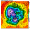
No the other teleconnections are looking good… the AO is going deeply negative again and the NAO looks like it’s making a run a negative by the middle of the month.
 
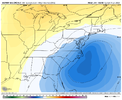
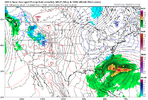
Looks a lot like the numerous past bomb snow storms that Upstate SC and Western NC have gotten the last 7-8 years.
With a marginal (being generous) air mass and a 1034 HP 1000 miles NE, rain is a much better bet. But we still have our 6 hour window around the 28th!

Edit: My bad 1036 HP. TN or WV might see a flake in the floodlights.
 
With a marginal (being generous) air mass and a 1034 HP 1000 miles NE, rain is a much better bet. But we still have our 6 hour window around the 28th!
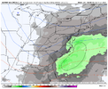
It's how we've gotten a lot of our snows the last decade. Like most threats it probably won't work out for any of 100 different reasons, but it's something to follow for now. If we get a similar look to that at 5h to verify(doubtful) I like our chances.
 
Back
Top