Webberweather53
Meteorologist
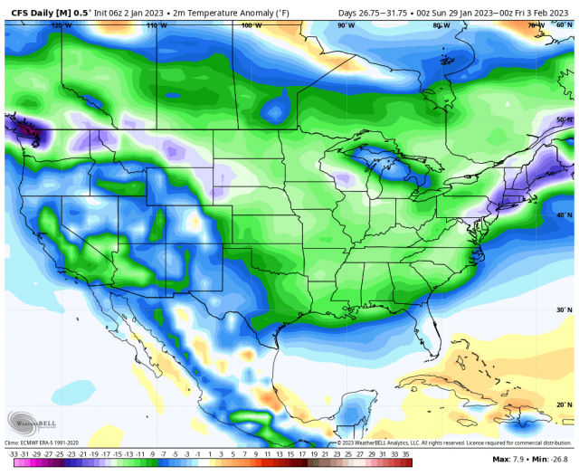
The SubX multi-model ensemble keeps the El Nino gravy train going into mid-late January w/ some semblance of a +PNA. Not a great pattern verbatim though, but probably the best we're gonna see before this Aleutian trough retrogrades even more & allows the -PNA/SE ridge to become re-established sometime near the end of January or early February.
View attachment 129148
View attachment 129149
View attachment 129146
View attachment 129147
For future reference, here's the link to this site: https://www.cpc.ncep.noaa.gov/products/people/jhicks/subx/