- Joined
- Jan 23, 2021
- Messages
- 4,602
- Reaction score
- 15,197
- Location
- Lebanon Township, Durham County NC
Believe the most support for...something i've seen is on EPS so far, which is a good feeling.
Pancake flakes. Nice
So I'm not the only one putting off taking the Christmas lights down. Good.
I can get you way more pancake flakes like that if you move to my part of Durham County.
House next door. And it's northwest of my location and usually marks the rain/snow boundary.If you can't figure out how to properly display a yard sign you shouldn't be allowed post in-my-backyard reports.
Classic wake county snow lineHouse next door. And it's northwest of my location and usually marks the rain/snow boundary.
That’s actually a very workable textbook Miller B setupCMC gives threading the needle a whole new meaning. I’d like to see a similar storm where this actually worked out. View attachment 129318
We would be chewing our nails if this storm was tonight much less 10 days away.View attachment 129319


Euro go boom with the CAD storm.... let's go!!


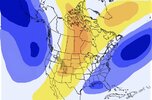
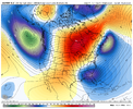
Well, we’re definitely far closer to the best case scenario H5 map I made days back on the 12z euro. Maintenance of the 50/50 low/lack of snow cover on top to aid cold feed is the biggest issue to meNot a great map, but This is the look I would want to show up on ensembles if you want a good looking snow pattern, note the lower heights in the ATL here is crucial, and a Rockies centric ridge, this is why you get “big dogs” in ninos because of these sorts of looks. You keep an active pacific jet, but if you time right with w SE can vortex/Atlantic low, then you got something. Not there yet on ensembles, but I’m starting to become encouraged by trends, it’s certainly that pattern if we get right, has more big dog potential then usual
What I want to see
View attachment 129028
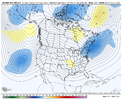
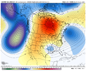
Gefs
View attachment 129029


Really nice trends hereNice trends here on the EPS around D6-7, northern stream/ extension from the TPV digging more towards the GLs helps because it drags down the cold feed for the next one View attachment 129342View attachment 129343


Need to see more trends like this to really put everyone outside the mountains in play.
View attachment 129341

I heard plenty of thunder today and those ten day model runs are showing some potential for the Piedmont area as far as winter precipitation.
I know anything ten days out verifying when it comes to winter weather is about as good as my chances of winning the lottery but who knows,
the stars may be lined up right for once.
Yes, and it thunders all the time in the tropicsI heard plenty of thunder today and those ten day model runs are showing some potential for the Piedmont area as far as winter precipitation.
I know anything ten days out verifying when it comes to winter weather is about as good as my chances of winning the lottery but who knows,
the stars may be lined up right for once.
