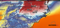
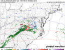
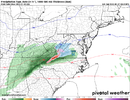
I would say if we do get a snow in a bad pattern it will show up inside day 4 or 5. No way do the models have the timing of key pieces right in a bad pattern at day 8 or 9. I've seen storm signals show up at day 8 or 9 verify but it's rare. And that's in the best of patterns. The pattern in December wasn't great for winter weather. That's why we didn't even have any bites on models other than goofus and day 8 or 9. That pattern was only good for vodka cold.My argument would be that while both a favorable and an unfavorable pattern can produce a snowstorm, you're going to have a better chance in a favorable pattern. I suppose that's why we think of it as a favorable pattern to begin with.
In this case there is simply no cold air and we're hoping for a feature to form that will enable what cold there is to be maximized in both its intensity, transport, and duration over our area. It's unfortunate, but that looks pretty unlike to happen.
-
Hello, please take a minute to check out our awesome content, contributed by the wonderful members of our community. We hope you'll add your own thoughts and opinions by making a free account!
You are using an out of date browser. It may not display this or other websites correctly.
You should upgrade or use an alternative browser.
You should upgrade or use an alternative browser.
Pattern Jammin January 2023
- Thread starter Goose88
- Start date
I get that! Maybe this should be in banter but then what is everyone basing what they’re posting off of. Simple single runs, ensembles, overall current pattern? I’ll agree that 99.9% of the time the odds are stacked against us in the SE and I’m not arguing for or against any winter weather precip at this point.Neither to be honest. Skill more than 7 days out is low for a storm either way. Ensembles are the most useful for long range patterns. But if you do use Ensembles for a storm signal it's best to do it like I described in my post and just count the hits and not pay attention much to a skewed mean
I’m just asking is the flip flop of many due to being let down so many times or is there more knowledge out there that speaks for or against it? Just seems when the gfs shows a signal and the euro doesn’t, it’s just the stupid gfs! When the euro shows a signal but the gfs doesn’t, the euro is on crack.
When the single models show something 10 days out, you can’t believe a single model run and need to look at ensembles. When the ensembles show anything, you can’t trust the ensembles you have to look at a specific run.
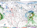
We have a chance at below freezing tonight and tomorrow night depending in cloud coverThe 12z GFS says low temps won't get below freezing the next 16 days for most of us. And what's worse this is what day 16 looks like:
View attachment 129550
This is what I describe as the "Back 2 the Future" syndrome.You could probably use that same thinking for a lot of this discussion though. You could say that they all missed the thing at day one that screwed up the thing at day 2 that messed up the thing on day 3 that caused the 50/50 not to form on day 5.
I think what happens is that the models tend to show if storms or blocks or 50/50s out in time and then have them set up in really favorable positions even further out in time that lead to wintry scenarios for our region. Unfortunately, they tend to frequently overdo these features and suppress the height field too far to the south and show winter storm solutions that are probably and usually unrealistic.
One minor thing changes everything,
And the entirety looks completely different afterwards.
Ur prior post is why I'll never punt an entire month nor even 2 weeks,
No matter what modeling & or analogs show.
No matter how consistent it's being shown.
If u live in region such as I who have never gone a entire winter without at least 1 minor event. (52 years & counting)
Then I highly doubt this is going to be the year u see nothing.
The best way is to just focus on the pattern 7-10 days out. And the ensembles are the best at that. The very knowledgeable ones on here fro, Webber, grit and a few others focus on the pattern. They haven't bought into this storm at all because of pattern recognition using ensembles. If you want to know if a threat is real pay attention to those guys.I get that! Maybe this should be in banter but then what is everyone basing what they’re posting off of. Simple single runs, ensembles, overall current pattern? I’ll agree that 99.9% of the time the odds are stacked against us in the SE and I’m not arguing for or against any winter weather precip at this point.
I’m just asking is the flip flop of many due to being let down so many times or is there more knowledge out there that speaks for or against it? Just seems when the gfs shows a signal and the euro doesn’t, it’s just the stupid gfs! When the euro shows a signal but the gfs doesn’t, the euro is on crack.
When the single models show something 10 days out, you can’t believe a single model run and need to look at ensembles. When the ensembles show anything, you can’t trust the ensembles you have to look at a specific run.
As far as the flip flopping with posters some of that is due to being excited seeing something pop up and they latch on even though they know it's probably not going to happen. Then 12 hrs later when it vanishes they get upset. I'm guilty of that myself. Being older than a lot on here I've been burned so much so yes that contributes to some of my pessimism.
Best advice is to just have fun on here reading the ups and downs. Eventually you'll learn who the wishcasters are, who the bittercasters are and who knows their stuff.
The truth is, when you have a model or models showing a winter storm beyond 4 or 5 days, you really need to see fairly good model agreement on the general features that are to come together to make the scenario unfold, and there really needs to be a cold air source that the models also agree on. Even then, it's not even close to a lock.
I'm just saying that if you're going to give a winter storm (outside of the mountains) genuine credibility at that range, there are things - things favorable for a winter storm - that need to be consistently modeled pattern-wise and feature-wise.
That doesn't mean that a winter storm can't sneak up on you at D3. But the chances of a winter storm sneaking up on you at D3 go down drastically when your highs are in the 50s and lows in the upper 30s ro 40.
iGRXY
Member
Yeah we should probably put a fork in this one. The key feature isn’t happening. Couldn’t get a phase so no deepening 50/50 and weak energy drills off quickly. Our hope relied on that 50/50. Models have completely lost it now and we needed this trend better today and it’s not happening. Need to punt to the end of January. Hope everyone here in the CAD areas like a bunch of 40 degree cold and cloudy days because they’re coming.
Webberweather53
Meteorologist
Mike is working on some pretty sick plots here to eventually showcase on his website (which is down atm for maintenance).
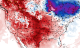
This plot shows the super ensemble mean height anomaly across the last 2 model runs (0z and 12z today) from the GEPS, GEFS, & EPS (so 6 model runs in all) as well as the signal-to-noise ratio of the ensemble mean anomaly across all ensemble members from all model suites.
Super cool
This plot shows the super ensemble mean height anomaly across the last 2 model runs (0z and 12z today) from the GEPS, GEFS, & EPS (so 6 model runs in all) as well as the signal-to-noise ratio of the ensemble mean anomaly across all ensemble members from all model suites.
Super cool
NBAcentel
Member
Mountains still on, 12z EPS wasn’t as great but still held on. if this trends to more of a stronger upper level low, the higher elevation could cash in, we’re still in this one, Im more confident on NW flow tbh though @Jimmy Hypocracy
Yep. My grid forecast has me at 32 tonight. Wouldn't that be terrible if 32 ended up being the coldest night of January.We have a chance at below freezing tonight and tomorrow night depending in cloud cover
Haven't hit the freezing mark since the morning of the 29th. I don't see us getting there tomorrow morning. A pretty incredible streak could get going as we approach the heart of Winter.. Even for the Armpit of Hell standards.
It probably won't be there are some encouraging signs that we set the wheels in motion as early as 1/15 to start transitioning to a workable pattern post 1/20. Cold availability may be a bugaboo though I'm not sure if we can get anything poleward enough to really dump but we will seeYep. My grid forecast has me at 32 tonight. Wouldn't that be terrible if 32 ended up being the coldest night of January.
BHS1975
Member
We have a chance at below freezing tonight and tomorrow night depending in cloud cover
Yeah they have been busting high for the lows lately.
Sent from my iPhone using Tapatalk
BHS1975
Member
It probably won't be there are some encouraging signs that we set the wheels in motion as early as 1/15 to start transitioning to a workable pattern post 1/20. Cold availability may be a bugaboo though I'm not sure if we can get anything poleward enough to really dump but we will see
The Crusher didn't have a super cold mass to work with.
Sent from my iPhone using Tapatalk
That's the best thing about this time of year we need a cold airmass but nothing out of the ordinary for it to snow. What the euro and some of the other models were spitting out the last couple days wasn't that cold it was just great wave timing with a seasonal cold shot sandwiched inThe Crusher didn't have a super cold mass to work with.
Sent from my iPhone using Tapatalk
It fell in a 10 day window that produced 4 seperate winter wx events here IMBY. We had a .2 ice event 2 days prior and it was still frozen on the limbs here that Monday night when the epic suprise unfolded. What made that event so awesome . That and it was a whopper for those in its path.The Crusher didn't have a super cold mass to work with.
Sent from my iPhone using Tapatalk
1993 wasnt a stellar winter eitheir. But it started to turn mid late Feb. I was in SW NC mtns then. So never say never, no matter how grim the computers look or the pattern is you are stuck in.
Cant ask for better placement ,prime climo
dsaur
Member
There is not enough data to feed, not enough super computing to run the data over and over with subtle changes... not enough buoys, not enough balloons, not enough high tech stations, and not enough money slotted to provide for better data, so we get what we get. It's better than when I got interested in weather in the 50's, but it should be much better by now. I have 52 right now at 6pm, and that's not an unusual temp for this time of year, nor would 22 be. It's winter, and as you say, still too many little variables, holes in the data, to be very accurate beyond a few days. Climo seems to be the best predictive tool, but the best storms can go against climo, lol. Maybe it's the surprise of them that makes them extra special.This is what I describe as the "Back 2 the Future" syndrome.
One minor thing changes everything,
And the entirety looks completely different afterwards.
Ur prior post is why I'll never punt an entire month nor even 2 weeks,
No matter what modeling & or analogs show.
No matter how consistent it's being shown.
If u live in region such as I who have never gone a entire winter without at least 1 minor event. (52 years & counting)
Then I highly doubt this is going to be the year u see nothing.
I agree with this mostly..but where were you living in 2011-2012? GSP did it. Went the entire winter without a flake or sleet pellet. I'm sure there have been many with just a trace. It certainly has been a dozen or so of those at CLT and RDU. A trace counts in the books but isn't accumulating winter precip. There have been many complete duds like that and it'll happen again sooner or later.This is what I describe as the "Back 2 the Future" syndrome.
One minor thing changes everything,
And the entirety looks completely different afterwards.
Ur prior post is why I'll never punt an entire month nor even 2 weeks,
No matter what modeling & or analogs show.
No matter how consistent it's being shown.
If u live in region such as I who have never gone a entire winter without at least 1 minor event. (52 years & counting)
Then I highly doubt this is going to be the year u see nothing.
i got about 4 inches last January so i have bout 5 yrs to go lolI agree with this mostly..but where were you living in 2011-2012? GSP did it. Went the entire winter without a flake or sleet pellet. I'm sure there have been many with just a trace. It certainly has been a dozen or so of those at CLT and RDU. A trace counts in the books but isn't accumulating winter precip. There have been many complete duds like that and it'll happen again sooner or later.
As a matter of fact Charlotte has did it 18 times. A trace is a snowless winter in my book.I agree with this mostly..but where were you living in 2011-2012? GSP did it. Went the entire winter without a flake or sleet pellet. I'm sure there have been many with just a trace. It certainly has been a dozen or so of those at CLT and RDU. A trace counts in the books but isn't accumulating winter precip. There have been many complete duds like that and it'll happen again sooner or later.

ajr
Member
That stretch in the early 90s is brutalAs a matter of fact Charlotte has did it 18 times. A trace is a snowless winter in my book.
View attachment 129563
Drizzle Snizzle
Member
Weird that Charlotte got only a trace in 1992. I'm pretty sure Atlanta got several inches that winter.
NoSnowATL
Member
Different location. That’s why.Weird that Charlotte got only a trace in 1992. I'm pretty sure Atlanta got several inches that winter.
That storm in January 1992 really weakened as it moved east and missed CLT to the south. I think Columbia, Myrtle Beach, and Wilmington all got around and inch from it.Weird that Charlotte got only a trace in 1992. I'm pretty sure Atlanta got several inches that winter.
"The '90s were so good"As a matter of fact Charlotte has did it 18 times. A trace is a snowless winter in my book.
View attachment 129563
If you grow up in Carrollton you had totally different weather than the northern suburbs of Atlanta especially the cad areas. Your weather was more like Alabama.Weird that Charlotte got only a trace in 1992. I'm pretty sure Atlanta got several inches that winter.
I lived in Northern GVL county.I agree with this mostly..but where were you living in 2011-2012? GSP did it. Went the entire winter without a flake or sleet pellet. I'm sure there have been many with just a trace. It certainly has been a dozen or so of those at CLT and RDU. A trace counts in the books but isn't accumulating winter precip. There have been many complete duds like that and it'll happen again sooner or later.
I got a trace that winter but it was a tough winter.
And I agree that a trace isn't really winter weather.
But I see several ppl on here canceling winter based upon Analogs & long Range models.
Maybe that turns out to be true but to me it's foolish too trust any model past 128 hours.
Like I said earlier,
I'll punt in April.
Until then I'll expect to see something timing based that's not caught by any model before 72 - 96 hours.
We've had big dogs in terrible patterns during bad analog years.
87 & 88 come to mind.
Btw if ur bar is a trace.
Then I have already gotten that in Dec.
My bar is a lil higher than that.
Drizzle Snizzle
Member
We had 6" from that storm in January 1992.If you grow up in Carrollton you had totally different weather than the northern suburbs of Atlanta especially the cad areas. Your weather was more like Alabama.
I remember being heartbroken as a kid when West Georgia would get snow and we would not in Gainesville.We had 6" from that storm in January 1992.
- Joined
- Jan 23, 2021
- Messages
- 4,602
- Reaction score
- 15,197
- Location
- Lebanon Township, Durham County NC
As someone who grew up just west of Charlotte, the 90s were brutal with the exception of the 93 superstorm and the 96 blizzard. Those are literally the two storms of note between February 1988 and December 1999. Honestly, the superstorm was only good for those of us west as wellThat stretch in the early 90s is brutal
As a comparison, 2010-2020 period was honestly decent. 2000-2010 was not bad as well.
Last edited:
Drizzle Snizzle
Member
I was heartbroken in December 1997 when there was a good bit of snow from Jackson to Birmingham but it vanished by the time it got to the GA border.I remember being heartbroken as a kid when West Georgia would get snow and we would not in Gainesville.
Yeah mine is too. I at least like a good 1-2 every year.I lived in Northern GVL county.
I got a trace that winter but it was a tough winter.
And I agree that a trace isn't really winter weather.
But I see several ppl on here canceling winter based upon Analogs & long Range models.
Maybe that turns out to be true but to me it's foolish too trust any model past 128 hours.
Like I said earlier,
I'll punt in April.
Until then I'll expect to see something timing based that's not caught by any model before 72 - 96 hours.
We've had big dogs in terrible patterns during bad analog years.
87 & 88 come to mind.
Btw if ur bar is a trace.
Then I have already gotten that in Dec.
My bar is a lil higher than that.
JHS
Member
That was a nice storm for the I-20 corridor from Miss to SC. Was a miss for upstate SC and much of NC.Weird that Charlotte got only a trace in 1992. I'm pretty sure Atlanta got several inches that winter.
JHS
Member
I remember this very well. I kept looking for snow for hours that night and finally gave up on it. That was one of several near misses we had from December 1988 through. Jan 1992.That storm in January 1992 really weakened as it moved east and missed CLT to the south. I think Columbia, Myrtle Beach, and Wilmington all got around and inch from it.
JHS
Member
1987 was not a bad year for winter weather through, especially for western NC. 4 big snowstorms in the mountains including a big one in early April that dropped 1-2 feet in most mountain locations in NC. We only had one real storm in 1988, but what a monster that was though. Heavy snow at 17 degrees here and was out of school for over a week.I lived in Northern GVL county.
I got a trace that winter but it was a tough winter.
And I agree that a trace isn't really winter weather.
But I see several ppl on here canceling winter based upon Analogs & long Range models.
Maybe that turns out to be true but to me it's foolish too trust any model past 128 hours.
Like I said earlier,
I'll punt in April.
Until then I'll expect to see something timing based that's not caught by any model before 72 - 96 hours.
We've had big dogs in terrible patterns during bad analog years.
87 & 88 come to mind.
Btw if ur bar is a trace.
Then I have already gotten that in Dec.
My bar is a lil higher than that.

