• Hello, please take a minute to check out our awesome content, contributed by the wonderful members of our community. We hope you'll add your own thoughts and opinions by making a free account!

Pattern Jammin January 2023

The 6z GEFS was probably an aberration. The 12z suite going to what the EPS & GEPS are showing w/ +PNA

This would be a good circulation pattern if we had the cold air in place already from say a previous arctic outbreak, but we're getting modest continental polar air masses from central Canada, which are already starting out pretty modified by the strong/extended N Pac jet.

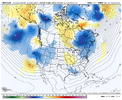
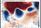
gfs-ensemble-all-avg-namer-z500_anom-3676000.png
 
Pattern being modeled is about as fast as you’ll ever see. But not only is it fast, it sucks while being fast. That’s all I’ve got today.
Hold the phone Jimmy
GFS says it’s only an hour drive away! Mountain mauler8AE14CA8-DBCE-4308-A74A-621CF57EDAA2.png
 
Yeah I mean after a torch period I’m not too worried about being average in the heart of our climo. Things can work out and we’re still 300+ hours out to the time I expect models to get somewhat more favorable for colder attacks and winter precip chances. Along with the possibility of a Strat warming disruption and how I know those can really change modeling as that comes into full swing I’m still not worried about not seeing more favorable periods of winter weather chances for the SE in general. No need to worry much about a 300+ hour forecast right now. It’s just a time to watch and see it comes closer and see how things trend. Also we’re just not going to see a slam dunk pattern like we did on Christmas those are rare so gotta remember that as well
 
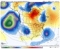
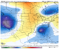
Probably the best EPS run yet but you can see the snap back occurring the the pacific as the EC trough is in place. We might have a very short window quite honestlyView attachment 129118

Yep that’s about what I figured. Short window here mid-late Jan as the pacific jet snaps back and we get some brief +PNA during the intervening transition period from one phase of the NPO to the other. Oth, we may get a respectable cold shot in the process as we get some blocking over the far North Pacific + Alaska
 
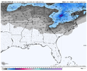
Its as if someone in Halifax County is outside burning trash at hour 126,heating up the BL on the 12z Canadian. Cant even get the moisture to turn blue, despite being behind the 534 line, let alone the 540 lol.

1672605526522.png
 
Its as if someone in Halifax County is outside burning trash at hour 126,heating up the BL on the 12z Canadian. Cant even get the moisture to turn blue, despite being behind the 534 line, let alone the 540 lol.

View attachment 129120
There’s no cold air source
 
Well JB thinks arctic air gets in the pattern? IDK
Euro and NCEP fighting their way toward phase 8, CFSV2 is all in..
euro now seeing a negative EPO developing, with an increasing strong neg AO
Euro by 360 has an inverted U-shaped ridge over the trough which to m means. widespread arctic air is taking over
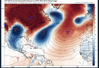
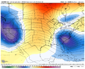
ecmwf_ensemble_avg_nhemi_z500_anom_3784000.png
 
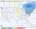
There’s no cold on our side, but in a time of desperation, this a trend you want to continue to see around Atlantic Canada View attachment 129124


Yep the Atlantic Canada trough is nice for locking in cold air, the problem is we don’t really have any to begin with, so you’re probably just trending to colder rain there. Bleh
 
Yep the Atlantic Canada trough is nice for locking in cold air, the problem is we don’t really have any to begin with, so you’re probably just trending to colder rain there. Bleh
The mountains are a different story though, I’d travel there and stay in with jimmy, go 50/50 for a Boone bomb, unless any other poster would wanna go and chip in
 
LOL. I've missed a lot on this forum. Based on WebberWeather's expert forecast, I'm going to go out on a limb and say that ya'll are waiting for some magic window of opportunity depicted on the 300 hour GFS that might drop a 2-6" snowfall if some PAC System is able to the thread the needle by timing the deeper cold air just right with one of those two vortexes sliding along the polar jet. You got that trough sliding into the wrong positions at 250 hours on the 18z. Then there's that tropical energy that tries to get involved at 300 hours, and then a some kind of subtropical system at 384 somehow lol. If you want snow, your best bet will be near Truckee, California. They'll probably get 5-10 times your yearly average in a week. This winter is putting in some work trying to end that drought in the SW.

BTW, the SOI hit 55 this past week and then 50 the next day. Despite that particular signal, I get the impression that we're going to see a radical shift towards El Nino. https://www.longpaddock.qld.gov.au/soi/
 
Back
Top