Wow
-
Hello, please take a minute to check out our awesome content, contributed by the wonderful members of our community. We hope you'll add your own thoughts and opinions by making a free account!
You are using an out of date browser. It may not display this or other websites correctly.
You should upgrade or use an alternative browser.
You should upgrade or use an alternative browser.
Pattern Jammin January 2023
- Thread starter Goose88
- Start date
DobsonCityWx
Member
GSP just punted to February 6th for winter radar coverage. Bull gear failed. Hello spring.
Gfs more amped system but also stronger high and it still doesn’t have onset ice. Yes 50/50 isn’t big there but again the pattern is progressive. Icon has the system very weak and further west. One any precip even gets here WAA takes over and that high will not be in the ideal location. Insitu may help in aiding onset ice for the mountains but anyone outside wouldn’t score. No need to argue on 1 ICON run there will be more.
rburrel2
Member
I guess we'll have to agree to disagree here. Precip is less than 12hrs away from CAD area's on the 180hr icon. The GFS has no 50/50.. the ICON has a 957mb low. That high pressure isn't going anywhere on the ICON. Even the GFS with no 50/50 low and our system being 10x stronger and going to Chicago we still get early onset ice east of the apps.Gfs more amped system but also stronger high and it still doesn’t have onset ice. Yes 50/50 isn’t big there but again the pattern is progressive. Icon has the system very weak and further west. One any precip even gets here WAA takes over and that high will not be in the ideal location. Insitu may help in aiding onset ice for the mountains but anyone outside wouldn’t score. No need to argue on 1 ICON run there will be more.
If you squint you can see there is a slight hint of a wedge signal through the Carolinas and into GA
rburrel2
Member
144hr 12z Euro looks like it's developing the 50/50 storm to me... should be a good run I think.
iGRXY
Member
iGRXY
Member


Just a slight difference lol
iGRXY
Member
Very positive changes so far
iGRXY
Member


Ahhhhh man that looks great right now. Deepening 50/50 low that is slowing down with a huge CAD signature.
rburrel2
Member
It's all about the bombing 50/50 low... we get that feature and it's game on for a CAD event. We don't and it's game over. GFS/CMC have no 50/50 bomb. ICON/Ukmet/Euro have it.
You would think this is where we want it.......


The players stay on the field. Do we have just enough cold though?


iGRXY
Member

This is why all that progression talk goes out the window when you have a deepening 50/50 low. It slows everything down.
Pretty strong CAD


1042 feeder high is pretty solid. Will it hold…
iGRXY
Member
?


Yep euro holds strong. That’s what you want to see.
Single digit dews into NC and only about 30 degrees colder than GFS accross the board..woofPretty strong CAD

Hello!


iGRXY
Member
This is what I was trying to explain to Nick earlier. Yes, the pattern is progressive, but the key here is to build your 50/50 and get a nice rocky mountain ridge go up. The 50/50 deepening slows the progression down considerably, especially as it bombs out.
iGRXY
Member

The ULL takes affect and we get the rare onset ice to snow switch over LMAOOOO
Is there snow on the backside here?


Warm nose ruins it for Central NC. Changes over to rain. LP hugging the close too closely.
Might be time to hold a couple cabins from Banner Elk to Cataloochee..Hello!

packfan98
Moderator
All of the models have the system really stalling out once it gets to the east coast, just different paths that it gets there. Big dog potential for someone. Mountains definitely sitting in the best position right now.
iGRXY
Member
For me to get excited I want to see a nice ULL form coming out of the plains with a bombing 50/50 low. The Euro/Icon/Ukie have it. The GFS and CMC have the ULL but no 50/50. ULL driven snow is always the "easiest" set up we can get as long as the track is favorable because it helps to pull in its own cold air on top of the CAA feed and CAD driven low level cold.
Guys can you debate in whamby or DM one another but leave it out of here.
Thanks
Thanks
PainWarm nose ruins it for Central NC. Changes over to rain. LP hugging the close too closely.

ForsythSnow
Moderator
No Kuchera but not bad


iGRXY
Member

That is a TEXTBOOK ULL track for snow in the western carolinas
One thing for sure as @packfan98 stated, this has big dog written all over it (for someone) Euro is crawling
rburrel2
Member
- Joined
- Jan 23, 2021
- Messages
- 4,602
- Reaction score
- 15,197
- Location
- Lebanon Township, Durham County NC
Looks like one of those 1980s snow lines
Back end upper level low always produces. Everyone gets some goods here for sure. Can’t hate this look right nowPain

LukeBarrette
im north of 90% of people on here so yeah
Meteorology Student
Member
2024 Supporter
2017-2023 Supporter
U know what’s nice?
It’s the euro showing it…
It’s the euro showing it…
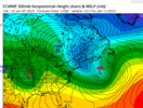
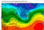
When you call out other posters with it, it is, geez.......This isn't whamby. this is explaining the similarity between ICON and Euro since we have to extrapolate the Icon post 180hrs. Geez... Notice the near identical 50/50 placement and strength at 168hrs.
View attachment 129440View attachment 129441


