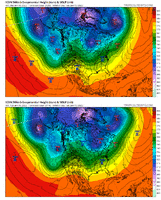
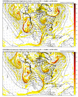
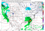
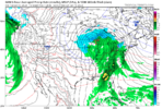
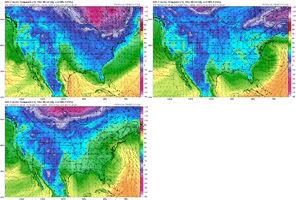
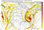
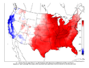
I’m feeling a trip to Lake Toxaway, looks like a killer spot with what models and ensembles are saying now. It was MLK weekend last year when they had the giant storm. Let’s go!!
-
Hello, please take a minute to check out our awesome content, contributed by the wonderful members of our community. We hope you'll add your own thoughts and opinions by making a free account!
You are using an out of date browser. It may not display this or other websites correctly.
You should upgrade or use an alternative browser.
You should upgrade or use an alternative browser.
Pattern Jammin January 2023
- Thread starter Goose88
- Start date
Something to keep in mind during this timeframe that temp have been average if best. There's a lot that can go wrong here.


iGRXY
Member
rburrel2
Member
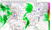
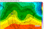
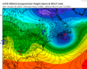
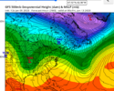
ICON looks to be setting up a major ice storm/wedge event at 174hrs. Key here is the 50/50 block is strong and in good position. If the 50/50 plays out that way I don't see how CAD area's miss this storm due to warmth... i'd be more worried about suppression. Also important that our storm doesn't have a northern stream wave attached to it mucking up the confluence over the great lakes/new england. GFS has been doing this each run. 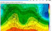

iGRXY
Member
Yeah this likely would lead to some type of storm in the CAD areas of NC/SC/VA/NEGA.
iGRXY
Member
Deepening 50/50 Low and holding the HP in Canada stationary. ULL energy diving. This likely would've been a storm just based off this view.
iGRXY
Member
Not too sure tbh. A high of 1038 strength that far north in a progressive pattern probably doesn’t get things done. Our prime placement for CAD events is a high much further south in PA. This would most likely skirt out and we’re left with a cold rain for most
Yeah this likely would lead to some type of storm in the CAD areas of NC/SC/VA/NEGA.
iGRXY
Member
We can score CAD off of low 1030 HP. You put a almost 1040 HP in SE Canada with a deepening 50/50 and that almost certainly would get the job done. Typical location is the NE but everywhere from the NE, MA, and SE Canada will get the job done, especially when you start pushing past 1033-1035mlbNot too sure tbh. A high of 1038 strength that far north in a progressive pattern probably doesn’t get things done. Our prime placement for CAD events is a high much further south in PA. This would most likely skirt out and we’re left with a cold rain for most
Even with the 50/50 the pattern is progressive you would need the storm moving in much quicker to take advantage of the quick hitting cold and dry air. It’s fleeting at the end of the icon similar to the current gfsWe can score CAD off of low 1030 HP. You put an almost 1040 HP in SE Canada with a deepening 50/50 and that almost certainly would get the job done. Typical location is the NE but everywhere from the NE, MA, and SE Canada will get the job done, especially when you start pushing past 1033-1035mlb
So is Goofy fixing to phase and do the dip here?


iGRXY
Member
Difference is it is deepening and in-situ with a border line 1040 HP would work. We rarely get an anchored HP in this day and time anyways. It may not be good enough for eastern NC, but for those of use back west? Yes it would work and would hold enough low level cold air to get something frozen.Even with the 50/50 the pattern is progressive you would need the storm moving in much quicker to take advantage of the quick hitting cold and dry air. It’s fleeting at the end of the icon similar to the current gfs
iGRXY
Member
Nothing like a nice cutter from the goofy.
Blue_Ridge_Escarpment
Member
Miller B, transferring the low around 192Nothing like a nice cutter from the goofy.
Iceagewhereartthou
Member
Ideally I would like to see this all a bit further south. Move that H over to about upstate NY and push that low down to the gulf coast, tracking to Jacksonville. I am worried this setup, as modeled here, is way too marginal for areas East of apps and outside the mtns. This is more typical of what has become the norm; its a chance but needs some work for many of us. I expect a ton of changes over the next week and it may not look anything like this at go time; Time of day will also be key for many.Not too sure tbh. A high of 1038 strength that far north in a progressive pattern probably doesn’t get things done. Our prime placement for CAD events is a high much further south in PA. This would most likely skirt out and we’re left with a cold rain for most
Verbatim there’s too much WAA you’ll end up with a 12z gfs solution. Cold rain. But maybe the upper level low can bring some cold air down to surprise us after the initial blow. Still we’re far from the end game here but this has always been a thread the needle type of threat.Difference is it is deepening and in-situ with a border line 1040 HP would work. We rarely get an anchored HP in this day and time anyways. It may not be good enough for eastern NC, but for those of use back west? Yes it would work and would hold enough low level cold air to get something frozen.
rburrel2
Member
CMC trended straight to the GFS... can't catch a break here. CMC now has the low going up through Chicago. Previous run had it transfering from the gulf coast to off the Charleston coast. sigh.
Webberweather53
Meteorologist
This day 8-10 setup objectively (still) looks like ? outside the mountains & foothills. 12z GFS showing a potential paste bomb for the mountains though, which is about the only thing I'd put much stock in atm given the pattern + analogs.
rburrel2
Member
It's not a thread the needle event... but a surface low tracking through Chicago definitely misses the goal posts.Verbatim there’s too much WAA you’ll end up with a 12z gfs solution. Cold rain. But maybe the upper level low can bring some cold air down to surprise us after the initial blow. Still we’re far from the end game here but this has always been a thread the needle type of threat.
Blue_Ridge_Escarpment
Member
GFS was actually a step in the right direction IMO. South of its 6Z runCMC trended straight to the GFS... can't catch a break here. CMC now has the low going up through Chicago. Previous run had it transfering from the gulf coast to off the Charleston coast. sigh.
- Joined
- Jan 23, 2021
- Messages
- 4,602
- Reaction score
- 15,197
- Location
- Lebanon Township, Durham County NC
Canadian went to Chicagoland and then transferred.
It transferred to Louisville but it transferred
It transferred to Louisville but it transferred
LukeBarrette
im north of 90% of people on here so yeah
Meteorology Student
Member
2024 Supporter
2017-2023 Supporter
CMC missed the confluence completely and therefor it sharted on all of us. Listen we got a long way to go with this one but if you miss confluence in 50/50 land forget about anything positive happening winter weather wise. When everything has to come together in a nice neat bow 200 hours out it’s probably best to pump the breaks on high hopes for winter weather. Lots of fail out potentials here
NoSnowATL
Member
I wouldn't say that, we might have a flooding thread out of it.Massive ULL in the heart of winter and can’t do a damn thing with it View attachment 129423
- Joined
- Jan 5, 2017
- Messages
- 3,774
- Reaction score
- 5,985
The GEFS looks terrible for snow chances over the next 10 days for anyone south of Kentucky. There are maybe three low placements in the southeast at 180 hours and they are all 100% rain. There is just no source for significant cold air and the mean storm track is through the midwest. It looks like October. I think we need to let this one go. Maybe it gets better the week of the 20th through 27th? Maybe it will be the last chance?
NoSnowATL
Member
UKMet with a ray of light amidst a sea of darkness and despair


Ukie fired first warning shots to burst our arctic snow potential bubble, so seeing this is goodUKMet with a ray of light amidst a sea of darkness and despair


Blue_Ridge_Escarpment
Member
That’s a textbook look, if euro agrees then we have a threat.UKMet with a ray of light amidst a sea of darkness and despair


Webberweather53
Meteorologist
rburrel2
Member
180hr ICON panels look really good too. We really only lost the CMC today with the 12z modeling. If the Euro holds we are still in the game for a CAD winter storm.
rburrel2
Member
olhausen
Member
Anyone else get colder than forecasted this morning? It was supposed to be anywhere from 38-35 Degrees but the actual low temp was 31 here this morning. I’ll take it during this dumpster fire pattern we are in. Of course the high was supposed to be 48 and I’m already at 50. ?
Verbatim this is too warm. It’s maybe onset ice for the mountains. High is retreating and north of where we ideally want it while our storm still has 12-24 hours until it moves in. This run would probably look similar to the 12z GFS if it kept upThat's a major incoming Wedge ice/mixed bag storm for CAD area's.View attachment 129431View attachment 129432
rburrel2
Member
Yep certainly love to see the ukie on the right side where we want it. Hopefully euro follows suit. Then we can discard the bad gfs and usually wild swinging cmc and iconUkie fired first warning shots to burst our arctic snow potential bubble, so seeing this is good
Blue_Ridge_Escarpment
Member
And the ICON is always too warm on the surface. Been a known bias since the models birth.Verbatim this is too warm. It’s maybe onset ice for the mountains. High is retreating and north of where we ideally want it while our storm still has 12-24 hours until it moves in. This run would probably look similar to the 12z GFS if it kept up

