accu35
Member
Leaving a ice storm today to come back home to a hurricane. 2020 thank you
I predict 53 for KATLThough it may be a little too low, FFC NWS map of highest gusts for ATL metro of 35-40 looks more likely to verify to me than the map posted here on the previous page that Ella Dorsey put out, that has gusts way up into the 50s and 60s, which would be similar to Opal. I experienced Opal and it was very bad. I’m not trying to minimize the 35-40 as that would be plenty enough for dangerous falling trees/limbs as well as lots of power outages. But I just think the Opal like 50s to 60s seems a bit much and may be based on models that tend to overdo these. Similar to Opal, Zeta will be moving very rapidly and likely even faster. That’s bad news as that will prevent that much weakening of the storm by the time it gets to the area. And there is the concern about extratropical energy being added. But remember that Opal was a cat 3 H when it made landfall and was still a cat 1 H when it was well up into AL. Zeta is expected to be only a cat 1 H at landfall and will weaken somewhat when going inland.
Make no mistake, this will be a big wx event though.
My forecast is for highest KATL wind gusts to be near 45, which is higher than the NWS’ 35-40 but lower than Ella Dorsey’s 54. There will be many trees and large limbs down along with lots of outages.
Any other predictions for KATL?
I agree that I doubt we see something as insane as Opal here. The Euro showing up to 70 yesterday here I know is overblown. I say the max however for gusts would be 60 mph. Now that I have a proper weather station set up I'll be able to record what we get exactly here as compared with Irma where I just had to guess.Though it may be a little too low, FFC NWS map of highest gusts for ATL metro of 35-40 looks more likely to verify to me than the map posted here on the previous page that Ella Dorsey put out, that has gusts way up into the 50s and 60s, which would be similar to Opal. I experienced Opal and it was very bad. I’m not trying to minimize the 35-40 as that would be plenty enough for dangerous falling trees/limbs as well as lots of power outages. But I just think the Opal like 50s to 60s seems a bit much and may be based on models that tend to overdo these. Similar to Opal, Zeta will be moving very rapidly and likely even faster. That’s bad news as that will prevent that much weakening of the storm by the time it gets to the area. And there is the concern about extratropical energy being added. But remember that Opal was a cat 3 H when it made landfall and was still a cat 1 H when it was well up into AL. Zeta is expected to be only a cat 1 H at landfall and will weaken somewhat when going inland.
Make no mistake, this will be a big wx event though.
My forecast is for highest KATL wind gusts to be near 45, which is higher than the NWS’ 35-40 but lower than Ella Dorsey’s 54. There will be many trees and large limbs down along with lots of outages.
Any other predictions for KATL?
Edit: Now if Zeta landfalls as a cat 2 instead of cat1, then it may be close to an Opal for ATL.
Yea I don’t see the winds as strong just because they never are. Atlanta area might see a few 40+ but I don’t see anything higher. A solid 20-30 mostly likely.Spann says he doesn't expect any widespread tree damage. Possibly gusts up to 40-45.
I agree that I doubt we see something as insane as Opal here. The Euro showing up to 70 yesterday here I know is overblown. I say the max however for gusts would be 60 mph. Now that I have a proper weather station set up I'll be able to record what we get exactly here as compared with Irma where I just had to guess.
Those products always seem to be quite over-blown. I would imagine that you have to multiply the output by .4 or so to get a better idea of what to expect.

No pun intended...
Sent from my iPhone using Tapatalk

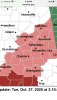
Wonder if Barrow County will be in the watchFFC going to Issues Tropical Storm Watch for a large part of their CWA shortly


From what I have seen no, but Hall and Gwinnett counties are.Wonder if Barrow County will be in the watch
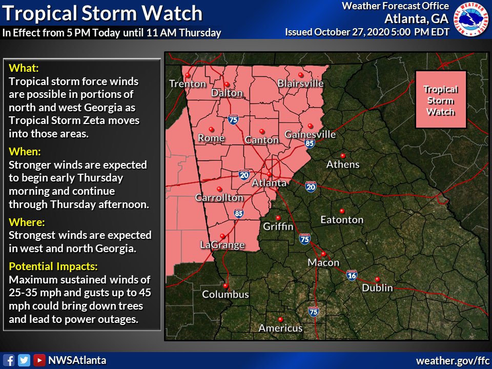
I thought a watch was only issued if sustained winds were forecast to be tropical storm but i guess it's gusts that matter.TS watch now in effect for a majority of N GA
Wonder if over towards Athens area will get added on later this evening or tomorrowTS watch now in effect for a majority of N GA
Doubt it given the trajectory of the storm.Wonder if over towards Athens area will get added on later this evening or tomorrow
I know it’s odd but I think maybe a lot of posters are in NC.This place is pretty quiet all things considered
This place is pretty quiet all things considered
I thought a watch was only issued if sustained winds were forecast to be tropical storm but i guess it's gusts that matter.
I’m sure it will pick up once she makes landfall. This one is going to be interesting. I can see another boom or bust scenario.This place is pretty quiet all things considered
Huh?I just quit posted when my reply was deleted!
Anyone think TS Watches will make it into the Upstate?
noAnyone think TS Watches will make it into the Upstate?
I think the watch is more in case the winds are stronger when it comes inland and they're saying 20 to 30 sustained right now. Models may be right about it being slightly stronger or may be too strong.I don't why they even issued one for Atlanta, honestly. It's gusts, not sustained winds. Which is by definition what warrants a TS watch/warning. A wind advisory/ and flood watch would of have been sufficient enough.
I don't why they even issued one for Atlanta, honestly. It's gusts, not sustained winds. Which is by definition what warrants a TS watch/warning. A wind advisory/ and flood watch would of have been sufficient enough.
 forecast.weather.gov