• Hello, please take a minute to check out our awesome content, contributed by the wonderful members of our community. We hope you'll add your own thoughts and opinions by making a free account!

Tropical Hurricane Idalia

No. It has never, ever been considered a reliable tropical model. I tried to make that point last night, and it was met with sarcasm about only believing in the Euro...or some such nonsense. I still maintain that last night's run (and today's 12z 3K run) tracking it near Columbia and into the NC coastal plain is too far west/north. But we'll see.
Yeah, that is way too far west. It will never be more than 30 miles from the coast in SC.
 
GFS 12z- Looks to be almost the same as 6Z. Tad weaker by 2mb. Still west of NHC track.
gfs_mslp_pcpn_frzn_seus_4.png
 
Reminder. The furthest edges (west or east) of the nhc cone to the lines can be where the center actually tracks. Not impacts within and outside it.

I think the cone is fine for what the models show currently, on either direction. Try not to get caught up directly into the very middle of it circulation/track wise.
 
The only global models that haven't had a substantially large west shift that I have seen are the icon and euro. Probably ukmet too, no access to current data though.
 
GFS 12z- Looks to be almost the same as 6Z. Tad weaker by 2mb. Still west of NHC track.
gfs_mslp_pcpn_frzn_seus_4.png
Looking at the 500mb chart this morning, there is some weakness extending from the NW over Louisiana. I wonder if the globals are picking up that and trying to pull it just a little to the west.
 
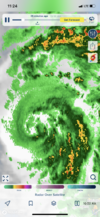
Looks to be moving slightly W of due N2F078CC4-5F29-46D3-91BF-A4FB2F68066B.png
 
Reminder. The furthest edges (west or east) of the nhc cone to the lines can be where the center actually tracks. Not impacts within and outside it.

I think the cone is fine for what the models show currently, on either direction. Try not to get caught up directly into the very middle of it circulation/track wise.
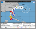
I'm comparing the hurricane models to the cone and I guess you could say the center is on the very western part of the cone. It's close though and I thought they'd give themselves a little wiggle room. Any future jog west and it's out of the cone. Same with the GFS.

Someone made a good point about the hurricane warnings already up in this area though. Hopefully that gets the locals attention. I just worry people look at these paths verbatim like they did with Ian thinking it was going into Tampa.

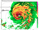
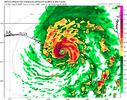
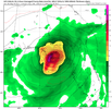
HWRF.pnghafsa_ref_10L_10.png
Cone.png
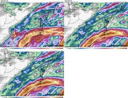
gfs_mslp_pcpn_10L_5.png
 
This is starting to look bad for Tallahassee. For a place that hadn’t had a hurricane for 31 years prior to 2016’s Hermine, this would be their third in the last seven years (including Michael, which was more of a glancing blow, but it being a Cat 5 still knocked out power for most of the city). The mossy oaks in the panhandle are not well suited for hurricanes.
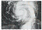
 
SUMMARY OF 200 PM EDT...1800 UTC...INFORMATION
----------------------------------------------
LOCATION...25.2N 84.9W
ABOUT 130 MI...210 KM WNW OF THE DRY TORTUGAS
ABOUT 240 MI...390 KM SW OF TAMPA FLORIDA
MAXIMUM SUSTAINED WINDS...90 MPH...150 KM/H
PRESENT MOVEMENT...N OR 360 DEGREES AT 15 MPH...24 KM/H
MINIMUM CENTRAL PRESSURE...974 MB...28.76 INCHES
 
Back
Top