They have retired a lot of I names, it’s getting dudficult to come up with ‘l’ namesWho came up with this name? seriously, never heard of it and I have many Amigas/Amigos.
-
Hello, please take a minute to check out our awesome content, contributed by the wonderful members of our community. We hope you'll add your own thoughts and opinions by making a free account!
You are using an out of date browser. It may not display this or other websites correctly.
You should upgrade or use an alternative browser.
You should upgrade or use an alternative browser.
Tropical Hurricane Idalia
- Thread starter weather nerd
- Start date
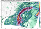
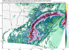
12K already coming in east of 12Z. 0Z, 6Z, 12Z, and now 18Z have all stepped east, in terms of landfall.
Kinda pointless to speak pressures based on models like the NAM but 920s showing up early on per 3KM. Stronger storm will pull East one would think.
edit: 914mb
edit: 914mb
Last edited:
Drizzle Snizzle
Member
Is some of this rain in Alabama and Georgia right now the outer bands of Idalia ?
NewnanWetather
Member
No it is notIs some of this rain in Alabama and Georgia right now the outer bands of Idalia ?
Drizzle Snizzle
Member
It's moving from South to North so thats why I was wondering.No it is not
It looks to me like it may be the beginning of a PRE eventIt's moving from South to North so thats why I was wondering.
Latest GOM IR Loop

 www.star.nesdis.noaa.gov
View of both: What a Beaut!


GOES-19 - Sector view: Gulf of America - Band 13 - NOAA / NESDIS / STAR
Near real-time publication of GOES-East and GOES-West images from NOAA/NESDIS/STAR
View of both: What a Beaut!

Another I’m noticing is that it’s moving a bit faster over land… at least through hour 30 which is all I’ve got up to now. It’s about 30-40 miles further NE at 0z Thursday than it was on the last run. So that tells me, the more it slows down after landfall, the further inland in SC it should be. Either way, I doubt expect the center to be more than 35-40 miles inland in SC.12K already coming in east of 12Z. 0Z, 6Z, 12Z, and now 18Z have all stepped east, in terms of landfall.
Models are doing the back and forth dance with it going west one run and back east the next.
Yes… it definitely looks like a PRE developing. None of the models have really picked up on it which is fairly typical. It’ll be interesting to see how far north it moves… it’s got plenty of juicy air ahead of it.It's moving from South to North so thats why I was wondering.
West to East wobbles, maybe why NHC hasn’t updated their track? ??
NoSnowATL
Member
I wouldn't look at the nam for tropical systems.
Models are doing the back and forth dance with it going west one run and back east the next.
Very interesting reading on the NWS Tallahassee site… there has never been a major hurricane to make landfall in Appalachee Bay in recorded history.
NoSnowATL
Member
18z should tell us everything we need.West to East wobbles, maybe why NHC hasn’t updated their track? ??
Saw this Graph. Passing along


NoSnowATL
Member
The NHC track says it should be moving NE any moment. Its moving N if not NNW.
970.5 mb.URNT15 KNHC 292024
AF304 1110A IDALIA HDOB 12 20230829
201430 2613N 08509W 6950 03092 9948 +099 //// 050033 034 032 004 01
201500 2611N 08508W 6946 03093 //// +098 //// 051033 034 031 004 01
201530 2610N 08506W 6947 03086 9923 +109 //// 049036 036 033 002 01
201600 2609N 08505W 6947 03080 9915 +110 //// 047035 037 034 001 01
201630 2608N 08504W 6948 03073 9906 +112 //// 046036 038 037 004 01
201700 2606N 08502W 6947 03068 //// +096 //// 042039 040 039 005 01
201730 2605N 08501W 6947 03059 //// +095 //// 036039 042 046 007 01
201800 2604N 08459W 6952 03045 //// +100 //// 031043 045 049 012 01
201830 2602N 08458W 6952 03035 //// +091 //// 037041 042 051 010 01
201900 2601N 08457W 6957 03012 9819 +108 //// 035045 046 054 004 01
201930 2600N 08455W 6945 03007 9799 +134 +129 035048 050 057 005 00
202000 2559N 08454W 6951 02979 //// +111 //// 034050 053 063 009 01
202030 2557N 08452W 6948 02966 //// +119 //// 030033 046 062 008 01
202100 2556N 08451W 6955 02941 //// +114 //// 039018 026 033 007 01
202130 2555N 08449W 6949 02942 9728 +137 //// 018006 015 019 001 01
202200 2553N 08448W 6947 02941 9715 +148 +137 251009 013 018 001 00
202230 2552N 08446W 6952 02938 9705 +160 +124 233016 018 017 002 00
202300 2551N 08445W 6947 02944 9708 +159 +122 228024 028 022 001 00
202330 2549N 08444W 6950 02942 9707 +163 +117 230035 037 028 001 00
202400 2548N 08442W 6947 02953 9717 +160 +120 240046 052 042 002 00
Just a thought, but could how strong Franklin has gotten helped to strengthen the ridge between the two storms and causing Idalia to stay further west longer?The NHC track says it should be moving NE any moment. It’s moving N if not NNW.
NoSnowATL
Member
I think so.Just a thought, but could how strong Franklin has gotten helped to strengthen the ridge between the two storms and causing Idalia to stay further west longer?
Brent
Member
Not much strengthening yet... But from what I remember most of the explosive intensification has always been at night
NoSnowATL
Member
All the hurricane models show it going boom tonight.Not much strengthening yet... But from what I remember most of the explosive intensification has always been at night
Stormsfury
Member
Yes, a small s/w ridge developed between Franklin and Idalia, transient though.I think so.
NoSnowATL
Member
Closest model when it comes to location/ MB strength looks to be the GFS.
Looking the 12z Euro and the 18z NAM3k are actually pretty much in lock step with each other through hour 30 in terms of both track and speed. At that time the 3kNAM really starts to slow down the speed as the trough begins to pull away and the Euro keeps it the speed up not slowing until it gets off shore. So the NAM brings center up slowly through SC about 30 miles or so inland to about Florence while the Euro keeps the center on shore but closer to the coast and exits around Myrtle Beach.
SUMMARY OF 500 PM EDT...2100 UTC...INFORMATION
----------------------------------------------
LOCATION...26.1N 84.8W
ABOUT 195 MI...310 KM SW OF TAMPA FLORIDA
ABOUT 300 MI...480 KM S OF TALLAHASSEE FLORIDA
MAXIMUM SUSTAINED WINDS...100 MPH...155 KM/H
PRESENT MOVEMENT...N OR 360 DEGREES AT 16 MPH...26 KM/H
MINIMUM CENTRAL PRESSURE...972 MB...28.71 INCHES
Question for knowledge and not a statement. If they moved the track west and the ridge to the east of Florida is stronger and the trough is pulling out faster how is the track pretty much the same with a westward update?
The cone looks a tad more north and west into NC.
Stormsfury
Member
Because it makes a sharp turn around the shortwave ridge...
This actually looks pretty good considering the trends in the modeling the last 18 hours and looks weighted to the latest guidance. They have obviously adjusted the landfall point to further north up the coast and made the adjustments to the storm surge forecasts.Question for knowledge and not a statement. If they moved the track west and the ridge to the east of Florida is stronger and the trough is pulling out faster how is the track pretty much the same with a westward update?
Hot towers going up with lightning in E eyewall. Should be interesting what recon finds
Looks like the eye is about to clear out before we lose visible imagery.Hot towers going up with lightning in E eyewall. Should be interesting what recon finds
NoSnowATL
Member
Same location, Faster and weaker. GFS 18z


Just about show time.
Very close to the 12z Euro. Exits off near Myrtle Beach around 12z Thursday. Also much more expansive rainfall to the northwest of the center… rain all the way back to the mountainsSame location, Faster and weaker. GFS 18z


Cat 3 winds in the mid-levels.
964 mb per latest NOAA recon which corresponds to 969 mb. Also 103 kt flight level winds and 84 kt SFMR winds.
URNT15 KWBC 292148
NOAA3 1210A IDALIA HDOB 07 20230829
213900 2616N 08420W 7524 02363 9855 +155 +175 182088 090 067 016 01
213930 2616N 08422W 7518 02349 9836 +157 +172 187090 091 070 013 01
214000 2616N 08424W 7526 02328 9817 +158 +172 185092 094 074 013 01
214030 2615N 08426W 7512 02320 9797 +154 +173 182093 095 073 014 01
214100 2615N 08428W 7516 02283 9760 +157 +178 183098 103 071 032 01
214130 2615N 08430W 7506 02273 9715 +177 +195 191071 094 073 046 01
214200 2615N 08432W 7515 02256 9701 +180 +230 194053 060 084 023 01
214230 2614N 08434W 7516 02243 9674 +197 +335 196045 050 065 006 01
214300 2615N 08436W 7516 02232 9662 +198 +375 200035 042 046 002 01
214330 2615N 08438W 7516 02231 9661 +197 +319 203026 034 031 002 01
214400 2616N 08440W 7515 02227 9662 +191 +200 200011 019 027 001 01
214430 2616N 08442W 7514 02227 9652 +201 +209 204006 009 025 000 01
214500 2617N 08445W 7520 02221 9646 +211 +187 355007 018 025 002 00
214530 2616N 08447W 7521 02234 9665 +207 +190 339045 052 040 002 00
214600 2615N 08449W 7517 02266 9687 +216 +183 326059 061 062 002 00
214630 2614N 08451W 7513 02300 9736 +189 +188 322062 064 064 002 01
214700 2613N 08452W 7519 02313 9779 +172 +185 316063 064 063 003 01
214730 2612N 08454W 7513 02339 9806 +166 +184 313062 064 063 004 01
214800 2611N 08456W 7511 02360 9833 +159 +183 320056 063 059 022 01
214830 2610N 08458W 7511 02375 9857 +153 +177 321055 056 055 007 01


