----------------------------------------------
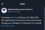
LOCATION...27.4N 84.6W
ABOUT 135 MI...215 KM WSW OF TAMPA FLORIDA
ABOUT 205 MI...330 KM S OF TALLAHASSEE FLORIDA
MAXIMUM SUSTAINED WINDS...110 MPH...175 KM/H
PRESENT MOVEMENT...N OR 10 DEGREES AT 18 MPH...29 KM/H
MINIMUM CENTRAL PRESSURE...960 MB...28.35 INCHES
-
Hello, please take a minute to check out our awesome content, contributed by the wonderful members of our community. We hope you'll add your own thoughts and opinions by making a free account!
You are using an out of date browser. It may not display this or other websites correctly.
You should upgrade or use an alternative browser.
You should upgrade or use an alternative browser.
Tropical Hurricane Idalia
- Thread starter weather nerd
- Start date
BHAMWX
Member
What about Dog Island?NNW, St George Island.
Wonder how long it will take for it to say "tweet unavailable"
Drizzle Snizzle
Member
It seems like the winds at reporting stations are never as high as the maximum sustained winds in a hurricane. What are the odds any station in Florida is going to report sustained winds of 100+ mph ?
Probably zero considering the sparsely inhabited coastline and compact nature of this storm.It seems like the winds at reporting stations are never as high as the maximum sustained winds in a hurricane. What are the odds any station in Florida is going to report sustained winds of 100+ mph ?
Itryatgolf
Member
The euro don't seem to do well with strength of hurricanes. The gfs was always 10-15 mb stronger and it will be closer to reality before all set and done
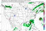
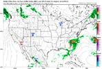
Well this is wrong because this will be a Cat 4 atleast at landfall0z NAM a lot weaker at landfall and comes off the SC coast at about SAV! View attachment 136652View attachment 136653
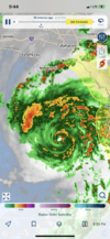
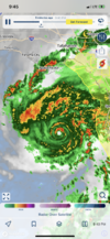
YesIs this an ERC???View attachment 136654View attachment 136655
Brent
Member
NHC now calling for a Cat 4 landfall
FORECAST VALID 30/1200Z 30.0N 83.9W...ON COAST
MAX WIND 115 KT...GUSTS 140 KT.
64 KT... 25NE 25SE 15SW 15NW.
50 KT... 50NE 50SE 25SW 25NW.
34 KT...100NE 160SE 60SW 60NW.
FORECAST VALID 30/1200Z 30.0N 83.9W...ON COAST
MAX WIND 115 KT...GUSTS 140 KT.
64 KT... 25NE 25SE 15SW 15NW.
50 KT... 50NE 50SE 25SW 25NW.
34 KT...100NE 160SE 60SW 60NW.
NHC now has the peak at Cat 4 at landfall.
11:00 PM EDT Tue Aug 29
Location: 27.7°N 84.5°W
Moving: N at 18 mph
Min pressure: 958 mb
Max sustained: 110 mph
Location: 27.7°N 84.5°W
Moving: N at 18 mph
Min pressure: 958 mb
Max sustained: 110 mph
Jrips2710
Member
It also initialized with a pressure 21mb higher than what it actually is right now.0z NAM a lot weaker at landfall and comes off the SC coast at about SAV! View attachment 136652View attachment 136653
Cary_Snow95
Member
Eye has really rounded out on radar
I wonder why Kemp did state of emergency for all of GA? Just the money aspect maybe? My mom is freaking in Valdosta. Locals talking scary and it may get rough. But isn't Valdosta on the not as bad side of it if it stays on the current track? Any thoughts on how bad it could be there. She should have let my sister come pick her up to go to Albany already. Geez
The current track puts Valdosta on the right hand side which is the bad side. The eye may go right over Valdosta. Current track takes the hurricane east of Albany which would be the better side as of right now but that can change in an hour.I wonder why Kemp did state of emergency for all of GA? Just the money aspect maybe? My mom is freaking in Valdosta. Locals talking scary and it may get rough. But isn't Valdosta on the not as bad side of it if it stays on the current track? Any thoughts on how bad it could be there. She should have let my sister come pick her up to go to Albany already. Geez
Yep. Gonna go bomkers from here on inEye has really rounded out on radar
Oh my. I thought it looked like it was going to the east of Valdosta too but that may have changed. Not good. Thanks Bham.The current track puts Valdosta on the right hand side which is the bad side. The eye may go right over Valdosta. Current track takes the hurricane east of Albany which would be the better side as of right now but that can change in an hour.
I think it just depends on which model you see. No one really knows I don't think.Oh my. I thought it looked like it was going to the east of Valdosta too but that may have changed. Not good. Thanks Bham.
Yeah I don't why I would think anybody knows exactly yet. LOL. People are getting all jacked up down there and worried. Me too for family a bit..Thanks.I think it just depends on which model you see. No one really knows I don't think.
REFER TO THE ATTACHED IMAGE FROM THE NWS TALLAHASSEE OFICE, VALDOSTA COULD AND WILL MOOST LIKELY SEE 100+MPH WINDSI wonder why Kemp did state of emergency for all of GA? Just the money aspect maybe? My mom is freaking in Valdosta. Locals talking scary and it may get rough. But isn't Valdosta on the not as bad side of it if it stays on the current track? Any thoughts on how bad it could be there. She should have let my sister come pick her up to go to Albany already. Geez

Drizzle Snizzle
Member
I would not want to be in Valdosta with this storm. Albany will get less impacts than Valdosta.I wonder why Kemp did state of emergency for all of GA? Just the money aspect maybe? My mom is freaking in Valdosta. Locals talking scary and it may get rough. But isn't Valdosta on the not as bad side of it if it stays on the current track? Any thoughts on how bad it could be there. She should have let my sister come pick her up to go to Albany already. Geez
Drizzle Snizzle
Member
My mom lives in Americus which is north of Albany. I told her to expect some gusty winds but nothing too terrible. Seems like along and East of I-75 is where the biggest impacts in GA will be.
Drizzle Snizzle
Member
It's funny because I've been watching The Weather Channel and all the cities they have listed on their map show nothing more than 60 mph wind gusts.
I would not want to be in Valdosta with this storm. Albany will get less impacts than Valdosta
IKR. I'm thinking it may be worse than what my mama and sister think and probably too late to go to Albany. I hope not.It's funny because I've been watching The Weather Channel and all the cities they have listed on their map show nothing more than 60 mph wind gusts.
Crazy. I thought it was showing signs of concentric eyewalls earlier, but now the inner eyewall has went bonkers and has taken completely over.
Edit: velocities rapidly growing in eyewall.
Edit: velocities rapidly growing in eyewall.
Drizzle Snizzle
Member
I don't like these maps TWC has been showing. They just showed the map again and it shows maximum gusts of 60ph tomorrow which I think could be way too low. I would advise your mom to leave Valdosa no later than early tomorrow morning.IKR. I'm thinking it may be worse than what my mama and sister think and probably too late to go to Albany. I hope not.
Getting mesovorts in the eyewall again. Looking stout.
lighting in the eyewall with this last hot tower
Thanks for your help. I'm going to tell my sis to go get her early and take back to Albany. Just hope she doesn't drive through bad stuff at like 5 to 7am. They ask me what's going on like I know. I just ask ya'll. LOL. Enough about mama on the forum. Carry on. Thanks.I don't like these maps TWC has been showing. They just showed the map again and it shows maximum gusts of 60ph tomorrow which I think could be way too low. I would advise your mom to leave Valdosa no later than early tomorrow morning.
I don't think it's too late.IKR. I'm thinking it may be worse than what my mama and sister think and probably too late to go to Albany. I hope not.
Here's the hourly forecast for Valdosta. Wind and rain looks to start about 5:00 a.m..Thanks for your help. I'm going to tell my sis to go get her early and take back to Albany. Just hope she doesn't drive through bad stuff at like 5 to 7am. They ask me what's going on like I know. I just ask ya'll. LOL. Enough about mama on the forum. Carry on. Thanks.


