Track went east again.

Last edited:
I think that’s a very real possibility.GSP has been talking about a possible PRE event in their AFD's.
I will be by the next run. We will be lucky to clouds at this point.We going to be out of the cone by tomorrow afternoon.
Yep non event hereWe going to be out of the cone by tomorrow afternoon.
Yeah even getting to be a concern for me on the coast missing this too far offshore. Gfs coming in much stronger and west still at 12z though.We going to be out of the cone by tomorrow afternoon.
Yep this is not our rainmaker that we desperately need. We'll have to hope for the best today through Tues for that. I do hope it stays relatively weak for the folks along the FL panhandle. I'm sure they would rather not see a major hurricane.We going to be out of the cone by tomorrow afternoon.
We are out. Too far east now. Next.Yep this is not our rainmaker that we desperately need. We'll have to hope for the best today through Tues for that. I do hope it stays relatively weak for the folks along the FL panhandle. I'm sure they would rather not see a major hurricane.
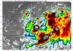
Convection starting to flare up closer to the LLC

"HAFS is as good as NOAA’s existing hurricane models when forecasting storm intensity — but is better at predicting rapid intensification. HAFS was the first model last year to accurately predict that Hurricane Ian would undergo secondary rapid intensification as the storm moved off the coast of Cuba and barreled toward southwest Florida." -NOAA
The 00z HAFS run last night just goes to show how prime the waters of the gulf loop currently are for rapid intensification potential:
View attachment 136510
I doubt it’s that compact, but I don’t expect an incredibly huge wind field either. I do expect to see the shield of rainfall spread very far northward as a result of the stalled front and trough dropping in.I wonder if this will be a compact storm like Charley.
Sent from my iPhone using Tapatalk
I doubt it’s that compact, but I don’t expect an incredibly huge wind field either. I do expect to see the shield of rainfall spread very far northward as a result of the stalled front and trough dropping in.
It is, but it’s some thing that makes sense with the overall set up. I think as we get closer you’ll see short term models latch onto it better than globals.The GFS is the only one showing that.
Sent from my iPhone using Tapatalk
Take another look. The end of those 2 tracks are not even close,
Yea it’s getting worst by the moment. We all might strike now.Take another look. The end of those 2 tracks are not even close,
Edit: Especially now that the official track is even further East.

No, the trough is gonna kick anything east. The southward movement, delaying it's move north, has given the trough time to kick it east. We might not be done with east shifts.Euro doesn’t look like it has much intensification. Would a stronger storm resist East movement some?
Looks impossible now. Mexico beach- West are in the clear now.Is there any chance at all there could be a west shift or is that virtually impossible ?
My mom lives in Southwest Georgia so I will tell her not to worry about any major impacts.Looks impossible now. Mexico beach- West are in the clear now.
I wouldn’t worry about it right now.My mom lives in Southwest Georgia so I will tell her not to worry about any major impacts.
Always a good rule of thumb to give someone near the cone 3 days away the all clear.My mom lives in Southwest Georgia so I will tell her not to worry about any major impacts.
No, the trough is gonna kick anything east. The southward movement, delaying it's move north, has given the trough time to kick it east. We might not be done with east shifts.
At least the Euro gives Ga and SC coast some good action too


I don't think it's going to impact you, either. All clear for Iowa.RAH one more East shift from getting a cloud storm at best!
The eastern shifts not done yet?