Levees becoming issues per Weather Channel. Not in NO, but I have fears that somewhere the pumps will fail.
-
Hello, please take a minute to check out our awesome content, contributed by the wonderful members of our community. We hope you'll add your own thoughts and opinions by making a free account!
You are using an out of date browser. It may not display this or other websites correctly.
You should upgrade or use an alternative browser.
You should upgrade or use an alternative browser.
Tropical Hurricane Ida
- Thread starter Snowfan
- Start date
Henry2326
Member
pcbjr
Member
Downeastnc
Member
Damn the dude that punched the eyewall to get to the eye for the stadium effect literally goes off the air right as he was about to break free into the eye....
TWC just announced this. It's south of New Orleans.
Does anyone know exactly how much of a water rise would cause water to start topping over the levees?
Cadi40
Member
New Orleans will definitely be clipped by the secondary eyewall and it doesn’t help that Ida is in no hurry to exit the area.
Jessy89
Member

That eye though still looks absolutely perfect
Sent from my iPhone using Tapatalk
Henry2326
Member
Does anyone know exactly how much of a water rise would cause water to start topping over the levees?
This 2019 article says that they expected the levees to no longer provide risk reduction by 2023 because the levees began sinking. This was faster then they anticipated in 2007.
Hmmmm.....might be even faster to 2021.
https://www.scientificamerican.com/...llion-upgrade-new-orleans-levees-are-sinking/
Reed is in the eye and reporting 942mb pressure still.
Mr. Golf
Member
I guess its been mentioned, but it's the anniversary of hurricane Katrina. I thought it was interesting for that??
It continues to go downhill in New Orleans and the pressure gradient is now up to 6 mb over just a 15 mile distance!
5 PM CDT:
N.O. INTL ARPT HVY RAIN 76 75 97 E48G74 29.16F VSB 1/2
N.O. DWNTWN HE HVY RAIN 77 75 93 E23G46 29.27F VSB 3/4
N.O. LAKEFRONT HVY RAIN 77 76 96 E54G78 29.34F VSB 1/2
5 PM CDT:
N.O. INTL ARPT HVY RAIN 76 75 97 E48G74 29.16F VSB 1/2
N.O. DWNTWN HE HVY RAIN 77 75 93 E23G46 29.27F VSB 3/4
N.O. LAKEFRONT HVY RAIN 77 76 96 E54G78 29.34F VSB 1/2
Henry2326
Member
Does anyone know exactly how much of a water rise would cause water to start topping over the levees?
This article says this about the West side. But it's breaching on the south side now.
"Starting with a giant surge barrier east of the city, the system is a 130-mile (210-kilometer) ring built to hold out storm surge of about 30 feet (9 meters). The National Hurricane Center on Friday projected Ida would bring a surge of 10 feet to 15 feet (3 to 4.6 meters) on the west bank.
At that level, it could come over the levees in some areas, said emergency manager Heath Jones of the Army Corps of Engineers’ New Orleans District.
“They’re designed to overtop in places” with protections against worse damage, including armoring, splash pads and pumps with backup generators, he said."
pcbjr
Member

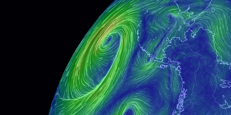
earth :: a global map of wind, weather, and ocean conditions
See current wind, weather, ocean, and pollution conditions, as forecast by supercomputers, on an interactive animated map. Updated every three hours.

earth :: a global map of wind, weather, and ocean conditions
See current wind, weather, ocean, and pollution conditions, as forecast by supercomputers, on an interactive animated map. Updated every three hours.


HSVweather
Member
Henry2326
Member
Henry2326
Member
Lost generator power in ICU.....had to move them to another floor.
The scary fact is unless we see rapid weakening, that 120-135mph sustained wind will be realized over Lake Pontchartrain and drive a massive surge into the west of it.
I've been thinking about the MRGO dam as well as the 32-foot floodgate that keeps Lake Borne from flooding Lake Ponchatrain. Thank God they were built, otherwise, this storm could have been so much worse. But, I can't help thinking about what a disaster it would be should particularly the Lake Borne gates, suddenly fail while holding back a 15-30 foot surge.
Just for clarification, the Lake Borgne Surge Barrier has no bearing on levels in Lake Pontchartrain. There have been talks of an Oosterscheldekering-like structure to block surge coming into the estuary, but it's big money and has some pretty substantial ecological considerations to overcome.
Henry2326
Member
TWC just said the same. And said it will push surge into Laplace, west of the lake, at the same time that Laplace is hit by the high winds.The scary fact is unless we see rapid weakening, that 120-135mph sustained wind will be realized over Lake Pontchartrain and drive a massive surge into the west of it.
So I thought they had built a floodwall there and locks at the Rigolets to prevent filling Ponchatrain from the sound prior to an incoming cane. No?Just for clarification, the Lake Borgne Surge Barrier has no bearing on levels in Lake Pontchartrain. There have been talks of an Oosterscheldekering-like structure to block surge coming into the estuary, but it's big money and has some pretty substantial ecological considerations to overcome.
Henry2326
Member
Tornadocane
Member
Camera in Laplace is almost underwater.
Mr. Golf
Member
The main problem with New Orleans is that its below sea level and it can flood pretty easily.
Going rapidly downhill at N.O. (Ignore the 32 dewpoints).
Intl Airport dropped 5 mb in the last hour and has 1/4 mile vis. There now is a whopping ~9 mb difference between there and Lakefront!
N.O. INTL ARPT HVY RAIN 77 32 19 E56G83 29.01F VSB 1/4
N.O. DWNTWN HE RAIN 78 76 93 MISG N/A VSB 1
N.O. LAKEFRONT HVY RAIN 77 32 19 E46G71 29.27F VSB 1/2
Intl Airport dropped 5 mb in the last hour and has 1/4 mile vis. There now is a whopping ~9 mb difference between there and Lakefront!
N.O. INTL ARPT HVY RAIN 77 32 19 E56G83 29.01F VSB 1/4
N.O. DWNTWN HE RAIN 78 76 93 MISG N/A VSB 1
N.O. LAKEFRONT HVY RAIN 77 32 19 E46G71 29.27F VSB 1/2
Some of the video I’m seeing easily rivals the worst of Michael.
So I thought they had built a floodwall there and locks at the Rigolets to prevent filling Ponchatrain from the sound prior to an incoming cane. No?
The LBSB, despite it's large scale when standing beneath it, is somewhat small in the grand scheme of things. It is in red in the picture. It's job is to keep surge from entering the intracoastal/Industrial Canal and penetrating into the city core. There is no structure that limits flow between Pontchartrain and the Gulf/Lake Borgne.

HSVweather
Member
Thanks! I've been gone from home too long lol.The LBSB, despite it's large scale when standing beneath it, is somewhat small in the grand scheme of things. It is in red in the picture. It's job is to keep surge from entering the intracoastal/Industrial Canal and penetrating into the city core. There is no structure that limits flow between Pontchartrain and the Gulf/Lake Borgne.
View attachment 89773
Jessy89
Member
Anyone think this may get updated to a cat 5 after all the damage assessments?
Sent from my iPhone using Tapatalk
Sent from my iPhone using Tapatalk
Brent
Member
Some of the video I’m seeing easily rivals the worst of Michael.
That would be crazy if it gets upgraded after the fact like Michael but I think it's possible. The lack of weakening for hours is another clue I know it was swamp but still. That's not normal
Last edited:
Anyone think this may get updated to a cat 5 after all the damage assessments?
Sent from my iPhone using Tapatalk
Possibly, but I think they will have to find damage that suggests it over just recon. In Michael they had flight level winds when reduced for height reached Cat 5 at the surface(they don’t to my knowledge here) and surface wind measurement from the aircraft that backed it up along with sub920mb pressure. I did see a sonde in the northern eyewall that had 161mph at the surface here, so they may use it and be enough, but who knows.
That would be crazy if it gets upgraded after the fact like Michael but I think it's possible. The lack of weakening for hours is another clue I know it was swamp but still. That's not normal
I mean, dang…
Brent
Member
I mean, dang…
I've already seen that video several times but still wow
MCBAMA
Member
Not sure if this has been posted.
Jessy89
Member
It took 8hrs for Ida to go from cat 4 to cat 3 that’s almost unheard of!
Sent from my iPhone using Tapatalk
Sent from my iPhone using Tapatalk
Sctvman
Member


